James Spann: Alabama’s dry, dusty October days continue through the weekend
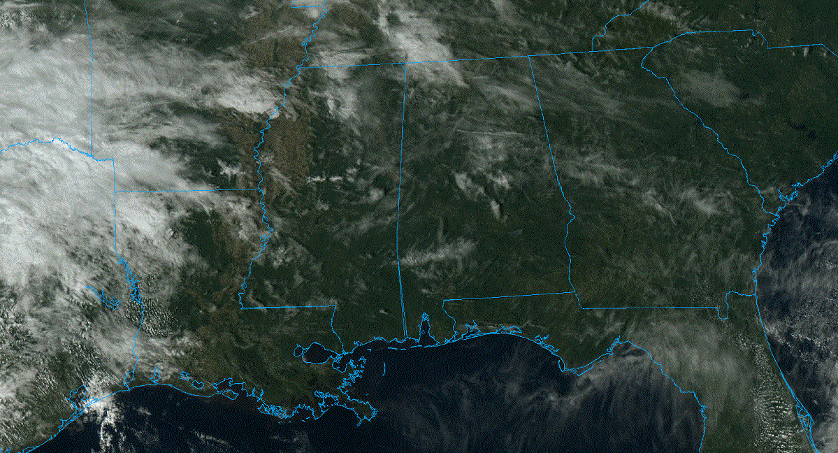
DRY: The sky is mostly sunny across Alabama this afternoon with temperatures in the upper 70s and low 80s. Mobile and Dothan have reached the mid 80s. Tonight will be mostly fair with a low generally in the 50s.
The forecast is for mostly sunny, mild days and clear, pleasant nights through Sunday. Daytime temperatures will be above average, with highs between 76 and 83 degrees. Lows will be mostly in the 50s and low 60s. The weather looks great for high school and college football games across the Deep South this weekend.
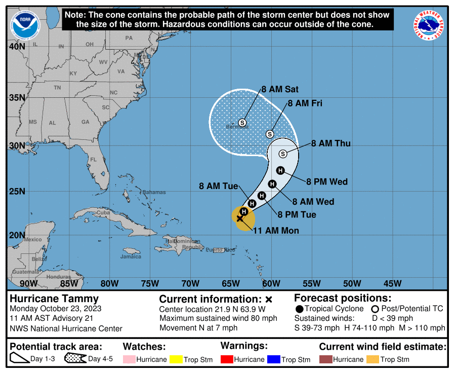
NEXT WEEK: Models suggest a cold front will bring a chance of showers on Halloween, but it doesn’t look like a big rain event at this point. Much cooler air follows for the latter half of next week, potentially the coolest air so far this season. We’re seeing some evidence in global models that the surface front could stall out near the Gulf Coast, which would keep some risk of light rain in the forecast Wednesday and Thursday.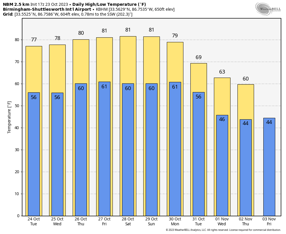 TROPICS: Hurricane Tammy, with winds of 80 mph, is about 260 miles north of Anguilla this afternoon and continues to move away from the northern Leeward Islands. The evolution of the upper air pattern around the system is uncertain over the next five to seven days, and this will bring much uncertainty to the track and intensity forecast.
For now, the National Hurricane Center has the system as a post-tropical cyclone near Bermuda Saturday morning, but this could easily change.
Satellite data indicates that an area of low pressure over the southwestern Caribbean Sea has developed a well-defined center. In addition, the associated showers and thunderstorms continue to show signs of organization. If the trends continue, advisories could be initiated later this afternoon or evening on a short-lived tropical depression. The low is expected to move inland over Nicaragua by early Tuesday and will likely produce heavy rains over portions of Central America during the next couple of days.
No tropical systems are expected near the Gulf of Mexico this week.
ON THIS DATE IN 1878: One of the most severe hurricanes to affect eastern Virginia in the latter half of the 19th century struck. This storm moved rapidly northward from the Bahamas on Oct. 22 and hit the North Carolina coast late that same day moving at a forward speed of 40 to 50 mph. The storm continued northward, passing through east central Virginia, Maryland and eastern Pennsylvania. The barometric pressure fell to 28.78 inches. The five-minute sustained wind reached 84 mph at Cape Henry. During the heaviest part of the gale, the wind at Kitty Hawk, North Carolina, registered 100 mph. The instrument itself finally blew away, and therefore no further record was made.
ON THIS DATE IN 1947: Fish fell from the sky in Marksville, Louisiana. Thousands of fish fell in an area 1,000 feet long by 80 feet wide, possibly due to a waterspout.
For more weather news and information from James Spann and his team, visit AlabamaWx.


