James Spann: Cold in Alabama again tonight; warmer by the weekend
CLOUDLESS SKY: There’s not a cloud in the sky across Alabama this afternoon with temperatures in the 50s and 60s. Tonight will be clear and cold, but not quite as cold as last night (a few spots were actually in the upper teens early this morning, including Gadsden at 19). Lows early Friday will be mostly between 27 and 35 degrees.
FRIDAY THROUGH SUNDAY: A warming trend headlines the forecast. With sunny days and fair nights, we expect a high in the 60s Friday, followed by 70s over the weekend.
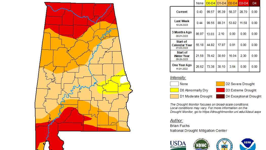
NEXT WEEK: Unfortunately, the chance of rain looks very low through the week as drought conditions will continue to intensify across Alabama and the Deep South. We now have a dry forecast with highs between 75 and 80 degrees through Wednesday, followed by a cooling trend Thursday and Friday. We continue to see signals of a decent rain event for the state by 10-15 days.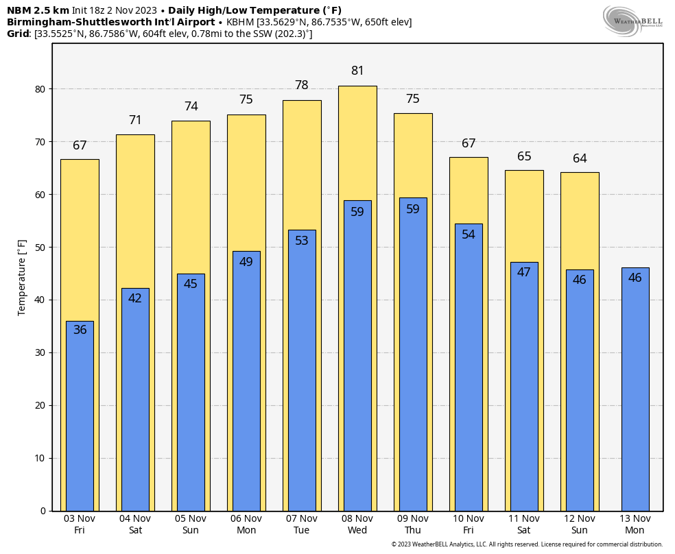 DROUGHT MONITOR: The new drought monitor was released this morning, and conditions continue to deteriorate. Right now, 99.57% of Alabama is either in a drought (95.39%) or abnormally dry. An extreme drought is defined for the Tennessee Valley and the southwest counties of the state.
FOOTBALL WEATHER: Expect a clear sky for the high school games across Alabama Friday night with temperatures falling through the 50s.
Saturday, UAB hosts Florida Atlantic at Protective Stadium in downtown Birmingham (2 p.m. kickoff). The sky will be sunny with temperatures in the low 70s.
Auburn travels to Nashville to take on Vanderbilt (3 p.m. CT kickoff). The sky will be clear with upper 60s at kickoff, dropping into the low 60s by the final whistle.
Alabama will host LSU at Bryant-Denny Stadium (6:45 p.m. kickoff). The sky will be clear with temperatures falling through the 60s. It will be a perfect night for football in Tuscaloosa.
TROPICS: Disorganized showers and thunderstorms over portions of the central and western Caribbean Sea are associated with a broad area of low pressure. Development, if any, of this system is expected to be slow to occur before it moves inland over Central America Friday night or Saturday. Regardless of development, the system has the potential to produce heavy rains over portions of Jamaica through tonight and across Central America on Friday and over the weekend. The chance of development has dropped to 20%.
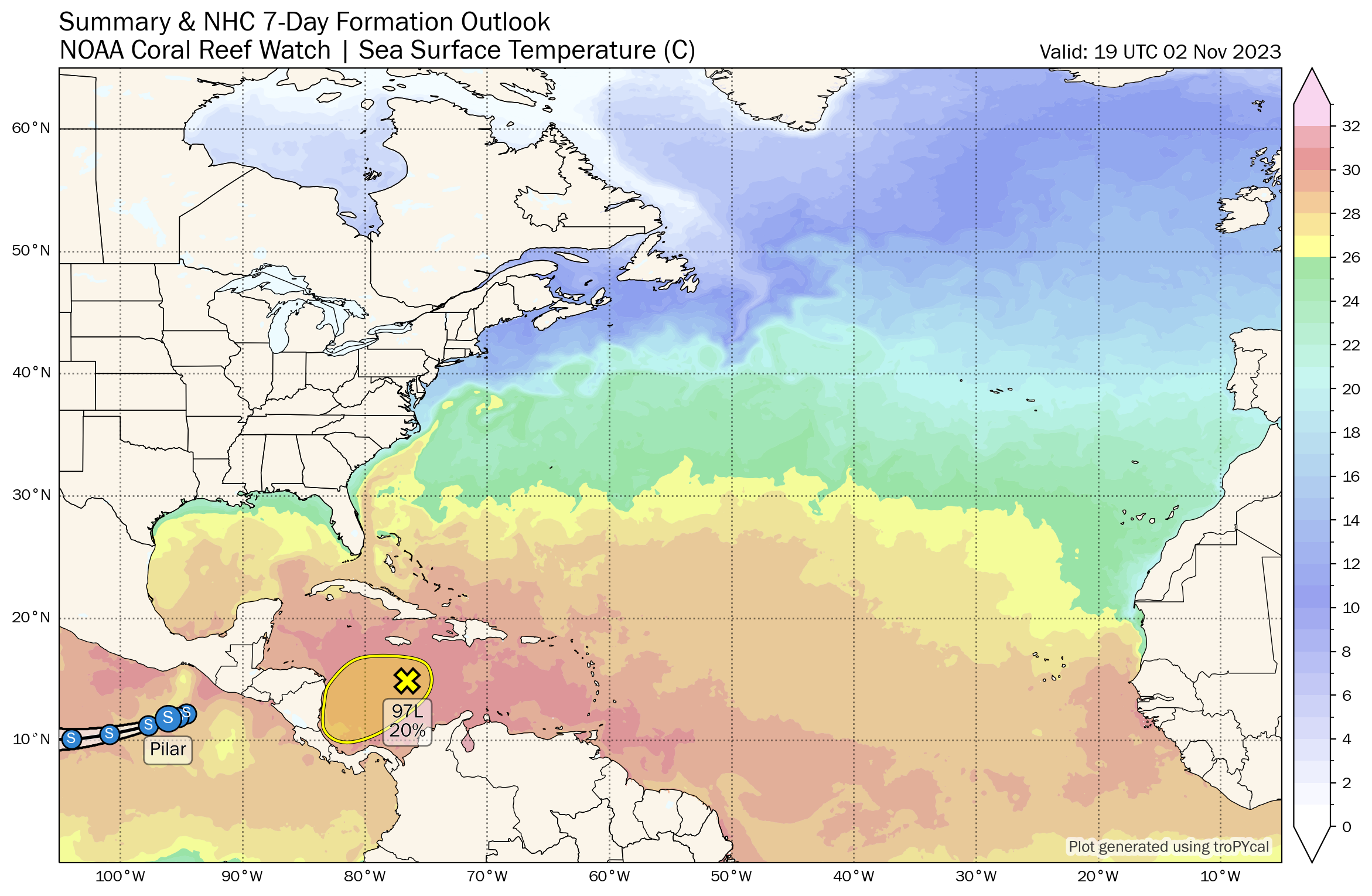 The rest of the Atlantic basin is very quiet.
ON THIS DATE IN 1992: Another infamous November Great Lakes storm brought windy conditions to Minnesota’s Lake Superior shoreline. Winds of 70 mph caused waves to crash over 130-foot walls along the shore.
For more weather news and information from James Spann and his team, visit AlabamaWx.


