James Spann: Dry weather continues in Alabama through Friday; rain returns by Christmas Day
SEVERE CLEAR: It’s another cloudless afternoon for Alabama with temperatures in the 40s over the northern half of the state and 50s to the south. Tonight will be clear and cold, with a freeze likely for the northern half of the state.
The weather will stay dry through Friday with mostly sunny days and fair nights. Another freeze is likely early Thursday morning, but daytime temperatures will be warmer Friday, with highs for most places between 57 and 65 degrees.
CHRISTMAS WEEKEND: Saturday will be dry and pleasant with a mix of sun and clouds. We will introduce the chance of a few showers Sunday with the approach of a weather system that will pull moist air northward into the state. The latest global model guidance suggests the more widespread rain won’t arrive until Sunday night and Christmas Day. It won’t rain all night Sunday night or all day Monday, but periods of rain are likely with some potential for thunder in spots. No severe storms are expected.
Temperatures will be relatively mild for late December over the weekend, with highs in the 60s Saturday and Sunday; communities near the Gulf Coast could touch 70 degrees. For Christmas Day, highs will be generally between 58 and 65 degrees across Alabama with clouds and rain at times.
REST OF NEXT WEEK: A slot of drier air will work into the state Tuesday with only isolated showers. Some rain is possible Wednesday, followed by colder, drier air Thursday and Friday. There’s still no sign of any bitterly cold Arctic air around here through the end of December.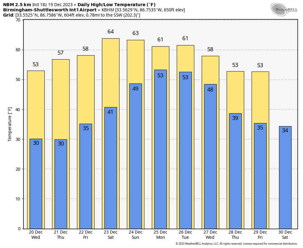 FOOTBALL WEATHER: For Saturday’s Birmingham Bowl (Troy vs. Duke, 11 a.m. kickoff at Protective Stadium), the sky will be partly sunny with temperatures rising from near 60 at kickoff into the mid 60s by the final whistle — a very comfortable day.
ON THIS DATE IN 2009: Snowfall totals from 1 to 2 feet were commonplace in what will go down as one of the biggest snowstorms in history on the East Coast and the first of four snowstorms for the Mid-Atlantic during the winter of 2009-10. The 15 inches of snow measured at Reagan International Airport on Dec. 19 was the third-highest daily snowfall on any calendar day at Washington, D.C., since snowfall records began in 1884. The total storm snowfall of 16.4 inches on Dec. 18-19 marks the sixth-highest two-day snowfall record for the city, putting it just below the second President’s Day storm in 2003 and ahead of the January 1996 storm.
For more weather news and information from James Spann and his team, visit AlabamaWx.


