Scott Martin: Alabama weather improves today with cooler temperatures
THIS WEEKEND: The northern counties can anticipate light rain or drizzle through the morning as a cold front approaches, ushering in breezy northwesterly winds and gradually clearing skies. Temperatures will vary significantly, with highs in the mid 50s in the northwest and near 70 in the southeast before the front’s passage. Most areas will reach their peak temperatures around midday.
Tonight and Sunday, cooler and drier conditions will prevail as cooler air settles over the region and surface high pressure holds sway to the west. Winds will remain elevated tonight, with lows ranging from the mid 30s to mid 40s. Sunday will bring sunny skies with highs in the mid 50s to lower 60s.
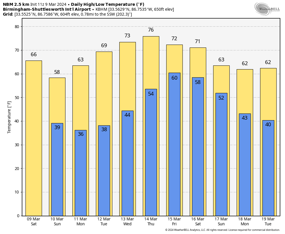
NEXT WEEK: Surface high pressure will dominate near the region on Sunday and Monday nights, resulting in light winds and temperatures dipping into the 30s. Frost and freezing temperatures will be possible each night. Southerly to southwesterly flow will lead to a rebound in temperatures and moisture through midweek, with passing shortwaves contributing to increased cloud cover but having minimal impact on local weather conditions.
Toward the end of the week, a shortwave and associated surface low will drag a cold front toward the southeast by Friday or Saturday. Models disagree on the timing and extent of the front’s movement. As of now, another wet end to the work week can be expected, but specific details may change.
For more weather news and information from James Spann, Scott Martin and other members of the James Spann team, visit AlabamaWx.


