James Spann: Alabama gets cooler Thursday with a few showers
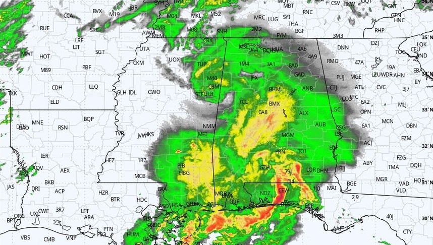
RADAR CHECK: A large mass of rain covers Alabama this afternoon. A few strong to severe storms are moving through the southeast corner of the state and the Florida Panhandle. The risk of severe storms will end soon for far southeast Alabama, and rain tapers off this evening elsewhere.
WAKE LOW: We note strong gradient winds (not related to thunderstorms) on the back edge of the big rain area due to a wake low; winds could gust to 30-40 mph in spots over the next few hours as the rain ends.
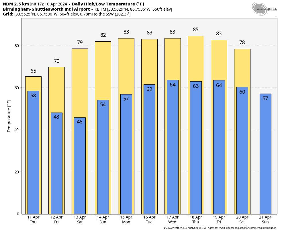
A few scattered showers are possible Thursday over the northern two-thirds of Alabama with a mostly cloudy sky; the day will be breezy and cooler, with a high in the low to mid 60s. The best chance of seeing sun will be near the Gulf Coast.
FRIDAY AND THE WEEKEND: The weather will be dry with sunny days and fair nights. The high will be in the low 70s Friday, followed by 80-degree warmth Saturday and Sunday. The coolest morning will come early Saturday with lows in the 40s.
NEXT WEEK: An upper ridge will set the stage for the warmest week so far this year, with daily highs between 80 and 85 degrees. The ridge will also keep the big rain producers west and north of the Deep South; the week looks dry.
ON THIS DATE IN 1979: This day was known as “Terrible Tuesday” to the residents of Wichita Falls, Texas, as a tornado rated F4 on the Fujita scale ripped through the city. A massive F4 tornado smashed into Wichita Falls, killing 43 people and causing $300 million in damage. Another tornado struck Vernon, Texas, killing 11 people.
For more weather news and information from James Spann and his team, visit AlabamaWx.


