James Spann: Most of Alabama rain-free Tuesday through the weekend
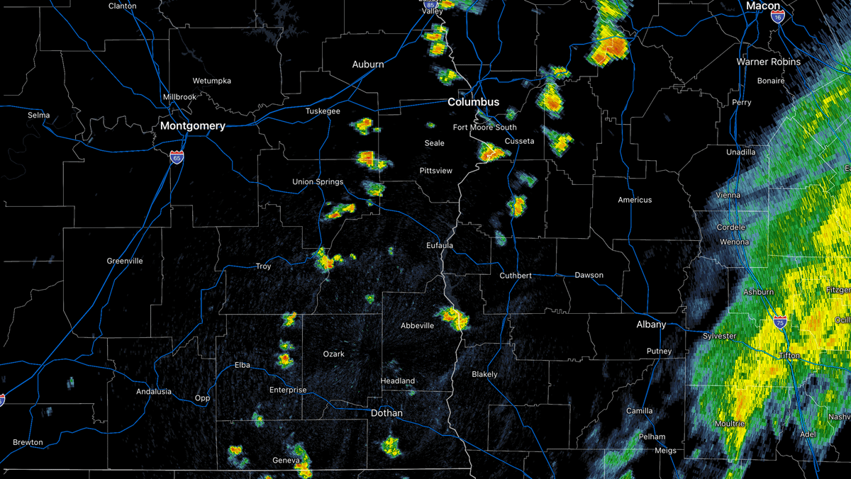
RADAR CHECK: We have a few small, isolated showers on radar this afternoon across southeast Alabama, in the general area from Auburn and Opelika down to Andalusia and Dothan. The rest of the state is enjoying a partly to mostly sunny sky with temperatures mostly in the low 90s. Isolated showers end this evening, and the sky will be mostly fair tonight with a low in the 70s.
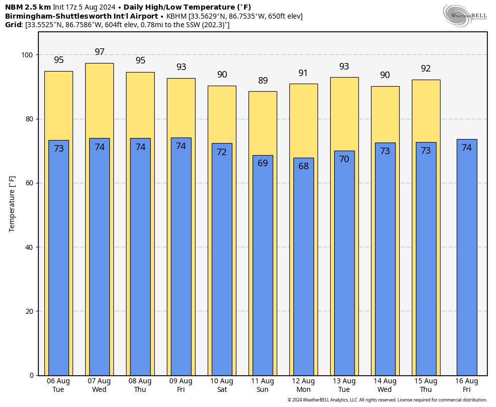
DRY WEEK AHEAD: The rest of the week will likely stay dry, with mostly sunny, hot days and fair, humid nights. Heat levels will peak on Wednesday with mid to upper 90s; by Friday the high will drop back into the low 90s. Lows will be in the 70s.
THE WEEKEND AND BEYOND: The dry pattern continues; expect lots of sunshine Saturday and Sunday with highs between 88 and 92 degrees. On the positive side, a drier air mass will drop into the state over the weekend with lower humidity and cooler nights. Most places will drop into the 60s early Sunday morning.
Much of next week looks dry, with only isolated showers and highs in the low 90s. It will be a very quiet period of weather for the state.
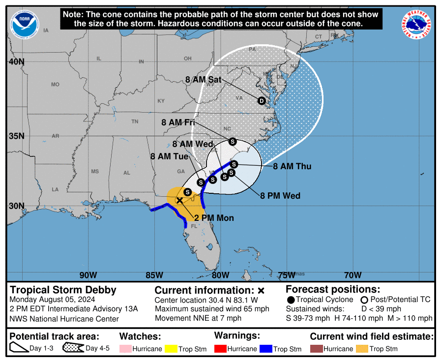
 DEBBY STAYS EAST OF ALABAMA: This afternoon Tropical Storm Debby is centered near Live Oak, Florida, with sustained winds of 65 mph. It is moving to the north/northeast at 7 mph.
Most of the track guidance turns Debby eastward, with the center moving off the coast near the Georgia/South Carolina border in about 36 hours. Debby should move very slowly near the South Carolina coast through 60 hours or so. Then, a midlevel ridge builds slightly to the northeast of the cyclone, which should push it back inland late this week.
Potentially historic heavy rainfall across southeast Georgia and the coastal plain of South Carolina through Saturday morning will likely result in areas of catastrophic flooding. Heavy rainfall will likely result in considerable flooding impacts from portions of central and northern Florida and across portions of central and northeast North Carolina through Saturday morning.
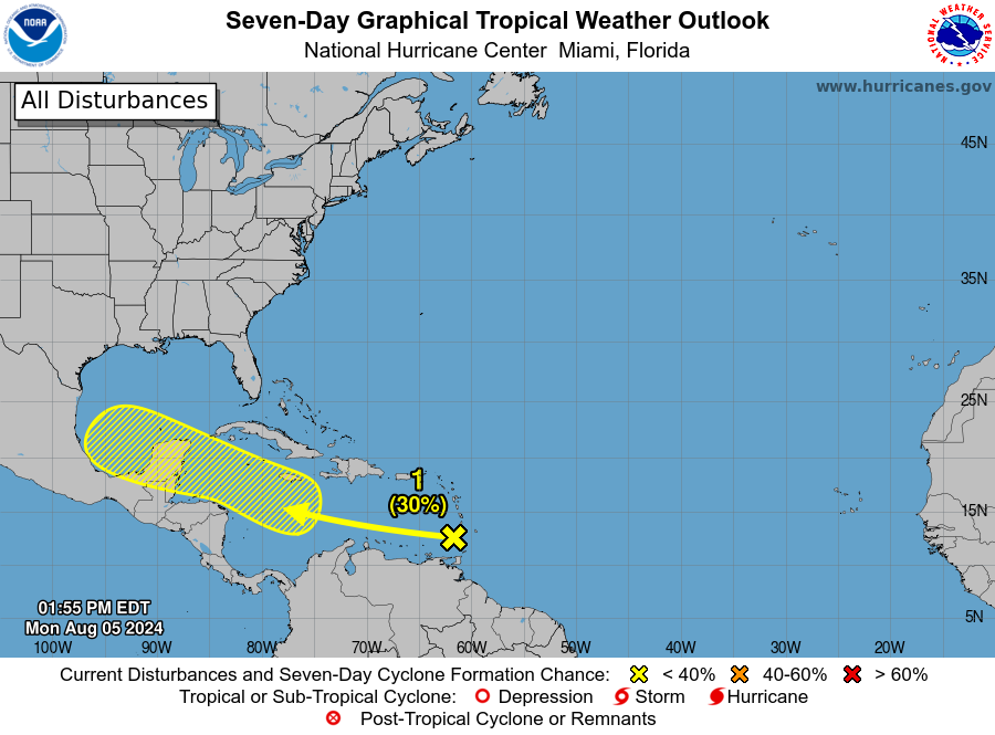
ELSEWHERE: Showers and thunderstorms associated with a tropical wave near the Windward Islands have changed little since this morning. Any development of this system should be slow to occur during the next couple of days while it moves westward over the eastern Caribbean Sea. Environmental conditions are expected to become more conducive for development later this week as the system moves across the western Caribbean Sea or the southern Gulf of Mexico. For now, the National Hurricane Center gives the system a 30% chance of development.
ON THIS DATE IN 1875: Several tornadoes moved across northern and central Illinois. One of the stronger tornadoes touched down in Warren and Knox County, where it destroyed 25 homes and killed two people.
For more weather news and information from James Spann and his team, visit AlabamaWx.


