James Spann: Alabama stays dry through the weekend, with lower heat levels by Saturday
James Spann forecasts a hot, dry day for Alabama from Alabama News Center on Vimeo.
DRY SUMMER PATTERN: The chance of any one spot seeing a shower across Alabama is 10% or less through the weekend. We expect mostly sunny days and fair nights through Sunday as the dry pattern continues and Tropical Storm Debby stays well to the east.
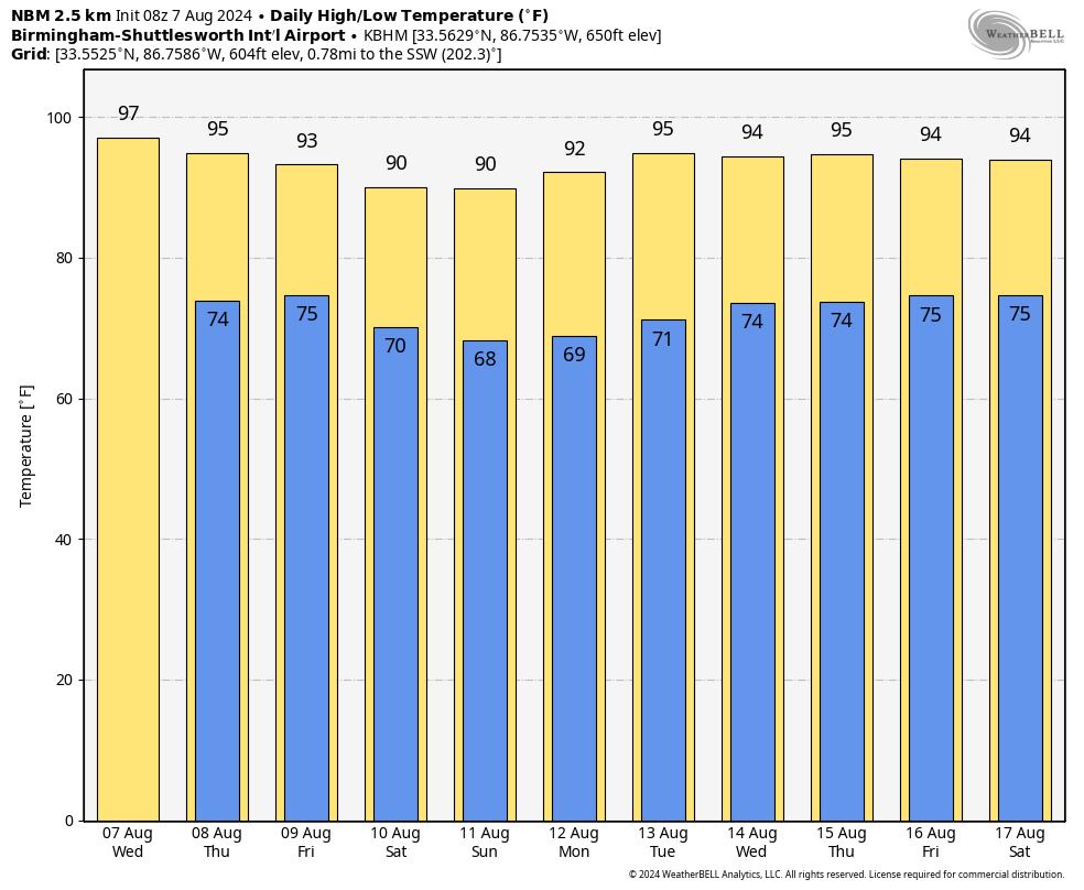
Today should be the hottest day of the week, with a high between 95 and 100 degrees for most places this afternoon. We expect mostly mid 90s Thursday and Friday, but a pattern change will bring down a drier continental air mass over the weekend. For Saturday and Sunday, highs over the northern half of the state will drop into the 88- to 92-degree range with lower humidity and cooler nights. Temperatures will be in the 60s early Sunday morning for a little touch of fall.
NEXT WEEK: Generally dry weather will continue Monday and Tuesday. We will mention the chance of widely scattered, mostly afternoon and evening showers and thunderstorms over the latter half of the week, but we still don’t expect any really widespread rain. Highs will be in the low to mid 90s through most of the week.
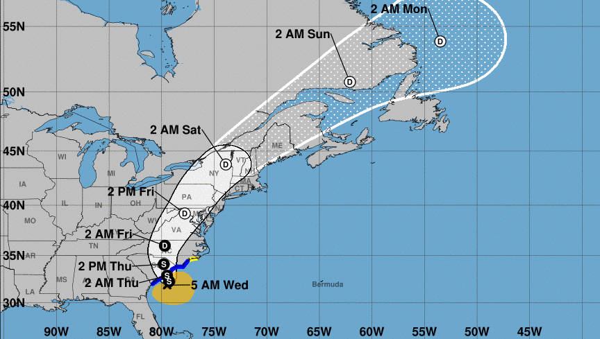
 TROPICS: Tropical Storm Debby this morning is about 65 miles south/southeast of Charleston and is drifting to the east at only 5 mph. Some drier air entered the circulation Tuesday and has really reduced the rain coverage and intensity along the coast of the Carolinas. The system will drift back inland Thursday, and it finally begins to accelerate to the northeast Friday. By Sunday it will be over eastern Canada.
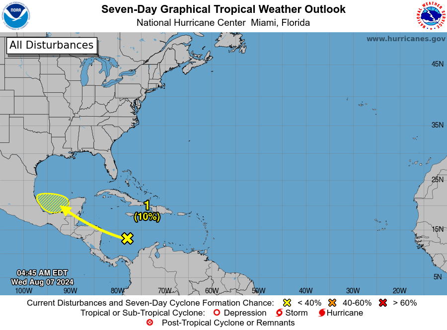
Elsewhere, showers and thunderstorms associated with a tropical wave over the southwestern Caribbean Sea remain disorganized. The northern portion of this wave could reach the southwestern Gulf of Mexico over the weekend, but the National Hurricane Center has dropped the chance of development to only 10%. The rest of the Atlantic basin is very quiet.
 ON THIS DATE IN 1980: Hurricane Allen bottomed out at 899 millibars (26.55 inches of mercury) while moving through the Yucatan Channel in the southeastern Gulf of Mexico. Allen was the second-lowest pressure ever recorded in the Western Hemisphere up to that time. Its winds at the time were sustained at 190 mph. It would move into south Texas on Aug. 10 as a Category 3 hurricane.
For more weather news and information from James Spann and his team, visit AlabamaWx.