James Spann: Showers, storms for Alabama Wednesday night; frost likely Friday morning
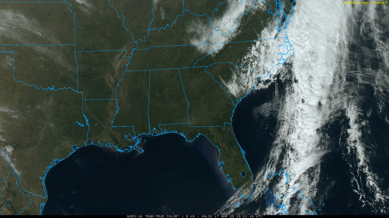
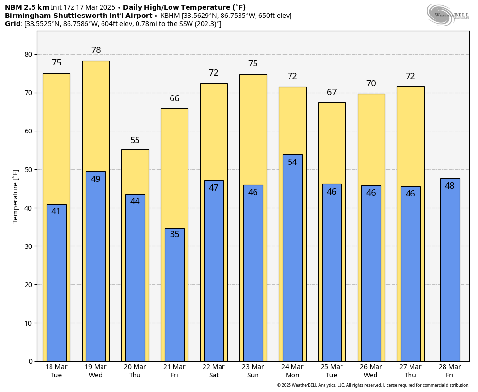
SUNNY MONDAY: There’s not a cloud in the sky across Alabama this afternoon with a very dry air mass in place; temperatures are in the 50s over the northern counties, with 60s to the south. Tonight will be clear and cool, with lows mostly in the 40s; colder spots will see mid to upper 30s.
Tuesday will be sunny and warmer, with a high in the 70s statewide.
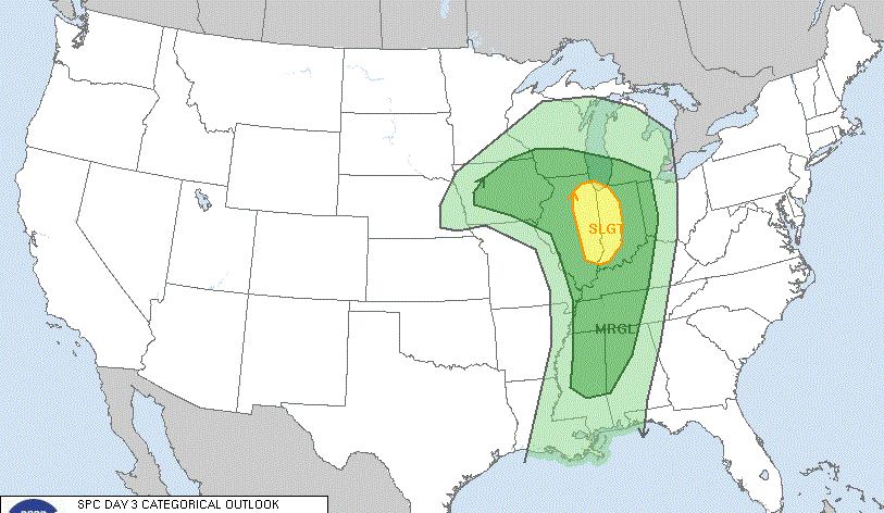
WEDNESDAY NIGHT COLD FRONT: Most of the day Wednesday will be dry and warm; many south Alabama communities will see a high in the low 80s. A cold front will bring a fast-moving band of showers and storms into the state Wednesday night; the Storm Prediction Center (SPC) has defined a marginal risk (level 1 out of 5) of severe thunderstorms for areas north and west of Birmingham.
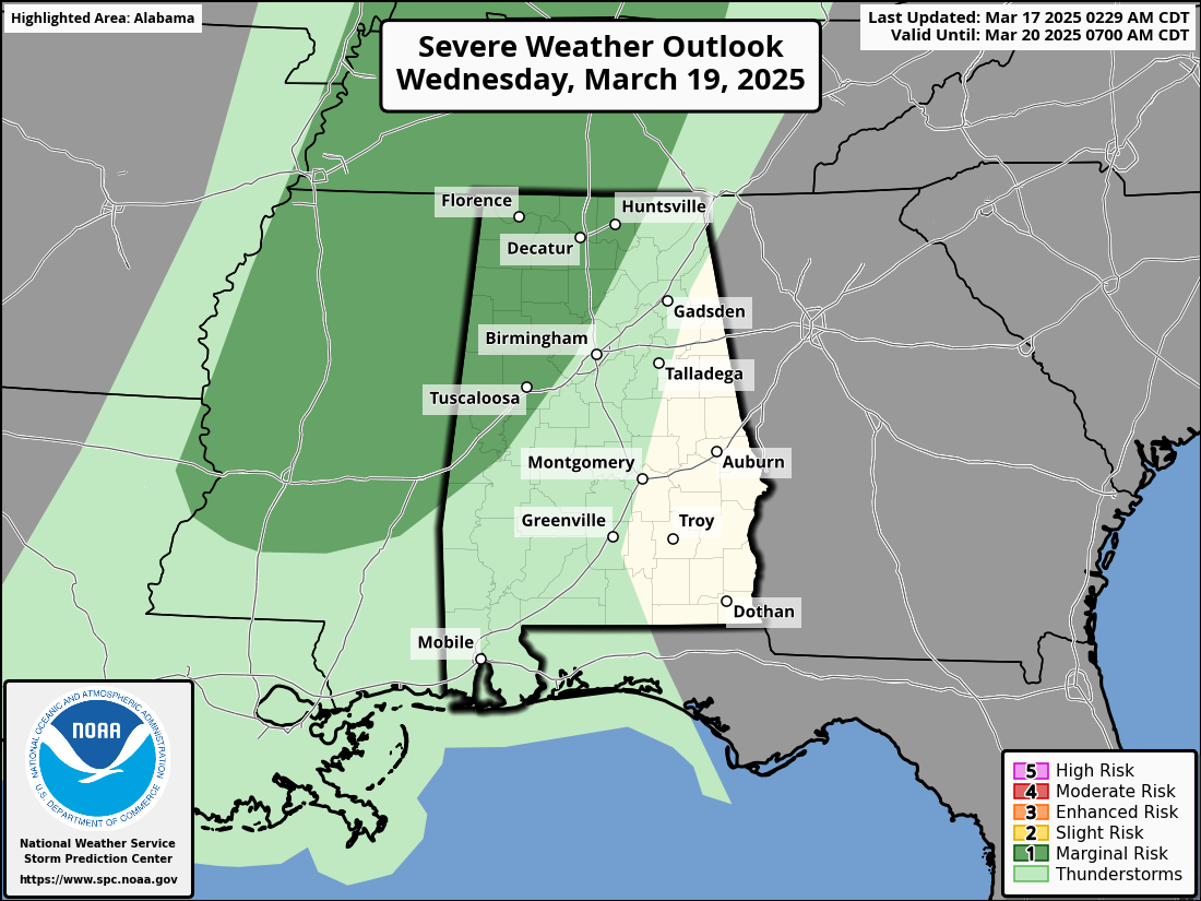
A few storms along the front could produce small hail and gusty winds, but with little surface-based instability and weak dynamic support, the overall threat is low.
Colder, drier air rolls into the Deep South Thursday. Highs will be in the 50s for the northern half of the state with a chilly north breeze. By Friday morning, we are looking at lows between 28 and 35 degrees over the northern half of the state, where frost is likely. Colder spots will see a late-season freeze. South Alabama will see lows between 38 and 44 degrees. During the day, the sky will be sunny with a high in the 60s.
THE ALABAMA WEEKEND: A few spotty showers are possible Saturday as moisture begins to return, but a decent part of the weekend will be dry with highs in the 70s. Showers and storms return Sunday night into early Monday; the SPC has defined a risk of severe storms west of Alabama with this system. We will monitor it closely for severe potential over the next few days.
TROPICS: The National Hurricane Center is monitoring a nontropical area of low pressure about 700 miles northeast of the northern Leeward Islands that is producing gale-force winds and a large area of disorganized showers and thunderstorms. Additional development of this low is not expected as it moves northward to northwestward into an environment of strong upper-level winds and dry air tonight and Tuesday. Hurricane season begins June 1.
STORM SURVEYS: Storm survey work from National Weather Service Birmingham is continuing today. So far, these are the tornado ratings from the weekend storms:
- Plantersville/Maplesville — EF-3
- Winterboro — EF-2
- Jackson’s Gap — EF-2
- Calera — EF-1
- West Shelby County — EF-1
- Bibb County — EF-0
- Hale/Perry counties — EF-0
Work will continue this week; at least 16 tornadoes likely touched down across Alabama, killing three people.
ON THIS DATE IN 1990: Showers and thunderstorms associated with a slow-moving cold front produced torrential rains across parts of the southeastern U.S. over two days. Flooding claimed the lives of at least 22 people, including 13 in Alabama. Up to 16 inches of rain deluged southern Alabama, with 10.63 inches reported at Mobile in 24 hours. Elba was flooded with 6 to 12 feet of water, causing more than $25 million damage, and total flood damage across Alabama exceeded $100 million. Twenty-six counties in the state were declared disaster areas.
ON THIS DATE IN 2021: Twenty-five tornadoes touched down in Alabama, including three rated EF-2. The longest-track tornado was around 36.5 miles, from Wayne County, Mississippi, to southern Marengo County. Other tornadoes occurred with this system from Louisiana and Mississippi to Georgia and Florida.
For more weather news and information from James Spann and his team, visit AlabamaWx.


