James Spann: Rain over south Alabama ends this evening; dry for the rest of the week

RADAR CHECK: Rain is confined to the far southern part of Alabama this afternoon; the sky has cleared over the northern counties. Rain over south Alabama ends this evening, and the sky becomes mostly fair statewide late tonight. Expect lows Tuesday morning between 45 and 55 degrees.
REST OF THE WEEK: Alabama’s weather for the rest of the week looks dry with highs mostly in the 70s, lows in the 40s and 50s, partly to mostly sunny days and fair nights.
THE ALABAMA WEEKEND: The weather becomes unsettled as moist air surges northward. We will bring in a chance of showers and storms on Saturday, but it won’t rain all day; the high will be between 75 and 80 degrees. On Sunday, a dynamic system will bring potential for severe thunderstorms to much of the Deep South. The Storm Prediction Center has defined a large severe-weather risk from the Gulf Coast to the southern Great Lakes.
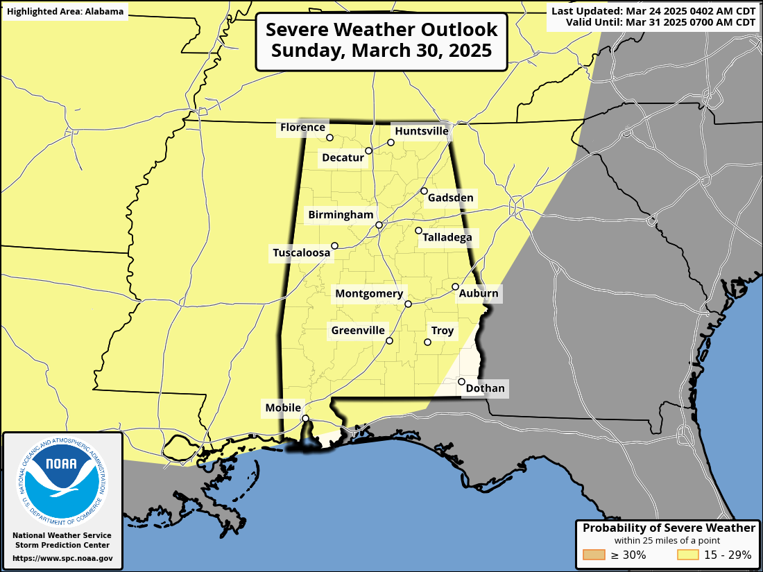
For now, it looks like the highest risk will come late Sunday and Sunday night, but it is too early for details concerning the threats, timing and magnitude of the event. Having a severe-weather threat in late March is very routine in Alabama. We will be able to be more specific later this week.
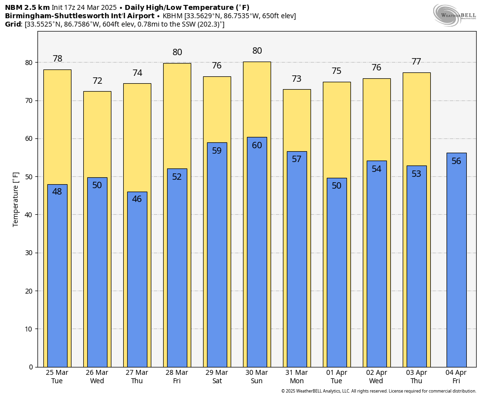
WHEN TO PLANT: We see no freezing temperatures across Alabama for the next 10 days, but the advice remains the same every year: Wait until April 15 if you want to plant something that might be harmed by a freeze or frost. We almost always have a sharp cold snap in Alabama sometime during the first half of April.
ON THIS DATE IN 1968: Unusually cold air was in place across the southern U.S.; Birmingham dropped to 23 degrees, which still stands as the daily record low.
For more weather news and information from James Spann and his team, visit AlabamaWx.


