James Spann: Rain ends in Alabama this evening; frost, freeze threat early Wednesday

RADAR CHECK: Light rain continues to fall across Alabama this afternoon east of a line from Fort Payne to Montgomery to Fairhope. The rest of the state is cloudy with temperatures mostly in the 50s. A few spots are in the mid to upper 40s; this is a 40-degree drop from the mid to upper 80s on Saturday.
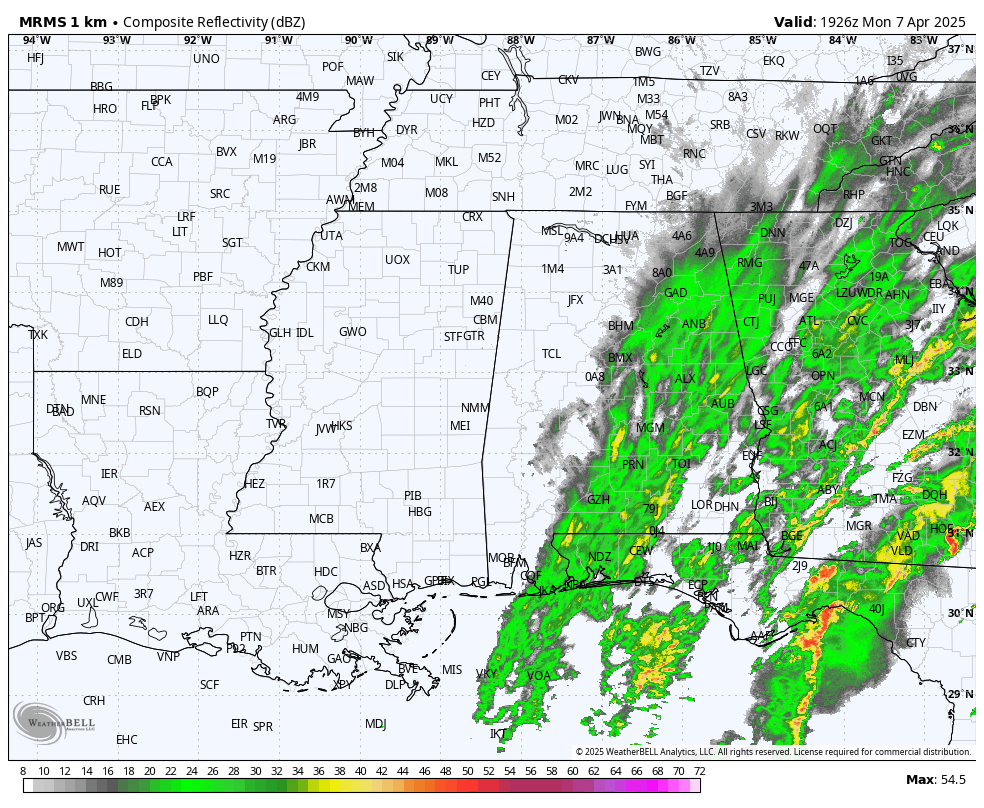
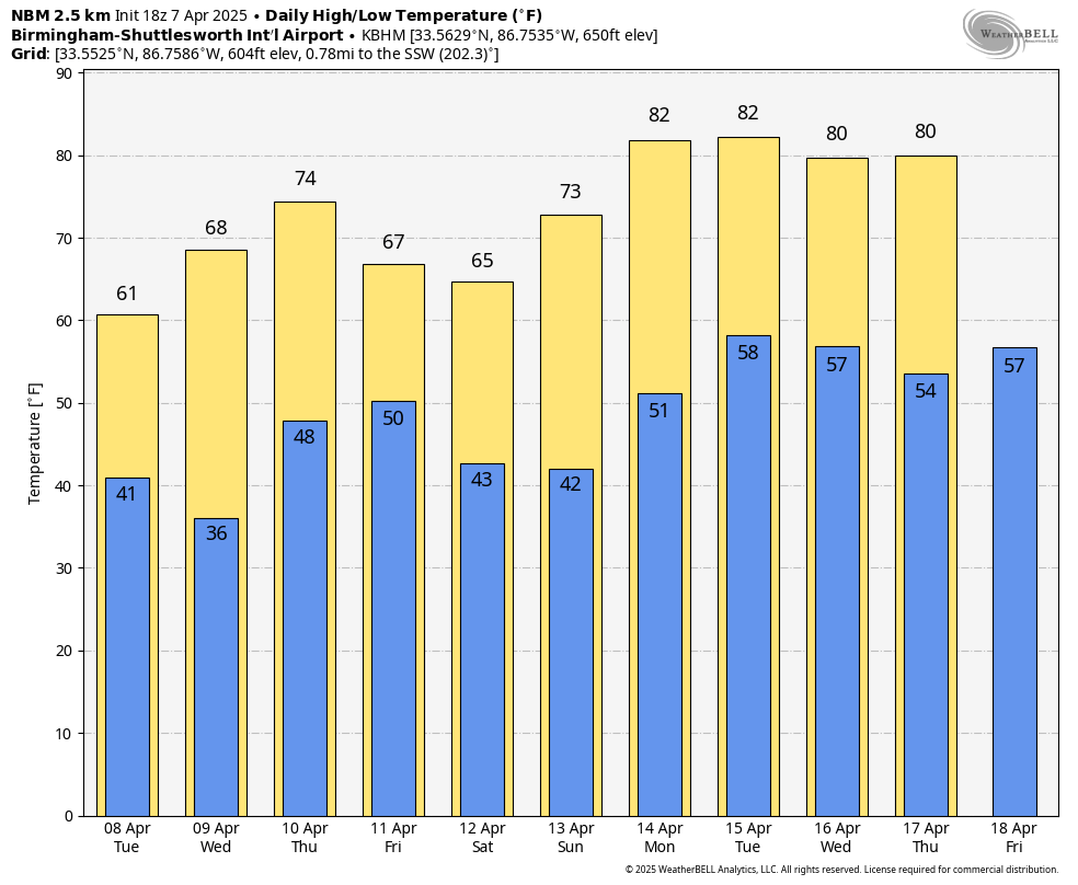
Rain will move out of the state tonight, and we expect gradual clearing overnight. The sky becomes mostly sunny Tuesday with highs in the 60s.
FROST/FREEZE POTENTIAL: The coldest morning of this late-season cold snap will come early Wednesday with low to mid 30s over the northern and central counties of the state. Frost is likely, and some spots will see a freeze. A freeze watch is in effect for roughly the northern third of Alabama.
On the positive side, this will most likely be the last widespread freeze and frost threat of the season for most communities, and after Wednesday morning we are giving the green light to plant.
A disturbance has potential to bring a few light rain showers to the state late Thursday, Thursday night and Friday, but rain amounts will be generally less than one-quarter inch for most places. Some places won’t see any rain at all. The high will be in the 70s Thursday, dropping back into the 60s Friday.
THE ALABAMA WEEKEND: The weekend will be cool and dry across the Deep South. Lows will be mostly in the 40s, with highs in the 60s Saturday and 70s Sunday.
At this point it looks like the weather will stay mostly dry next week as an upper ridge begins to rebuild; highs return to the low 80s.
STORM SURVEYS: National Weather Service Huntsville identified three EF-1 tornadoes from the weekend system; one at Sheffield, one at Tuscumbia and one near Aqua Vista and Elgin. Survey work will continue today. NWS Birmingham has identified one EF-1 tornado in Dallas County at Sardis, not far from Selma.
ON THIS DATE IN 2007: The mercury plummeted across Alabama as one of the coldest April air masses in history affected parts of the Deep South. It was 26 at Muscle Shoals and 27 at Huntsville, both records for the date. A passing upper disturbance caused cloud cover over parts of the state overnight, limiting the temperature drop over central sections, where lows were closer to 30 degrees. It was 30 at Birmingham. A few snow flurries associated with the disturbance occurred over parts of north-central Alabama the night before.
For more weather news and information from James Spann and his team, visit AlabamaWx.


