James Spann: Another beautiful spring day for Alabama; warm, mostly dry Easter weekend ahead

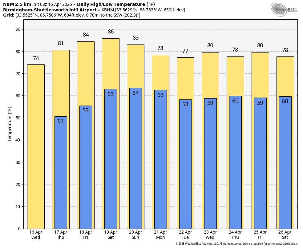
NICE WARM-UP: Some of the colder spots over north Alabama have dipped into the 30s early this morning, but most places are in the 40s at daybreak. Look for a high in the 70s today with sunshine in full supply.
The weather stays dry through Saturday with highs returning to the 80s beginning Thursday.
EASTER: There are still big model differences concerning the weather Sunday, but we will continue to side with the reliable European global model, which keeps most of the state warm and dry during the day, with highs in the 80s. A cold front will bring a chance of showers and storms to the state Sunday night.
The front will become nearly stationary around the Alabama/Tennessee border and will keep a chance of showers in the forecast Monday and Tuesday. Some risk of rain will likely continue through the rest of the week as a moist, unstable air mass remains in place. For now, it doesn’t look like a severe weather situation for Alabama, with the main dynamic support well to the north.
ON THIS DATE IN 1998: A historic outbreak of at least 13 tornadoes struck Middle Tennessee. Many were strong or violent and tracked long distances, killing four people and injuring nearly 100 while causing hundreds of millions of dollars in damage. One tornado struck downtown Nashville, blowing out numerous windows in skyscrapers and causing the collapse of some older buildings. Three violent tornadoes in southern Middle Tennessee reached F4 to F5 intensity, and an F3 tornado in Pickett County damaged or destroyed hundreds of homes and businesses. Wilson County was struck by four tornadoes during the event.
For more weather news and information from James Spann and his team, visit AlabamaWx.


