James Spann: Strong storms in Alabama late tomorrow night
James Spann: Alabama storms late Tuesday night could pack a punch from Alabama NewsCenter on Vimeo.
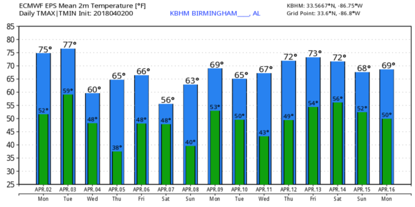
WARM, DRY MONDAY: With a partly sunny sky, we project a high close to 80 degrees this afternoon. Clouds increase late tonight, and tomorrow will be a mostly cloudy, mild day with only an outside risk of a shower. The high tomorrow will be in the 76- to 80-degree range for most north and central Alabama communities.
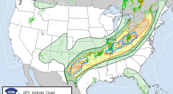
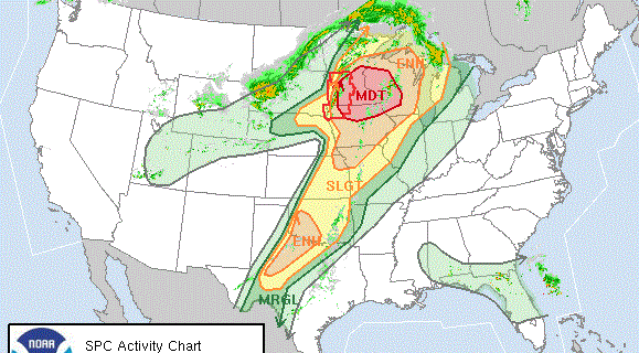
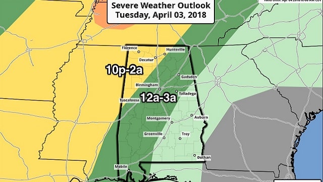
STRONG STORMS TOMORROW NIGHT: A cold front will push a line of thunderstorms into our state late tomorrow night, and those will pack a punch. The Storm Prediction Center has a “slight risk” of severe storms defined for northwest Alabama, areas west of a line from Aliceville to Jasper to Huntsville. A “marginal risk” extends eastward to Heflin, Prattville and Atmore.
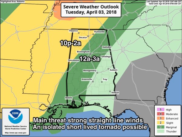
TIMING: The line of storms should enter the northwest corner of Alabama around 10 tomorrow night, reaching I-59 (Tuscaloosa, Birmingham, Gadsden) around 2 a.m. Wednesday. The weakening line will move down to near Montgomery by 3:30 to 4 a.m.
THREATS: The main threat with the line of storms will come from strong, possibly damaging straight-line winds. An isolated, short-lived tornado is possible, mainly over northwest Alabama in the “slight risk” zone. A few of the heavier storms could produce some small hail.
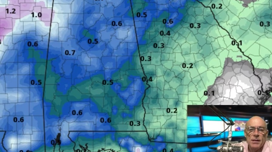
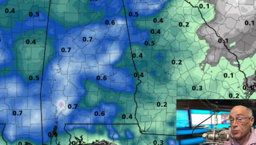
RAIN AMOUNTS: Rain totals should be one-half to three-quarters of an inch for most places; no flooding is expected.
The sky becomes mostly sunny Wednesday, but the day will be breezy and much cooler, with a high only in the low 60s; temperatures won’t get out of the 50s in the Tennessee Valley of far north Alabamaa.
FROST POTENTIAL THURSDAY MORNING: With a clear sky and light wind, we project a low in the mid 30s with a good chance of frost over the northern half of Alabama. Traditionally colder spots will hit the freezing mark. Growers, beware. Then, during the day Thursday we warm to near 70 with a good supply of sunshine.
FRIDAY AND THE WEEKEND: Clouds return late Thursday night, and Friday will be a cloudy day with a chance of showers and possibly a thunderstorm as a cold front drops in from the north. The front will stall out over south Alabama, and Saturday for now looks wet at times and pretty cold for April, with temperatures in the 50s all day. Global models actually suggest parts of Tennessee, North Carolina and maybe even northeast Georgia will have a chance of sleet and snow Saturday in colder air.
On Sunday, the front lifts northward as a warm front; the day will be warmer with a high close to 70, and showers remain possible.
NEXT WEEK: Monday will be a mild day with a chance of showers and storms, followed by cooler, drier air for the midweek.
BEACH FORECAST: Click here to see the AlabamaWx Beach Forecast Center page.
WEATHER BRAINS: You can listen to our weekly 90-minute netcast any time on the web or on iTunes. This is the show all about weather featuring many familiar voices, including meteorologists at ABC 33/40. We will produce this week’s show tonight at 8:30. You can watch it live here.
CONNECT: You can find me on all of the major social networks:
Facebook
Twitter
Google Plus
Instagram
Pinterest
Snapchat: spannwx
For more weather news and information from James Spann and his team, visit AlabamaWx.