James Spann: Showers remain scarce across Alabama today
James Spann has the midweek forecast for Alabama from Alabama NewsCenter on Vimeo.
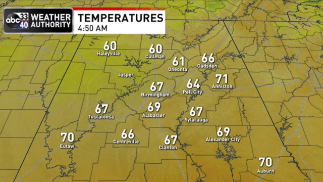
“COOL” AUGUST MORNING: There was a little hint of fall in the air over north Alabama early this morning; check out these temperatures just before daybreak:
- Decatur — 60
- Cullman — 60
- Haleyville — 60
- Huntsville — 63
- Hueytown — 65
- Talladega — 65
- Bessemer — 66
- Gadsden — 66
- Sylacauga — 67
- Tuscaloosa — 67
- Birmingham — 68
The air remains relatively dry over the northern half of the state; we expect a partly to mostly sunny sky today with only isolated showers this afternoon. The high will be between 85 and 89 degrees. Scattered storms will form over south Alabama later today, but even there many places will be dry.
THURSDAY THROUGH THE WEEKEND: We don’t expect much change Thursday — partly sunny with just a handful of isolated showers. Then, Friday through the weekend, we will have the usual chance of random, scattered, mostly afternoon and evening showers and thunderstorms with a mix of sun and clouds daily. Odds of any one spot getting wet will be 35-45% each day. Highs will be in the upper 80s Friday and Saturday, and close to 90 Sunday.
NEXT WEEK: An upper ridge begins to build across the region, meaning heat levels will rise a bit. We expect a high in the low 90s most days next week with partly sunny days and widely scattered showers and storms from about 1 until 10 p.m.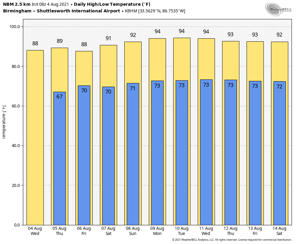
TROPICS: The Gulf of Mexico and the western part of the Atlantic basin remain very quiet this morning. Out in the far eastern Atlantic, a small, weak area of low pressure, with limited shower and thunderstorm activity, is passing near the Cabo Verde Islands. Significant development of this system is not expected during the next day or so due to unfavorable upper-level winds and marginally warm waters. Afterward, the system is forecast to move northward or north-northwestward over cooler waters, ending its development chances.
A tropical wave is forecast to move off the west coast of Africa by late Thursday. Environmental conditions appear somewhat conducive for slow development over the far eastern Atlantic through the weekend into early next week while the system moves generally westward at about 15 mph.
ON THIS DATE IN 2008: Severe storms moved across northern Illinois and Indiana with tornadoes and stiff winds reported. With tornado sirens blaring, the game at Wrigley Field between Cubs and Astros was stopped as fans were told to evacuate to the lower concourse. Passengers at O’Hare International Airport were evacuated to lower levels of buildings as well. An estimated 350 flights were canceled.
BEACH FORECAST: Click here to see the AlabamaWx Beach Forecast Center page.
WEATHER BRAINS: You can listen to our weekly 90-minute show any time on your favorite podcast app. This is the show all about weather featuring many familiar voices, including the meteorologists at ABC 33/40.
CONNECT: You can find me on the major social networks:
For more weather news and information from James Spann and his team, visit AlabamaWx.


