James Spann: Mild December days ahead for Alabama
PLEASANT DECEMBER DAY: With a sunny sky, temperatures are in the 60s across most of Alabama this afternoon. Humidity values are low and tonight will be clear and cool, with a low in the 40s for most communities.
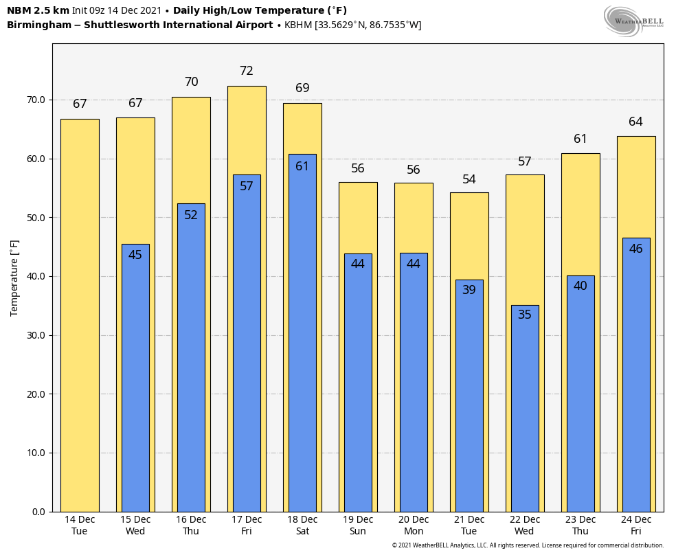
 Dry weather continues through Friday with a warming trend. Expect lots of sunshine Wednesday, followed by a partly sunny sky Thursday and Friday. Wednesday’s high will be close to 70, followed by low to mid 70s Thursday and Friday, not far from record warmth. Here are the records for Birmingham:
- Wednesday (Dec. 15) — 77 (1971)
- Thursday (Dec. 16) — 76 (1924)
- Friday (Dec. 17) — 73 (1984)
THE ALABAMA WEEKEND: A cold front will bring clouds and showers to the state Saturday. This won’t be an all-day rain, but occasional showers are likely. Some thunder is possible as the air will be unstable, but severe storms are not expected with weak dynamic forcing. The high Saturday afternoon will be between 67 and 71 degrees. The front will drift down near the Gulf Coast late Saturday night, and the latest global model data suggests much of the day Sunday will be cool and dry, with highs in the 50s. The sky will feature more clouds than sun and showers should be few and far between.
A wave of low pressure rides along the front, setting the stage for more rain Sunday night into Monday. The weather stays cool Monday, with a high in the 50s.
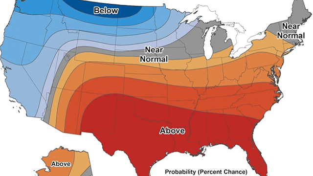
REST OF NEXT WEEK: Dry weather is expected Tuesday through Thursday; a cold front could bring showers toward the end of the week. Highs will be in the 50s Tuesday and Wednesday, then back in the 60s Thursday and Friday. It still looks like temperatures will be above average across the Deep South on Christmas Day.
 ON THIS DATE IN 1952: Traces of snow or sleet occurred at or near Pensacola, Crestview, DeFuniak Springs, Quincy, Carrabelle, Tallahassee, St. Marks, Monticello, Madison, Mayo, Live Oak, Lake City, Glen St. Mary and Hilliard in Florida. The frozen precipitation occurred before noon at most points, but happened in the afternoon at Mayo and Lake City and near Hilliard. Temperatures were above freezing and snow or sleet melted as it fell.
ON THIS DATE IN 1997: What was expected to be a cold rain turned out to be one of the biggest snow events on record across parts of the Deep South. A cold-core upper low provided dynamic cooling, and rain changed to heavy, wet snow across parts of central Mississippi and Alabama. Snow amounts of around 8 inches were reported around Jackson, Mississippi, with amounts of 2-4 inches across parts of west Alabama in places like Demopolis.
BEACH FORECAST: Click here to see the AlabamaWx Beach Forecast Center page.
WEATHER BRAINS: You can listen to our weekly 90-minute show any time on your favorite podcast app. This is the show all about weather featuring many familiar voices, including the meteorologists at ABC 33/40.
CONNECT: You can find me on the major social networks:
For more weather news and information from James Spann and his team, visit AlabamaWx.


