Scott Martin: Showers possible for Alabama today; severe storms possible Wednesday, Thursday
TODAY: Ridging is still in control of our weather today, but we are now in a southwesterly flow and moisture levels will be increasing throughout the day. We can expect mostly cloudy skies with scattered showers, with the best chances over northwestern Alabama. A few locations in the south may have some thunder with these passing showers. Afternoon highs will be in the lower 70s to the lower 80s. Rain chances will become more likely tonight and some thunder may be mixed in, but no severe weather is expected.
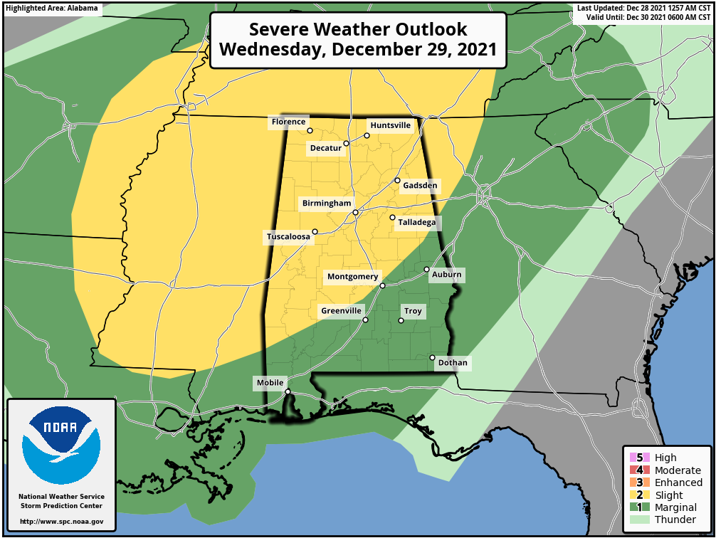
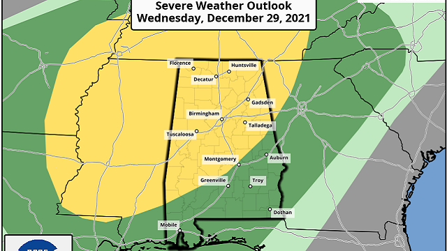
SEVERE STORMS POSSIBLE WEDNESDAY: Wednesday will be mostly cloudy, with showers and thunderstorms developing during the afternoon and into the evening. A few of these storms may become strong to severe with the main threat of damaging wind gusts up to 60 mph, but there is a small risk of a brief tornado or two. Highs will be in the lower 70s to right around 80 degrees.
A slight risk for severe storms is up for most of north and central Alabama, mainly north and west of a line from Hayneville (Lowndes County) to Wetumpka (Elmore County) to Wedowee (Randolph County), while the Storm Prediction Center has placed the rest of the state in a marginal risk.
Timing on this severe threat will be spread out from the afternoon Wednesday through the night and will continue for the southern parts of the state on Thursday as the front will struggle to move through and will eventually stall in the southern half of Alabama. So be sure to have fresh batteries in those weather radios and keep your mobile devices charged, and be ready to act if your location goes under a warning.
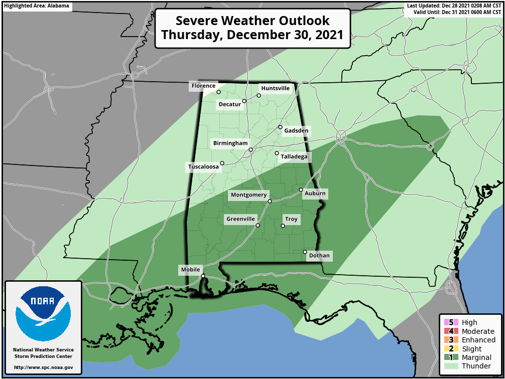
STRONG STORMS POSSIBLE AGAIN THURSDAY: Showers and thunderstorms will continue moving through the state on Thursday, and a few of those may become strong to severe. A marginal risk is up for the southern portions of the state, mainly along and south of a line from Linden (Marengo County) to Clanton (Chilton County) to Wedowee (Randolph County). Again, the main risk will be from isolated damaging wind gusts up to 60 mph, with a much smaller risk of a brief tornado. Once the front passes your location, the threat will be over and the rain will begin to taper off. Skies will remain mostly cloudy, with highs in the 70s.
NO BREAK FROM THE RAIN ON FRIDAY: The front starts to retreat back to the north as a warm front on Friday; that will keep showers and thunderstorms likely for much of the state. For now, there is no risk of severe weather for north and central Alabama on the outlook for Friday, but I wouldn’t be surprised if we had a few storms with gusty winds. Highs will be in the 70s.
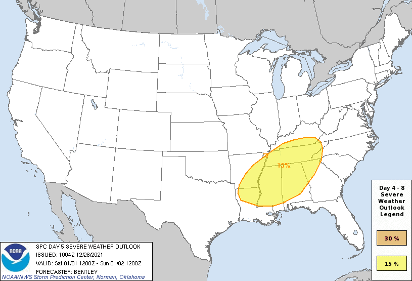
MORE SEVERE WEATHER POSSIBLE THIS WEEKEND: Our next threat of severe storms will come Saturday, as a strong cold front will move into the state during the early afternoon and slowly progress across north and central Alabama through the rest of the day and into the pre-dawn hours Sunday morning. The SPC has expanded the risk area to include all of north and central Alabama except for the extreme southeastern locations. It looks like all modes of severe weather will be possible with this system as it will be the stronger of the two events, but we’ll need to get through this first system before we can focus on the details for the weekend. Much colder air will move in behind the front on Sunday, and we’ll get a chance to finally start to dry out. Saturday’s highs will be in the 70s, dropping back into the upper 40s to the upper 60s on Sunday.
For more weather news and information from James Spann, Scott Martin and other members of the James Spann team, visit AlabamaWx.


