Scott Martin: Very nice Saturday for Alabama; a few strong storms possible Sunday
NOT A BAD SATURDAY: High pressure will be stationed over the extreme southeastern parts of the state today. That will allow us to have mostly sunny skies with decent temperatures. Highs will be in the mid-50s to the lower 60s.
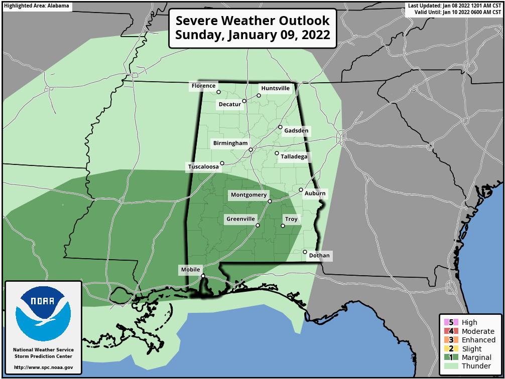
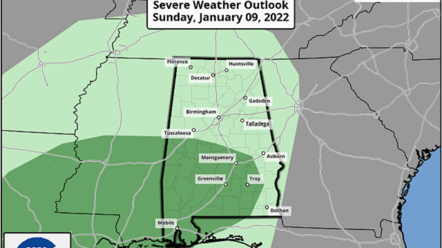
A FEW STRONG STORMS POSSIBLE SUNDAY: A frontal system will move into western Alabama starting as early as just before daybreak Sunday morning and will make its exit late Sunday night. A warm front will move northward ahead of the system that will destabilize the atmosphere. The Storm Prediction Center has a marginal risk up for locations along and south of a line from Moundville to Verbena to Clayton, where there is a small potential of isolated damaging wind gusts up to 60 mph and a brief tornado. Highs will be in the lower 60s to the lower 70s.
NEXT WEEK: Skies will clear out and become sunny Monday, with highs in the mid-40s to the upper 50s. Tuesday will feature more sunshine and still be rather cool, with highs reaching the mid-40s to the mid-50s. Wednesday brings slightly warmer temperatures, reaching the upper 40s to the mid-50s. And Thursday will be a little warmer still, with a good bit of sunshine and highs in the mid-50s to the lower 60s.
We have a little disagreement in the models for Friday. The Global Forecast System is keeping us dry with partly to mostly sunny skies. However, the European model has a few showers creeping into the state from the west starting around midday. We’ll have to watch over the next day or so to see if they come into better agreement. Highs will be in the mid-50s to the lower 60s.
For more weather news and information from James Spann, Scott Martin and other members of the James Spann team, visit AlabamaWx.


