James Spann: Dry weather continues for Alabama as Ian stays far to the east
LONG DRY SPELL TO CONTINUE: Birmingham has recorded only 0.19 inch of rain over the past 20 days, and the dry pattern will continue into October. We are forecasting sunny, pleasant days and fair, cool nights through Friday, with highs in the 70s and lows in the 40s and 50s.
Ian will remain well east of Alabama over the weekend, and most of the state will stay dry with a good supply of sunshine Saturday and Sunday. A few raindrops are possible near the Georgia state line Saturday afternoon, but odds of meaningful rain there look lower as the track of Ian shifts eastward. Highs over the weekend will hold in the 70s, with lows in the 50s.
NEXT WEEK: We expect no real change; and there’s no sign of any major rain event for Alabama. Look for mostly sunny days with highs between 78 and 82 degrees. Lows will be in the upper 50s and low 60s most mornings. FOOTBALL WEATHER: For the high school games in the state Friday night, the sky will be mostly clear with temperatures falling through the 60s.
Saturday, Alabama travels to Fayetteville to take on Arkansas (2:30 p.m. CT kickoff). The sky will be sunny with temperatures in the low 80s as the game begins. There’s no risk of rain.
Auburn hosts LSU Saturday (6 p.m. kickoff) at Jordan-Hare Stadium. The sky will be mostly fair with temperatures falling from near 72 at kickoff into the 60s during the game.
UAB will be in Houston to take on Rice (6:30 p.m. CT kickoff). The sky will be clear with temperatures falling from the low 80s at kickoff into the mid 70s by the final whistle.
RACE WEEKEND: The weekend looks great for Talladega as Ian stays to the east. Expect a good supply of sunshine Saturday and Sunday with highs in the mid 70s.
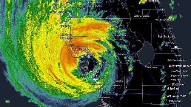
IAN MAKES LANDFALL: NOAA Doppler radar imagery indicates that the eye of Ian made landfall along the southwestern coast of Florida near Cayo Costa around 2:05 p.m. CT. Data from an Air Force Reserve reconnaissance aircraft indicate that Ian’s maximum sustained winds were estimated to be near 150 mph (Category 4 strength). The latest minimum central pressure estimated from reconnaissance data is 940 millibars (27.75 inches).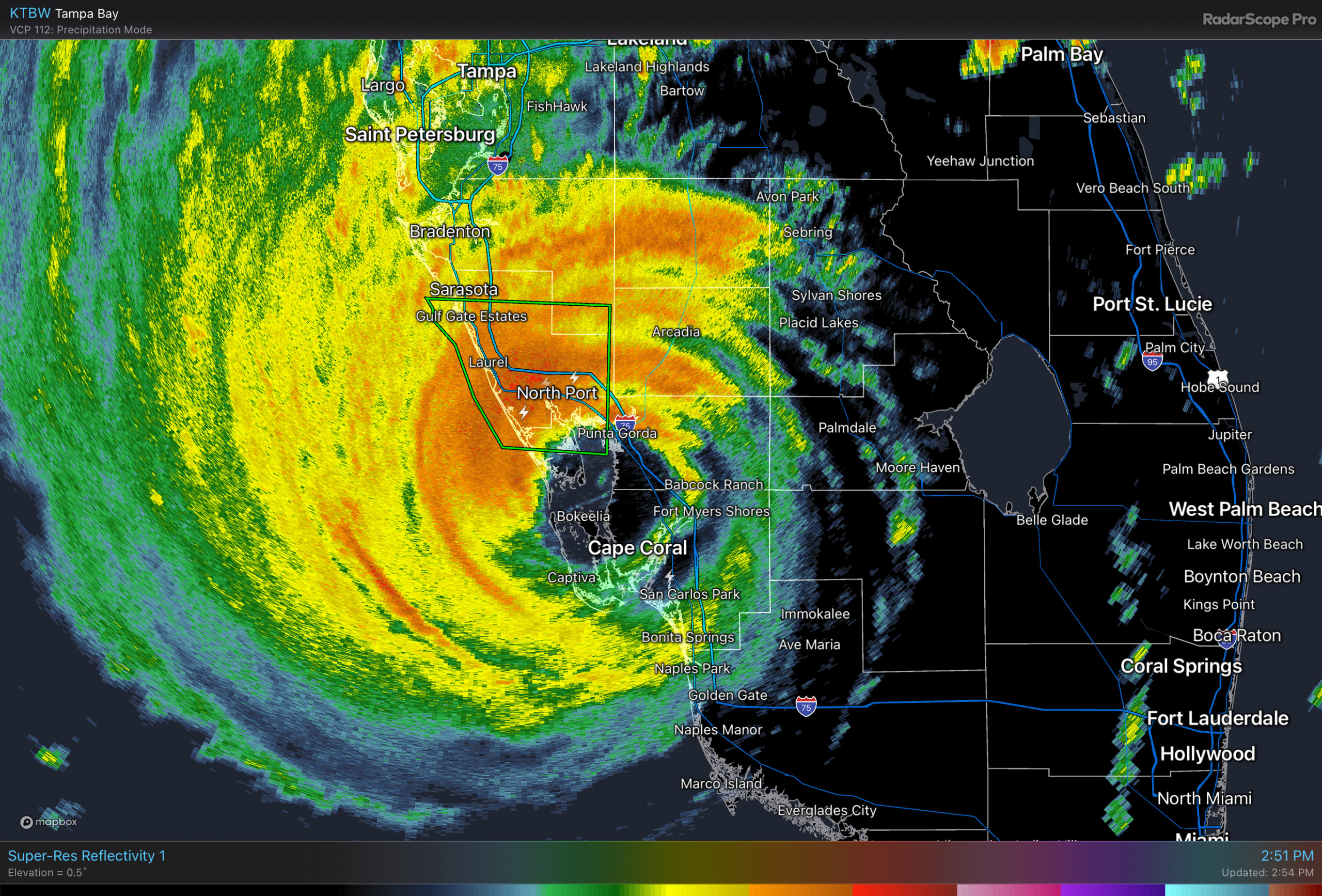
Ian will slowly weaken inland over the Florida Peninsula tonight; it will ultimately dissipate across parts of the Carolinas over the weekend.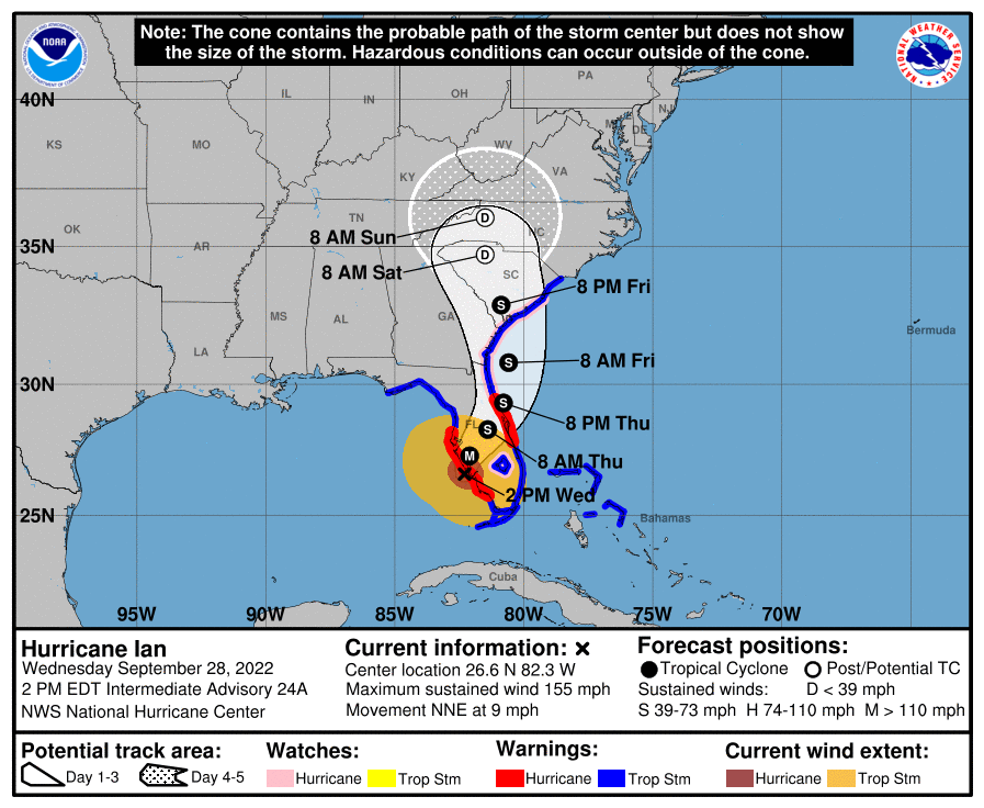 TD 11 FORMS: Tropical Depression 11 has formed in the middle of the Atlantic. It will move northward and dissipate far from land in a few days. If it becomes a tropical storm, the name will be Julia. The rest of the Atlantic basin is quiet.
ON THIS DATE IN 1998: Hurricane Georges made landfall near Biloxi with maximum winds of 110 mph and a minimum pressure of 964 millibars. After landfall, Georges moved very slowly across southern Mississippi and weakened to a tropical depression by the morning of Sept. 29, when the center was about 30 miles north-northeast of Mobile. One fatality was reported in the mainland United States directly related to the hurricane. That occurred in Mobile due to freshwater flooding. In Escambia County, Florida, there were three fatalities indirectly related to Georges. Insured property damage was estimated to have cost $2.955 billion in Florida, Alabama, Mississippi and Louisiana. Throughout the area, agriculture took a beating with the cotton, soybean and pecan crops almost destroyed.
BEACH FORECAST: Click here to see the AlabamaWx Beach Forecast Center page.
For more weather news and information from James Spann and his team, visit AlabamaWx.


