James Spann: Widespread rain returns to Alabama Saturday night, after a few afternoon showers
DRY THROUGH SATURDAY MORNING: Rain has ended across Alabama this afternoon, and we are seeing some filtered sunshine over the northern counties of the state. Temperatures are mostly in the 60s; Mobile has reached the low 70s. Tonight will be mostly fair with a low between 45 and 52 degrees.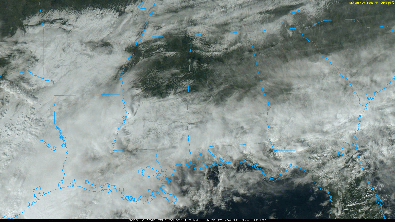
Clouds will increase across the state Saturday, and a few isolated showers could form during the afternoon over the western half of the state. But the better chance of rain comes Saturday night. The Storm Prediction Center has defined a marginal risk of severe thunderstorms for the southern quarter of Alabama Saturday night.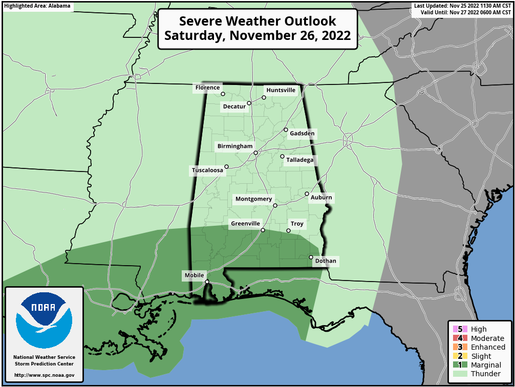
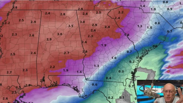
Enough low-level shear should exist for some low-level updraft rotation and perhaps a tornado or two across far south Alabama Saturday night. Isolated damaging winds may also occur as convection spreads eastward across the central Gulf Coast states. For north and central Alabama, expect just a large area of rain with some thunder; no severe storms are expected for that part of the state. Rain amounts Saturday night will be around 1 inch.
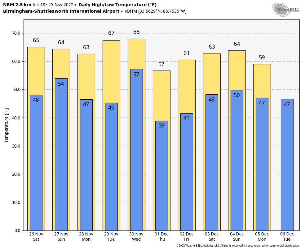
On Sunday, rain ends very early in the day, and the sky becomes partly sunny with a high in the mid 60s. Sunday will be windy, with gusty west winds of 15-25 mph.
NEXT WEEK: Monday will be dry with a high in the upper 60s. Clouds increase Tuesday, and rain and storms return to the state Tuesday night into part of the day Wednesday. This is a dynamic system, and some potential for strong to severe thunderstorms could evolve across Alabama, but it remains too early to be specific. The SPC has defined a risk of severe storms west of Alabama during the day Tuesday.
Dry air returns Thursday and Friday with seasonal temperatures.
 HIGH SCHOOL PLAYOFF GAMES: The weather will be dry for the high school football games across Alabama tonight. The sky will be mostly fair with temperatures generally in the 50s; some fog is possible.
IRON BOWL: It will be a mild day for the biggest football game of the year in Alabama Saturday (Auburn at Alabama, 2:30 p.m. kickoff). Expect a temperature in the upper 60s at kickoff. A passing shower is possible during the game, but the most widespread rain won’t arrive in Tuscaloosa until after the completion of the game. The chance of a passing shower Saturday afternoon is 20-25%. Temperatures fall into the low 60s by the final whistle, and rain becomes widespread across west Alabama by 9 Saturday night.
Saturday morning should be dry for the tailgaters.
ON THIS DATE IN 1950: A storm called the “storm of the century” affected the eastern part of the U.S., killing hundreds and causing millions of dollars in damages. New York City recorded a 94-mph wind gust and Bear Mountain, just north of the city, recorded a 140-mph gust. Record low temperatures were reported on the southern end of this storm in Tennessee and North Carolina. The storm was unique as Pittsburgh saw 30 inches of snow, while Buffalo saw 50 degrees with 50-mph wind gusts.
The temperature at Birmingham dropped to 5 degrees, the coldest November temperature on record. Snow fell over the northern half of the state the day before, on Nov. 24.
ON THIS DATE IN 1986: An EF3 tornado carved out a path of 44 miles through parts of Coffee, Dale and Barbour counties in southeast Alabama. The twister developed in the New Brockton area, then moved through Ariton, Elamville, Clio and Clayton, where it dissipated. There were three injuries in New Brockton and one church, three homes and two other buildings were destroyed. Another church and 17 houses were damaged. Near Ariton, an injury occurred in a mobile home.
BEACH FORECAST: Click here to see the AlabamaWx Beach Forecast Center page.
For more weather news and information from James Spann and his team, visit AlabamaWx.


