James Spann: Warm days for Alabama, then cooler over the weekend
WARM DECEMBER WEATHER: The temperature has reached 80 degrees at Mobile and Evergreen at mid-afternoon; elsewhere temperatures are mostly in the 70s with a mostly cloudy sky. The average high for Birmingham on Dec. 6 is 59. The sky is mostly cloudy across the state, but we are seeing only widely scattered showers over the northern counties.
Any showers across the state Wednesday and Thursday will be few and far between as an upper ridge over the Gulf of Mexico expands northward. Showers are possible Friday ahead of an approaching cold front, but rain amounts most likely won’t be too heavy.
Highs will stay in the 70s through Friday, not far from record levels.
Here are the record highs for Birmingham. We’re not expecting to break them, but it will be close:
- Dec. 6 (today) — 78, set in 1998
- Dec. 7 (Wednesday) — 80, set in 1951
- Dec. 8 (Thursday) — 79, set in 1978
- Dec. 9 (Friday) — 74, set in 1946
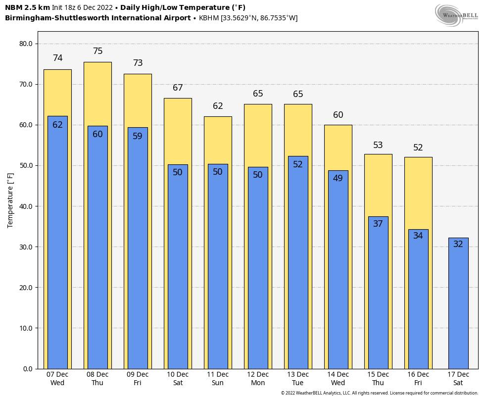
THE ALABAMA WEEKEND: For now, Saturday looks relatively dry with only widely scattered showers. Periods of rain look likely Sunday as moist air surges northward. Highs over the weekend will be in the mid to upper 60s with generally cloudy conditions.
NEXT WEEK: While a few isolated showers are possible Monday and Tuesday, the rain will be more widespread Wednesday and Wednesday night, along with the chance of a few thunderstorms. The Storm Prediction Center has a risk of severe storms defined in its convective outlook for Monday, but for now it looks like the severe weather threat in Alabama will be fairly low at midweek as the main dynamic support will pass well to the north. We will still watch model output closely over the next few days for any changes.
Cooler, drier air returns Thursday and Friday. Highs will be in the 60s and low 70s for the first half of the week, dropping into the 50s by Thursday. Global models are showing signals for colder weather for the Deep South over the latter half of December.
TROPICS: A large area of low pressure over the central subtropical Atlantic, about 800 miles northeast of the northern Leeward Islands, continues to produce a broad area of showers and thunderstorms. Environmental conditions appear marginally conducive for development, and a subtropical or tropical storm could form in the next couple of days. By Thursday night or Friday, the low will move northeastward over cooler waters and interact with a mid-latitude trough, limiting subtropical or tropical development of the system.
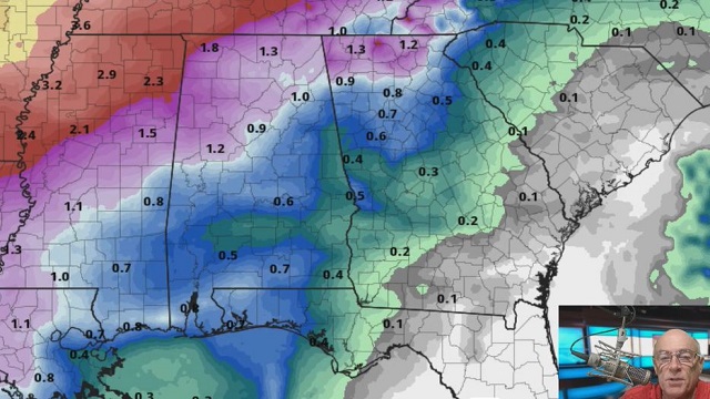
This system is far from land and won’t affect the U.S.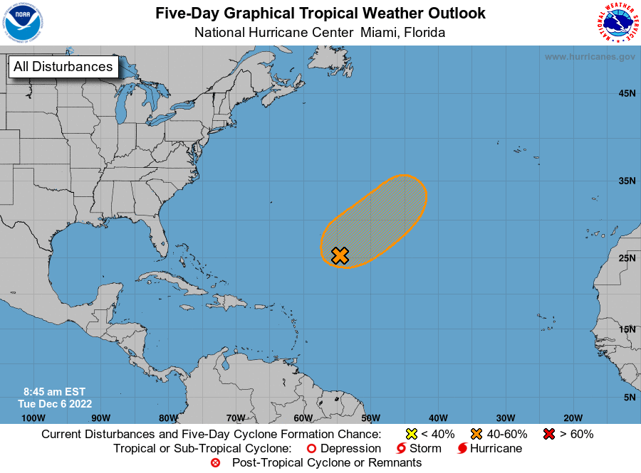 ON THIS DATE IN 1913: A snowstorm from Dec. 1 through Dec. 6 dumped a record total of 45.7 inches in Denver, Colorado. This storm produced the most snow ever recorded in a single Denver snowstorm.
ON THIS DATE IN 1983: An F3 tornado moved through Selma before dawn; it was on the ground for 13 miles. At least 103 structures were damaged or destroyed along the path. Thirty to 40 vehicles at a new car dealership were destroyed. Numerous units at the Rangedale Housing Project in Selma were demolished and one person was killed. Clarence Chappell was asleep when the tornado hit. A dormitory at Selma University was struck by the twister. Fifty students were occupying the dorm at the time. Seven suffered minor injuries when the tornado destroyed the roof and parts of the second floor of their dorm.
BEACH FORECAST: Click here to see the AlabamaWx Beach Forecast Center page.
For more weather news and information from James Spann and his team, visit AlabamaWx.


