James Spann: Showers for Alabama tonight, Wednesday; strong to severe storms possible Thursday
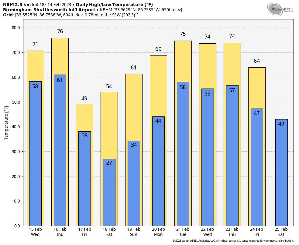
SPRING PREVIEW: Temperatures have exceeded 70 degrees across much of Alabama this afternoon with a partly to mostly sunny sky. Clouds will thicken tonight, and showers will move into the state ahead of a surface front. Gradient winds will continue to increase over the next few hours, averaging 10-20 mph with higher gusts. A wind advisory is in effect through tonight for the Tennessee Valley of north Alabama.
The front will become nearly stationary across the region Wednesday. The day will be mostly cloudy with a few showers during the day. A thunderstorm can’t be ruled out during the afternoon but should remain below severe limits. The temperature stays mild, with highs in the low 70s in most places.
THURSDAY: The Storm Prediction Center has most of Alabama in a slight risk (level 2 out of 5) of severe thunderstorms Thursday.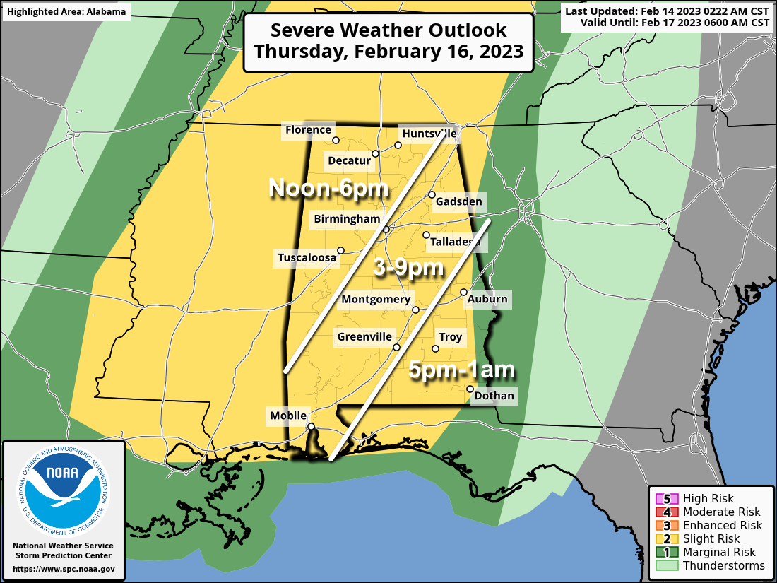
The primary threat of strong to severe storms will come during the afternoon and evening, and over the western two-thirds of the state. Based on forecast instability and wind profiles, thunderstorms will be capable of producing hail, strong winds and possibly a few isolated tornadoes. The day will be breezy with a high in the low to mid 70s.
Having this type of threat is common this time of the year; Alabama’s tornado season runs from November through May. Have a reliable way of hearing warnings if they are needed and have a good plan of action in the event you fall into a tornado warning polygon.
FRIDAY AND THE WEEKEND: Friday will feature a clearing sky as a much colder air mass moves into the state. Temperatures will hold in the 40s over the northern counties, with 50s to the south. We start the weekend with 20s early Saturday morning, followed by a high in the 50s with a sunny sky. Sunday will be another sunny day, with highs in the 60s.
NEXT WEEK: The warming trend continues; we rise into the low to mid 70s during the first half of the week. A few showers are possible by Tuesday, and there will be a chance of rain statewide Wednesday, possibly into part of the day Thursday.
ON THIS DATE IN 1895: The most significant snowfall in the history of Houston, Texas, occurred on Feb. 14-15. The area saw 20 inches of snow.
ON THIS DATE IN 1958: Snow lovers got a special gift as the heaviest snowfall since 1948 blanketed Birmingham with more than 2 inches. Roads in the Magic City quickly became snow-packed and impassable. Roads between Birmingham and Atlanta were especially dangerous. The northwest corner of Alabama was blanketed with 3-6 inches. Six to 8 inches fell in Decatur. At the Birmingham Municipal Airport, a Delta Airlines DC-7 slid off the runway and buried itself nose-deep in slush and mud when the nosewheel broke. The 43 passengers were uninjured.
BEACH FORECAST: Click here to see the AlabamaWx Beach Forecast Center page.
For more weather news and information from James Spann and his team, visit AlabamaWx.


