James Spann: Warming trend continues for Alabama; severe storms possible Friday night
James Spann has the midweek forecast for Alabama from Alabama News Center on Vimeo.
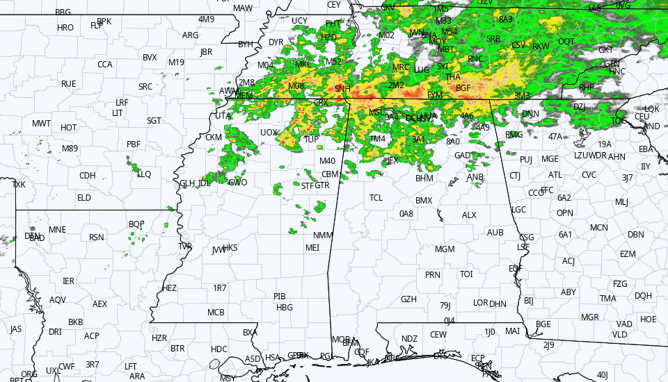
ILLEGAL SHOWERS: We have showers over the northern third of Alabama early this morning, generally north of I-20. These are “illegal” because they weren’t in the forecast for today; the idea was that most of the rain this morning would be north of the Tennessee River, over far north Alabama and Tennessee. But the air moistened up sufficiently for some rain down into the northern third of the state. These showers will fade this afternoon, and the rest of the state will be dry with a mix of sun and clouds. Temperatures reach the low 70s this afternoon in most places as the warming trend continues.
Thursday will be mostly sunny and warm, with a high between 80 and 85 degrees. The day Friday will also be warm and dry with a mix of sun and clouds; temperatures rise into the low to mid 80s again. South winds will increase by afternoon.
FRIDAY NIGHT: A cold front will push an organized band of thunderstorms into Alabama Friday night into the early hours Saturday. The Storm Prediction Center has defined a slight risk (level 2 out of 5) of severe storms for areas west of a line from Fort Payne to Verbena to Camden to Jackson. A marginal risk extends as far east and south as Opelika and Geneva.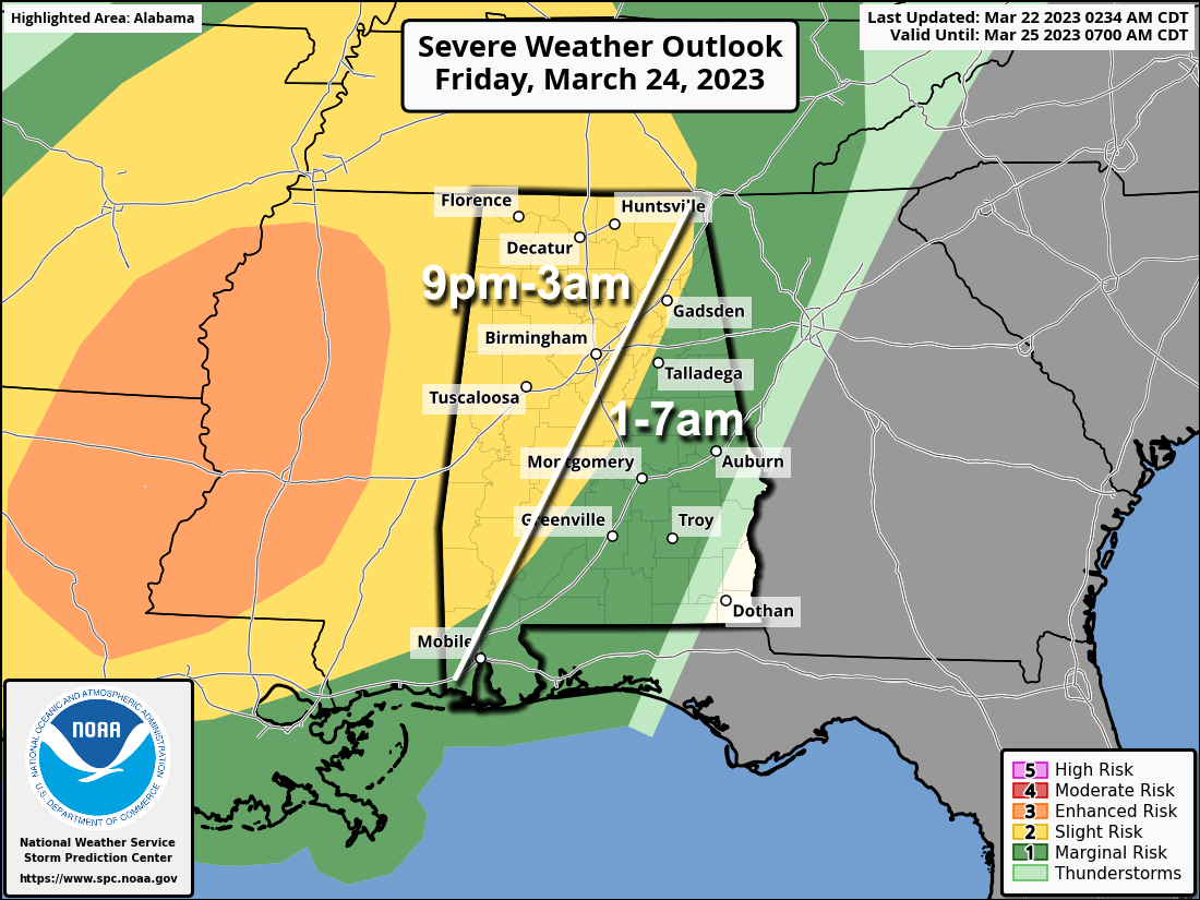 The surface and upper-air synoptic pattern certainly favors severe thunderstorms; the main question involves the degree of surface-based instability available. This will likely be a linear event with the main threat coming from strong, potentially damaging straight-line winds, but a few tornadoes are very possible.
The window opens up for severe storms over far west Alabama as early as 9 p.m.; the line will advance through the state through the early morning Saturday. This will be a middle-of-the-night type event, and everyone will need a reliable way of getting warnings. The baseline is a NOAA Weather Radio; every home and business needs one. Have Wireless Emergency Alerts enabled on your phone and be sure “Do Not Disturb” is not active Friday night.
THE ALABAMA WEEKEND: Storms end very early Saturday morning; the sky becomes partly to mostly sunny with a high around 80 degrees. Clouds return Sunday, and we will bring in a chance of showers and thunderstorms by afternoon; the high Sunday will be between 75 and 80 degrees.
NEXT WEEK: Showers and storms are possible Monday, but drier air returns Tuesday. Global models suggest showers could return Friday. Highs will be in the upper 60s and 70s through the week.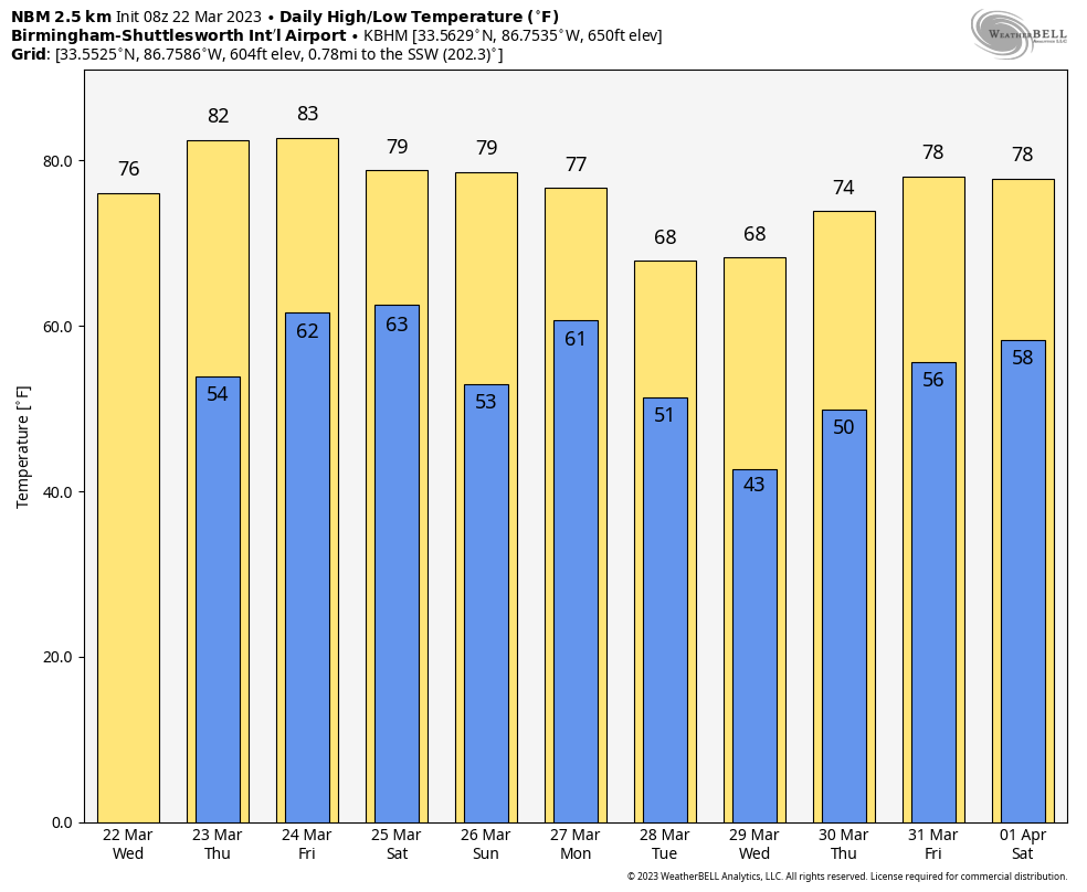 ON THIS DATE IN 1893: The first tornado was recorded in Oklahoma City, Oklahoma, on this date. It destroyed 14 buildings and injured four people as it passed through the center of town. There was minor damage to the Weather Bureau office, which was at Grand and Robinson in south Oklahoma City.
ON THIS DATE IN 2022: Three tornadoes touched down in southwest Alabama, including an EF-1 that moved through Baldwin County from Summerdale to Robertsdale.
BEACH FORECAST: Click here to see the AlabamaWx Beach Forecast Center page.
For more weather news and information from James Spann and his team, visit AlabamaWx.


