James Spann: A few sprinkles over north Alabama early this morning
James Spann forecasts mostly dry weather for Alabama through the weekend from Alabama News Center on Vimeo.
RADAR CHECK: An upper trough is producing a few patches of “illegal” light rain over north Alabama early this morning (rain that wasn’t forecast); otherwise, the state is dry with temperatures mostly in the 60s. The sprinkles won’t last long, and most of the state will remain rain-free today with highs in the low to mid 80s and a mix of sun and clouds. A few isolated showers can’t be ruled out over the southern counties today.
The upper trough moves on to the east tonight, and we expect dry weather Friday and Saturday with a good supply of sunshine both days. Highs remain in the 80s, lows in the 60s. On Sunday, we will introduce the chance of a few showers by afternoon as moisture levels begin to rise. The sky will be occasionally cloudy Sunday with a high in the mid 80s.
NEXT WEEK: We will forecast a chance of showers Monday through Wednesday, with the higher probabilities over the northern half of the state — nothing too widespread, nothing too heavy. The weather looks dry Thursday and Friday with a northwest flow aloft developing. Highs hold in the 80s through the week, with lows in the 60s. FOOTBALL WEATHER: The sky will be clear for the high school games across Alabama Friday night, with temperatures falling through the 70s, possibly reaching the 60s by the fourth quarter.
Saturday Auburn will travel to College Station to take on Texas A&M (11 a.m. CT kickoff). The sky will be mostly sunny with temperatures rising from near 90 at kickoff to near 95 by the final whistle.
Alabama will host Ole Miss at Bryant-Denny Stadium Saturday (2:30 p.m. kickoff). The sky will be partly to mostly sunny with temperatures in the mid 80s.
UAB will be in Athens to take on Georgia Saturday (6:30 p.m. CT kickoff). The weather looks dry with a mostly clear sky; temperatures will fall from near 77 at kickoff into the 60s by the fourth quarter.
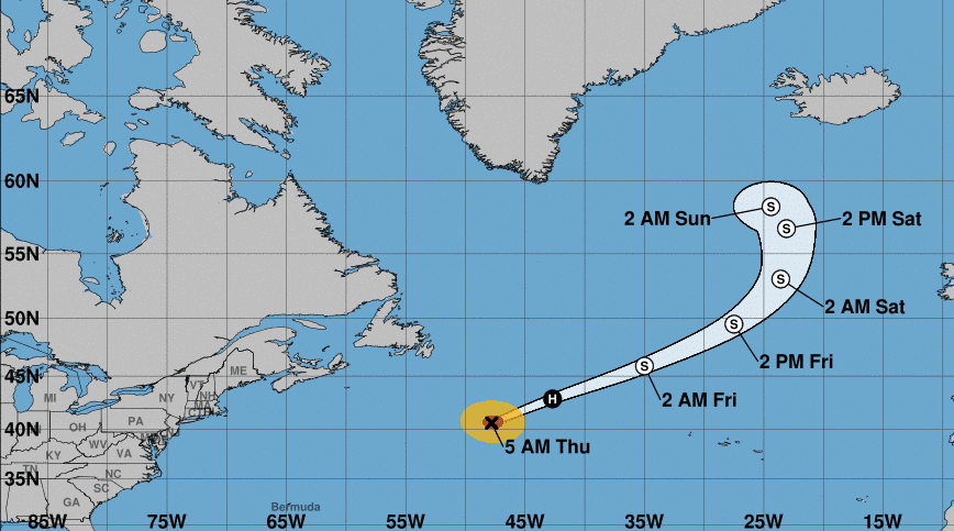
TROPICS: Hurricane Nigel, with winds of 85 mph, is racing northeastward and becomes post-tropical in the North Atlantic Friday far from land.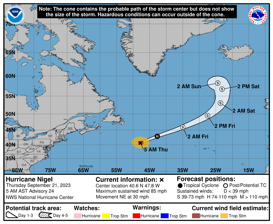 Closer to home, a nontropical low-pressure system is expected to form within a large area of disorganized showers and thunderstorms east of the Florida peninsula within the next day or so. This system could acquire some subtropical characteristics Friday while it moves generally northward. Regardless of development, this low is likely to bring gusty winds to gale force, heavy rain and high surf to portions of the Southeast and Mid-Atlantic United States late this week and into this weekend. The National Hurricane Center (NHC) gives it a 40% chance of development.
A tropical wave near the Cabo Verde Islands in the eastern Atlantic is expected to merge with another disturbance a few hundred miles to its west in a few days. Environmental conditions are forecast to be conducive for gradual development, and a tropical depression is likely to form late this week or this weekend while the system moves generally westward at 10 to 15 mph across the eastern and central tropical Atlantic. Global models suggest this will likely turn north before reaching the Lesser Antilles or the U.S.; the NHC gives it a 70% chance of development.
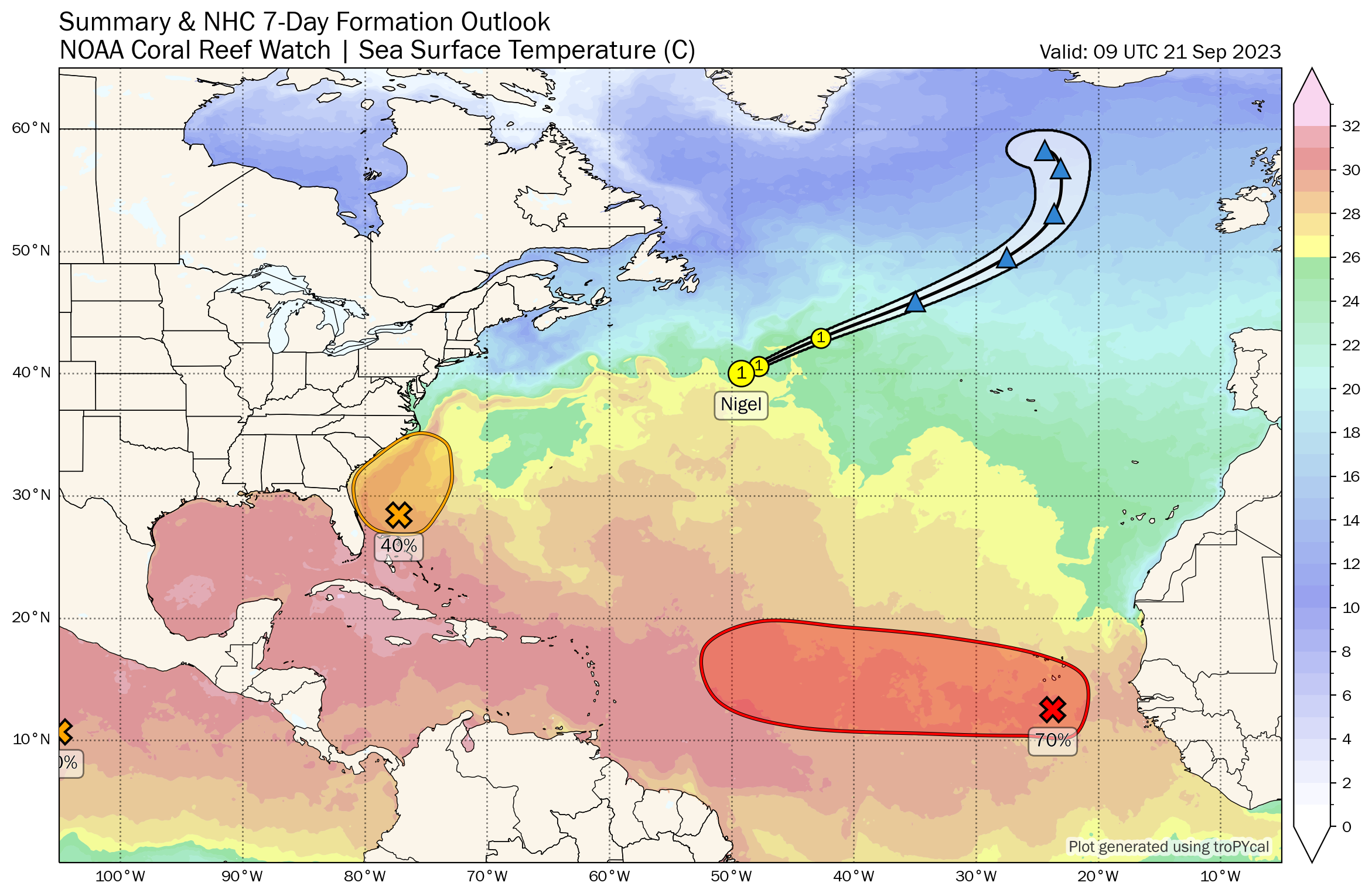 No tropical systems are expected near the Gulf of Mexico for at least the next seven days.
ON THIS DATE IN 1938: One of the most destructive and powerful hurricanes in recorded history struck Long Island and southern New England. This Category 3 hurricane was traveling at 47 mph when it made landfall near Bellport, New York. This storm caused at least 600 deaths and left approximately 63,000 homeless.
ON THIS DATE IN 1989: Hurricane Hugo made landfall on Isle of Palms, South Carolina, as a Category 4 storm. This storm brought strong winds to many areas of South Carolina. In downtown Charleston, sustained winds of 87 mph were reported, along with gusts of 108 mph. Hugo was the strongest hurricane to make landfall on the continental U.S. since Hurricane Camille in 1969. The cleanup and recovery efforts that followed were extensive throughout the areas affected by Hugo. There were at least 39 fatalities during the post-storm recovery phase; more people died in South Carolina in the hurricane’s aftermath than during its passage.
For more weather news and information from James Spann and his team, visit AlabamaWx.


