James Spann: Big soaking ahead for Alabama, a few strong storms for southern counties
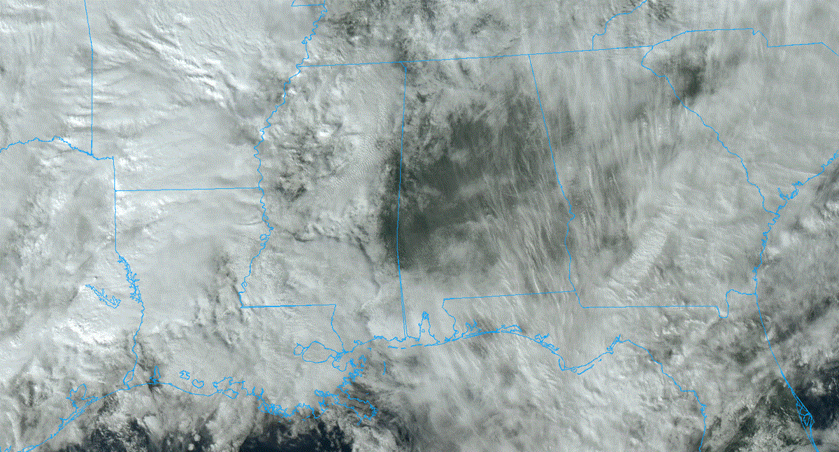
RADAR CHECK: Most of Alabama is rain-free this afternoon with a bit of filtered sunshine. Clouds will thicken again tonight, with rain possible at times, mainly after midnight.
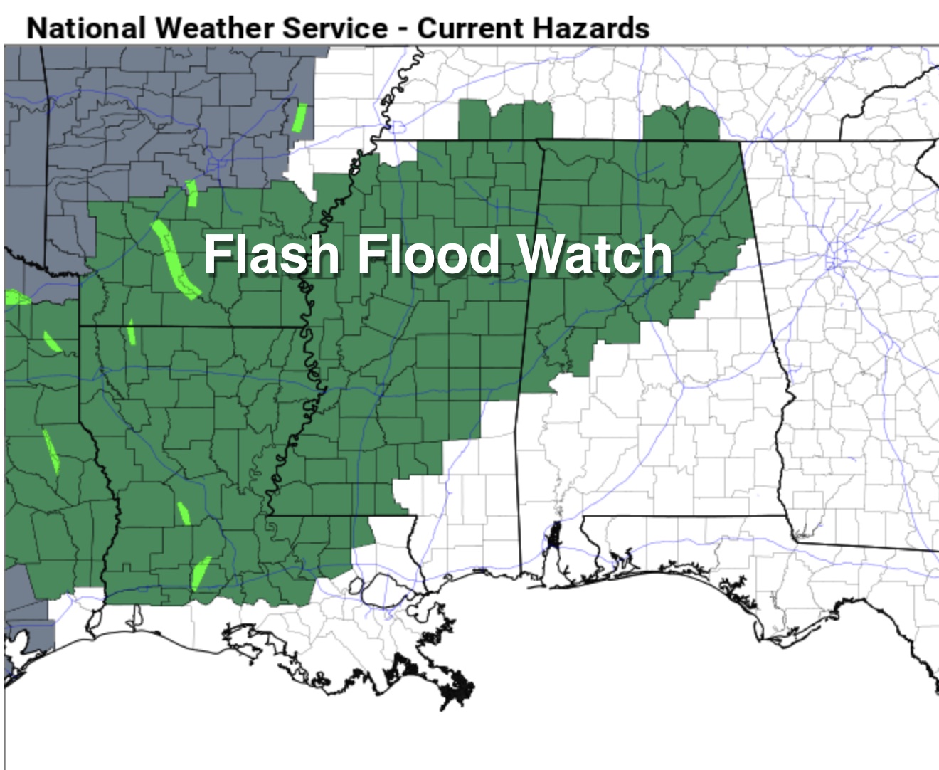
REST OF THE WEEK: Widespread rain is likely Wednesday, Thursday and into Friday morning. The rain could be heavy at times, and a flash flood watch has been issued for areas north of a line from York to Brent to Calera to Sylacauga to Spring Garden.
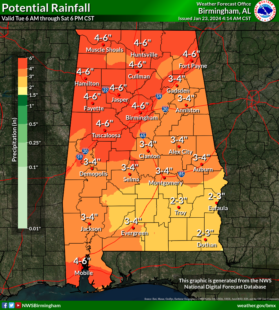
Rain amounts of 2-4 inches are likely between today and Saturday night across the state, with isolated amounts of 5-6 inches possible over the northern counties. This could lead to some flooding.
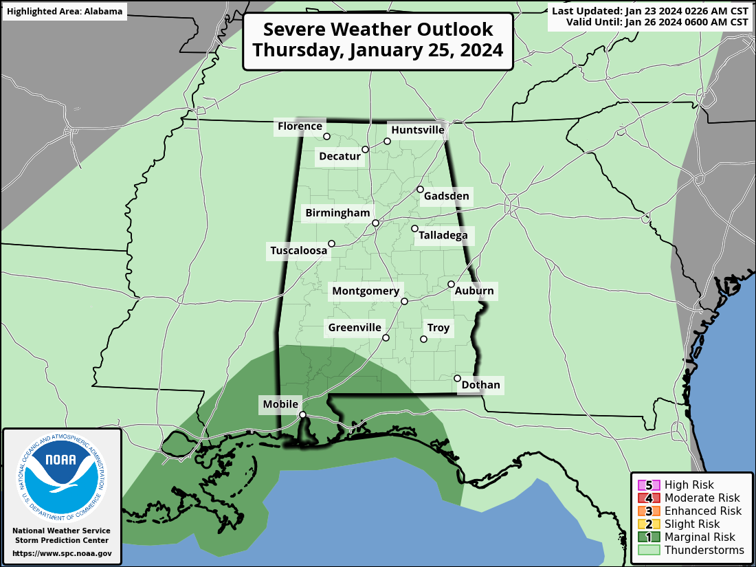
A few strong thunderstorms will be possible across far south Alabama Wednesday and Thursday; heavier storms there could produce strong, gusty winds. Extreme south Alabama is in a marginal risk (level 1 out of 5) of severe thunderstorms Thursday. Highs will be in the 60s, with potential for low 70s across the southern third of the state.
THE ALABAMA WEEKEND: We expect a break in the rain Friday afternoon and Friday night, but another wave of rain and storms is expected Saturday. Global models suggest there will be some surface-based instability, and strong storms are possible statewide. It’s a little too early to know whether severe thunderstorms will be an issue, but it certainly is possible. Highs will remain in the 60s over much of the state, with low 70s for some south Alabama communities.
Sunday will be cloudy and cooler with some lingering rain possible; highs drop into the low to mid 50s.
NEXT WEEK: At this point the weather next week looks mostly dry across the Deep South with seasonal temperatures — highs mostly in the 50s, lows in the 30s.
ON THIS DATE IN 1940: A winter storm dropped 9.5 inches of snow on Birmingham, the second-highest snow on record (below the 13 inches received during the Blizzard of ‘93). All roads into and out of the city were glazed with a thick layer of ice. Ethelsville reported 14 inches of snow. The entire state was blanketed. Other amounts included 9 inches at Gadsden, 7.5 inches at Anniston, 6 inches at Tuscaloosa and Decatur, 4 inches at Butler and 3 inches at Florence. A foot of snow had fallen at Columbus, Mississippi.
ON THIS DATE IN 1969: An F4 tornado cut a 120-mile-long path from Jefferson through Copiah, Simpson, Smith, Scott and Newton counties in Mississippi, killing 32 and injuring 241 others. Property damage was estimated at $2 million. An inbound Delta Airlines aircraft reported a hook echo on its scope with this storm.
For more weather news and information from James Spann and his team, visit AlabamaWx.


