James Spann: Flash flood watch for much of Alabama; lots of rain through Saturday

James Spann forecasts abundant rain for Alabama through Saturday from Alabama News Center on Vimeo.
WET: We will have elevated rain chances across Alabama through the beginning of the weekend, and the flash flood watch has been expanded. It is now in effect for areas generally north of a line from Mobile to Montgomery to Opelika.
The first wave of rain arrives later this morning and will continue through the afternoon and tonight. The heaviest rain through tonight will be over the northern half of the state. Periods of rain and a few thunderstorms will continue statewide Thursday into Friday morning. The rain will be heavy at times, and a few strong thunderstorms are possible Thursday over the southern half of the state. The Storm Prediction Center (SPC) has defined a marginal risk (level 1 out of 5) of severe thunderstorms south of a line from Demopolis to Montgomery to Eufaula.
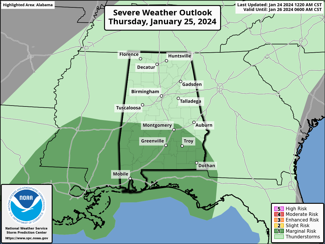
The main threat from the heavier storms will come from strong straight-line winds.
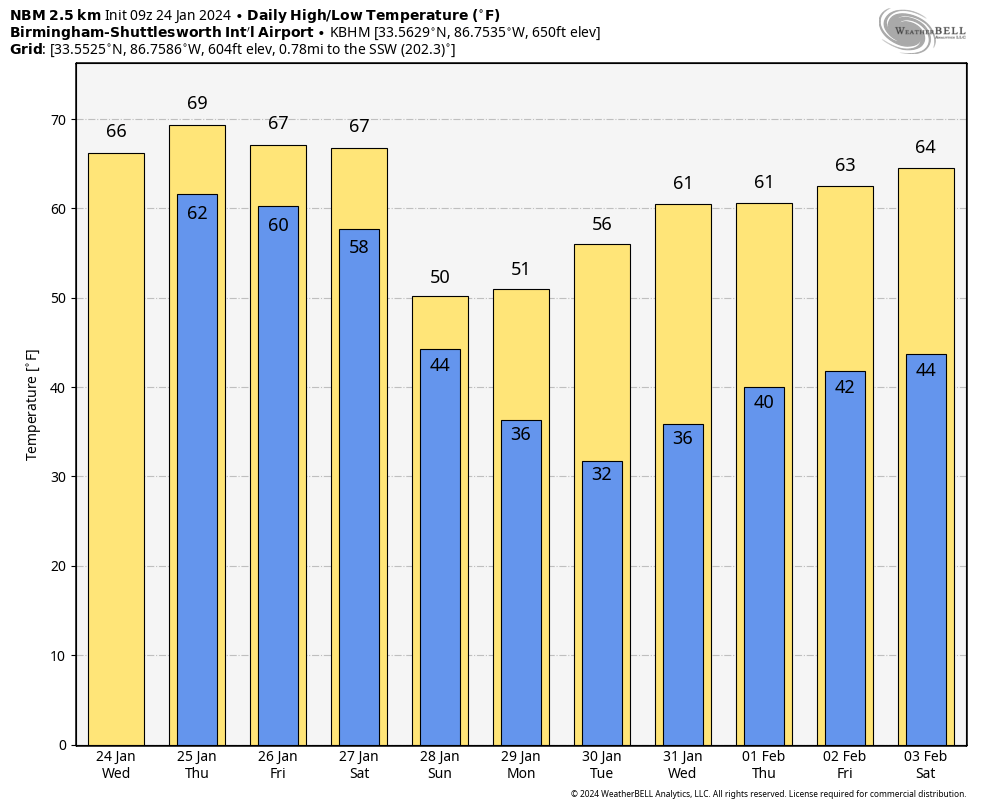
Rain will taper off Friday morning, and we expect only spotty showers Friday afternoon and night. Temperatures will remain mild this week, with highs in the 60s for most of Alabama; low 70s are possible for the southern third of the state.
THE ALABAMA WEEKEND: Another wave of rain and thunderstorms will move through the state Saturday, and the SPC has defined a severe weather risk for about the eastern half of the state.
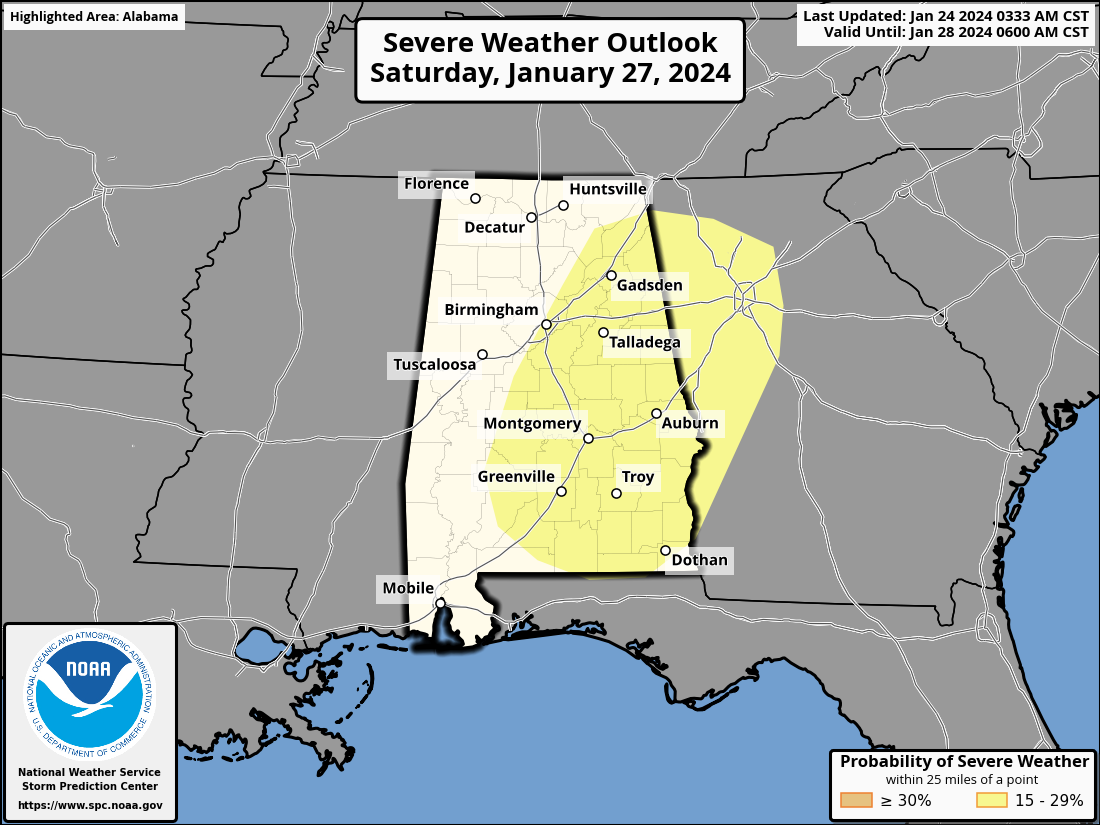
If the air can become unstable, a few storms Saturday could produce strong winds across Alabama. It remains to be seen whether there will be a tornado threat; once we get within the 60-hour window Thursday we will be able to see high-resolution, convection-allowing model data that will give us a much better look at the situation.
Sunday will be mostly cloudy and cooler with some patchy, light rain possible for north Alabama; highs drop into the low to mid 50s.
NEXT WEEK: For now, the week looks dry with highs in the 50s and 60s; lows will be in the 30s and 40s.
ON THIS DATE IN 1964: An F4 tornado tore through Harpersville in Shelby County, killing 10 people. From the National Weather Service Birmingham storm survey: “Two houses along U.S. 280 were completely carried away from their foundations. One was picked up and carried some 500 feet, where it was slammed into another house. Four died in that house (one of the injured died later), and five died in another house across Highway 280 about 300 yards northeast of the first house that was destroyed. In the latter house, an electric freezer weighing several hundred pounds was carried some 150 yards before being dropped.”
For more weather news and information from James Spann and his team, visit AlabamaWx.


