James Spann: Showers for Alabama tonight, possibly a thunderstorm early Thursday

SUN AND CLOUDS: We have a wide range of temperatures across Alabama this afternoon due to a rather erratic cloud cover across the state. Where clouds are in place, temperatures are in the 50s, but where the sun is shining readings are between 65 and 70 degrees. Clouds thicken statewide tonight, and we will forecast developing showers ahead of an approaching cold front.
In the outlook that runs through 6 a.m. Thursday, NOAA’s Storm Prediction Center has defined a marginal risk (level 1 out of 5) of severe thunderstorms for parts of north and central Alabama. In the outlook valid after 6 a.m., a marginal risk is in place for parts of south Alabama.
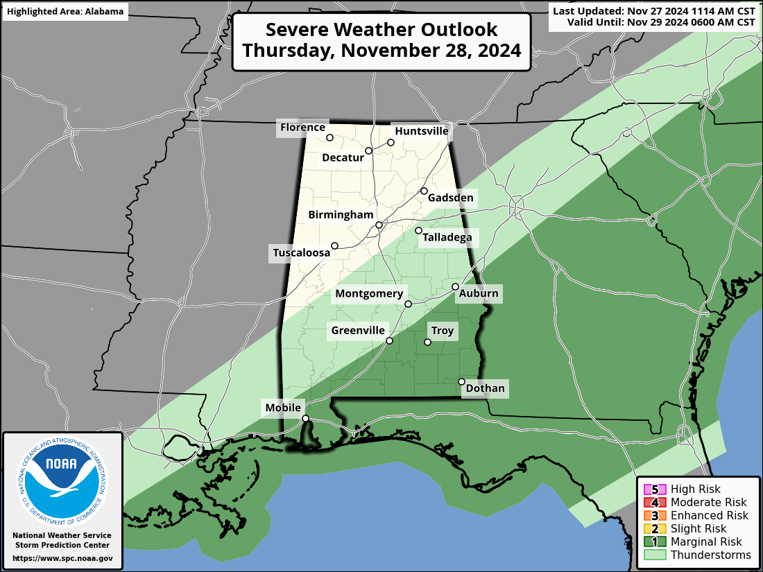
Models continue to show a faster progression of the front, with showers ending over the northern half of the state by 5-6 a.m.; rain will be out of south Alabama by late morning.
With meager instability and somewhat marginal wind fields, the overall severe thunderstorm risk is low. Many places won’t have any thunder and hardly any rain. If a stronger storm can develop, gusty winds and small hail are possible. The chance of a brief, isolated tornado is very low but not zero.
Rain amounts will be less than one-quarter of an inch for most places, and there is a chance some communities won’t have enough rain to measure.
Temperatures will go the wrong way Thursday. Most places will be in the low 60s just before daybreak, but temperatures will fall through the 50s quickly, reaching the 40s across the northern half of the state by afternoon. A brisk northwest wind will make it feel colder.
FRIDAY AND THE WEEKEND: The weather will be cold and dry with mostly sunny days and fair nights. Highs will be in the 40s and 50s, with lows below freezing for the northern two-thirds of the state (20s and low 30s). It will be the coldest air so far this season.
NEXT WEEK: Cold, dry weather continues Monday and Tuesday; some of the colder spots across north Alabama could reach the upper teens, and a freeze is likely down to the Gulf Coast. Temperatures moderate a bit over the latter half of the week, with highs reaching the low 60s by Friday. The week looks mostly dry, although models hint at some light rain Thursday or Friday.
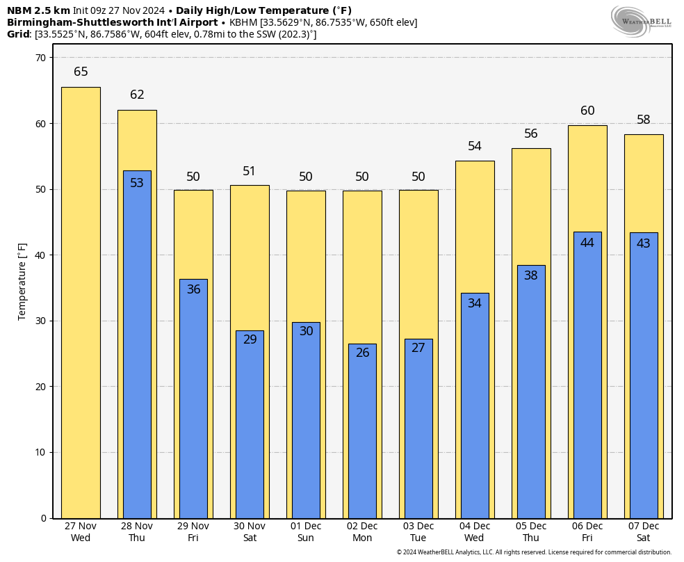 IRON BOWL: The weather will be cold and dry Saturday in Tuscaloosa for this year’s Iron Bowl (Auburn at Alabama, 2:30 p.m. kickoff). The sky will be mostly sunny, and temperatures will drop from near 50 at kickoff to near 40 by the final whistle.
ON THIS DATE IN 1898: A powerful storm known as the Portland Gale affected coastal New England on Nov. 26-27. The storm formed when two areas of low pressure merged off the coast of New Jersey and traveled up the East Coast. It produced hurricane-force winds in Nantucket and sank more than 150 boats and ships.
ON THIS DATE IN 2019: Two small EF-0 tornadoes touched down in south Alabama. One was just northeast of Brundidge, the other near Clio.
For more weather news and information from James Spann and his team, visit AlabamaWx.


