James Spann: Weekend showers for Alabama; severe storms late Sunday night, Monday

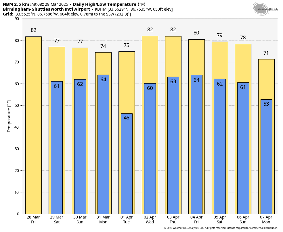
WARM, DRY DAY AHEAD: Temperatures will exceed 80 degrees over much of Alabama this afternoon with a partly sunny sky. Clouds will increase tonight as moisture levels rise.
THE WEEKEND: No doubt it will rain at times over the weekend, but it certainly won’t be a washout, and a decent part of both days will be dry. Some thunder is possible, but the risk of severe storms will remain northwest of Alabama through Sunday evening. Highs will be between 75 and 82 degrees.
SEVERE THUNDERSTORM THREAT: A very unstable air mass will move into Alabama Sunday night ahead of a dynamic storm system that will bring the chance of severe thunderstorms to the Deep South. In the Storm Prediction Center’s outlook valid through Monday morning at 7, an enhanced risk (level 3 of 5) has been defined for northwest Alabama. There is a slight risk (level 2) down to Thomasville, Rockford and Wedowee, and a marginal risk (level 1) for the rest of south Alabama.
The window for severe storms will open up a little before midnight Sunday night over the northwest corner of the state, spreading southward through the night into Monday morning. All modes of severe thunderstorms will be possible, including large hail, damaging winds and a few tornadoes.
This is a middle-of-the-night event, meaning it is critical that you can hear warnings. The baseline for every home is a NOAA Weather Radio. On your phone, be sure the sleep and “do not disturb” modes are turned off so you can receive notifications. If you live in a mobile home, be sure you know of a shelter that is open or a 24/7 business that can serve as a shelter. Have transportation available.
The severe weather risk will wind down by early Monday afternoon across southeast Alabama as the storms move out of the state.
REST OF THE WEEK: Tuesday looks dry; then another system will bring showers and storms back into the state Wednesday. Thursday and Friday look mostly dry and warm, with highs in the low to mid 80s as an upper ridge builds across the Deep South.
 ON THIS DATE IN 1920: The worst tornado disaster of record occurred in Chicago, killing 28 people and causing $3 million damage. It was part of an outbreak that saw 38 tornadoes hit the Midwest and the Deep South. More than 380 people died during the Palm Sunday outbreak.
In Alabama that day, a long-track tornado from near Deatsville to West Point, Georgia, killed 17 people. The greatest destruction was in Tallapoosa County in the vicinity of Susanna, Agricola and Red Ridge. One person was killed in another tornado in Calhoun County near Jacksonville.
For more weather news and information from James Spann and his team, visit AlabamaWx.


