James Spann: Summer-like warmth for Alabama; storms stay north and west

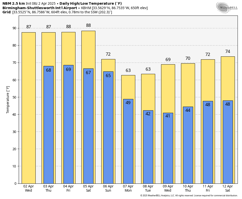
SUMMER PREVIEW: Alabama’s weather will feel more like June as we are forecasting highs in the upper 80s for most places through Saturday. A few communities could reach 90 degrees for the first time this year. These temperatures are right at record levels for early April. The same strong upper ridge aloft responsible for the heat will also keep most of the storms just north and west of Alabama through Saturday.
The Storm Prediction Center (SPC) has defined a high risk (level 5 out of 5) of severe thunderstorms for parts of the Mid-South late this afternoon and tonight, including west Tennessee, but high-resolution models keep almost all of this activity over west Tennessee and north Mississippi through the night. A shower or storm could drift into the northwest corner of Alabama late tonight, but most of the state will be dry.
A wind advisory is in effect for a decent part of Alabama today; winds out of the south will average 12-25 mph, with gusts to 30-35 mph possible.
Alabama’s weather will stay mostly dry through Saturday as the waves of showers and storms will stay to the north and west. A major flood threat will likely unfold over the next four days from Arkansas to Ohio, where rain amounts of 5-10 inches are likely.
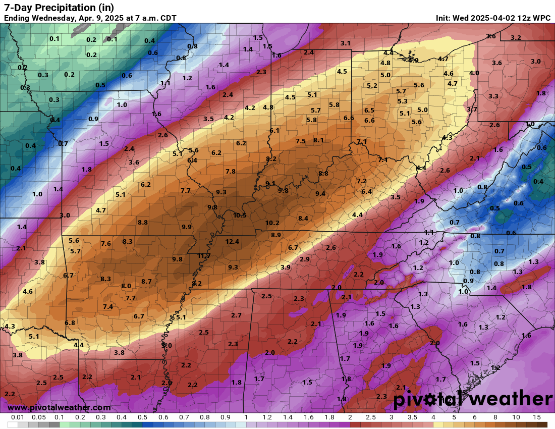
THE ALABAMA WEEKEND: Saturday will be another dry and very warm day, with highs in the mid to upper 80s. As the ridge breaks down, showers and storms will finally move into the state after midnight Saturday into Sunday. The SPC has all of Alabama in a severe weather risk, but it remains too early to be specific about the magnitude of the threat. The event looks very similar to what we experienced on Monday; hopefully, it will be mainly a big rainmaker with some small hail and gusty winds, but that remains to be seen. We will be able to provide more details later this week. Rain amounts of 1-2 inches are likely.
NEXT WEEK: Much colder air invades the Deep South. Temperatures will likely drop into the 30s across the northern half of the state by Tuesday and Wednesday mornings with potential for frost; a few colder spots could see a late-season freeze. For now, much of the week looks dry.
STORM SURVEY: The tornado that moved through Dothan Monday was rated EF-1 by the National Weather Service in Tallahassee; it was down for 3.11 miles with the peak wind estimated at 105 mph.
ON THIS DATE IN 1957: An F3 tornado tore through Dallas. Ten people were killed and 216 were injured. Total damage was $1.5 million. This tornado was among the most photographed and studied in history.
ON THIS DATE IN 1982: Severe thunderstorms spawned 56 tornadoes in the central U.S., including 17 in the Red River region of Texas and Oklahoma. The tornadoes claimed 30 lives and injured 383 other people. A violent tornado near Messer, Oklahoma, left only the carpet tack strips on the slab of a house it destroyed and carried a motel sign 30 miles.
For more weather news and information from James Spann and his team, visit AlabamaWx.


