James Spann: Intense summer heat just ahead for Alabama
HERE COMES THE HEAT: In terms of climatology, the hottest part of the summer in Alabama is from mid-July through mid-August. And, right on cue, the hottest weather so far this year is just ahead.
Today’s weather won’t be much different from yesterday; we rise into the mid 90s today, and scattered showers and storms will form during the heat of the day. Like yesterday, some spots will see heavy amounts of rain from the slow-moving storms, and the chance of any one spot getting wet is about one in four. Part of the Birmingham metro area received more than one inch of rain yesterday.
Hopefully you will catch a shower today, because odds drop off tomorrow through the weekend as an upper high builds into Alabama from the west. The warmer air aloft will mean fewer afternoon showers and storms, and higher heat levels.
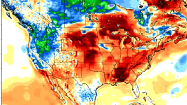
TRIPLE DIGIT HEAT AHEAD: Expect upper 90s tomorrow, and highs close to 100 degrees Thursday, Friday and Saturday. Heat advisories will be needed, and the “heat index” will exceed 105. We will be flirting with record highs on a few days. Here are the daily records for the Birmingham Airport:
- Thursday, July 21 ,101 (1952).
- Friday, July 22, 100 (1993).
- Saturday, July 23, 105 (1952).
- Sunday, July 24, 104 (1952).
Again, we know you have the sense to go into air-conditioned rooms, drink water and get out of the sun during the hottest part of the day. But those who have to work outdoors will need to watch out for each other; heat stroke is serious. The hallmark symptom of heat stroke is a core body temperature above 105. But fainting may be the first sign. Other symptoms may include a throbbing headache; lack of sweating despite the heat; red, hot and dry skin, and muscle weakness or cramps.
Understand afternoon storms are possible on these hot days, but they will be very widely scattered.
SUNDAY AND NEXT WEEK: The weather stays hot, but heat levels back down slightly as the ridge shifts a little to the west. Highs will be mostly in the mid to upper 90s Sunday and Monday, and back in the low to mid 90s by the latter half of next week.

TROPICS: All remains quiet across the Atlantic basin; tropical storm formation is not expected this week.
AT THE BEACH: About eight to 10 hours of sunshine daily from Gulf Shores to Panama City Beach through the weekend, but you will deal with a passing thunderstorm from time to time. Highs 88-91 on the immediate coast, with mid to upper 90s inland. See a detailed Gulf Coast forecast here.
WEATHER BRAINS: You can listen to our weekly 90-minute netcast anytime on the web, or on iTunes. This is the show all about weather featuring many familiar voices, including meteorologists at ABC 33/40.
CONNECT: You can find me on all of the major social networks:
Facebook
Twitter
Google Plus
Instagram
For more weather news and information, visit AlabamaWX.


