James Spann: Drier air arrives in Alabama Monday after some weekend storms, showers
James Spann: Unstable air will keep Alabama in the soup through Sunday from Alabama NewsCenter on Vimeo.
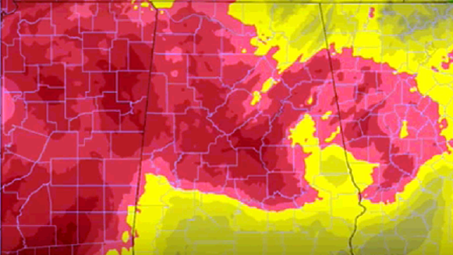
UNSETTLED THROUGH THE WEEKEND: A blanket of moist, unstable air will continue to cover Alabama today and tomorrow; the sky will be occasionally cloudy with scattered to numerous showers and thunderstorms, most active during the afternoon and evening. With high precipitable water values, where storms do form they will drop lots of rain in a short amount of time, much like yesterday.
Temperatures will remain below 90 degrees in most places today and tomorrow because of the limited amount of sun.
HIGH SCHOOL FOOTBALL TONIGHT: Unfortunately, summer storms tend to be very random and scattered, and there is no skill in knowing exactly when and where they will pop up in advance. The chance of any one high school stadium seeing rain tonight at kickoff time is about one in three, and in some cases lightning will be an issue. Temperatures will be generally in the low 80s at kickoff, dropping into the 70s during the second half of the games with very high humidity levels.
SUNDAY: A surface front (we don’t use the words “cold front” in August) will approach North Alabama; much of the state will continue to stay in a soupy airmass, with a few passing showers and storms likely. But the far northern counties of the state could very well begin to get in dry air; places like Florence, Athens and Huntsville will see a marked decrease in the number of showers Sunday.
NEXT WEEK: A surge of drier, continental air will drop into North Alabama Monday, and we will leave showers out of the forecast through Tuesday. Humidity values will be a little lower, nights a little cooler. Some of the normally cooler spots could easily reach the upper 50s early Tuesday morning. Moisture begins to return Wednesday, and a few afternoon showers are possible, with some risk of scattered showers and storms into Thursday and Friday as well.

AT THE BEACH: About seven to nine hours of sunshine over the weekend with a few scattered showers and storms from Gulf Shores to Panama City Beach; pretty much the same type weather on through much of next week. Highs on the immediate coast will stay in the 87- to 90-degree range, with low 90s inland. Sea water temperatures are mostly in the mid to upper 80s. See a detailed Gulf Coast forecast here.
FIONA: The tropical storm in the open Atlantic will gain latitude in coming days and is expected to weaken to a tropical depression over the weekend because of dry air in the surrounding environment. This will likely recurve and is no threat to land.

The wave to the east of Fiona has a chance of developing in coming days, and is expected to become Tropical Storm Gaston. It will take a more southerly track, and should be approaching the Leeward Islands in about four to five days. Global models, however, turn this northward before reaching the Caribbean, and for now it doesn’t look like a great threat for the Gulf of Mexico.
WEATHER BRAINS: You can listen to our weekly 90-minute netcast anytime on the web, or on iTunes. This is the show all about weather featuring many familiar voices, including meteorologists at ABC 33/40.
CONNECT: You can find me on all of the major social networks:
Facebook
Twitter
Google Plus
Instagram
For more weather news and information, visit AlabamaWX.


