James Spann: Another hot September afternoon ahead for Alabama
James Spann: Dry, hot day is here for most of Alabama from Alabama NewsCenter on Vimeo.
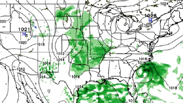
DRY WITH A HOT AFTERNOON: With a tropical system to the east pulling down drier air, it looks like most of Alabama will be rain-free today with ample sunshine. Temperatures will soar into the mid 90s this afternoon; both the Global Forecast System and the NAM models are printing a high of 95 degrees for Birmingham. If that verifies, it will be 10 degrees above the average high of 85, but nowhere close to the record high of 102 degrees, set on Sept. 15, 2015. Yes, it can be very hot well into September in Alabama.
Not much change tomorrow, although we will mention the risk of a few isolated afternoon and evening showers. The chance of any one spot getting wet is only about 10 percent, and the high will be in the 91- to 94-degree range with a partly to mostly sunny sky.
THE WEEKEND: A weak surface front will be a little north of Alabama, and we will mention “widely scattered, mostly afternoon and evening thunderstorms” both days, but widespread rain is not expected. Days will be partly sunny, and highs will be pretty close to 90 degrees.
FOOTBALL WEATHER: Mostly fair weather for the high school games across Alabama Friday night, with only a very small risk of a shower around kickoff. Temperatures will fall through the 80s.
Auburn will host Texas A&M Saturday evening at Jordan-Hare Stadium (6:30 CT kickoff). Looks like a great night for football; the sky will be mostly fair with only a small risk of a shower during the first half. Temperatures will fall from near 86 degrees at kickoff to near 80 by the final whistle.
Alabama travels to Oxford to play Ole Miss Saturday (2:30 p.m. CT kickoff). The sky will be partly sunny, and a passing shower or storm is possible during the game. Temperatures will hover in the 87- to 90-degree range.
NEXT WEEK: The overall pattern won’t change much: an upper ridge in place, a relatively dry air mass. Mostly sunny days, fair nights, any afternoon showers widely spaced and afternoon temperatures above average, with highs close to 90.

TROPICS: Julia is now a tropical depression off the coast of South Carolina. Steering currents have collapsed, and this thing will pretty much just hang around for the next five days. The heaviest rain should remain just offshore. No impact on Alabama.

Tropical Storm Ian remains in the middle of the Atlantic, far from land, and will become post-tropical tomorrow as it gains latitude.
Tropical Depression 12 is in the eastern Atlantic; it has a chance of becoming Tropical Storm Karl in three to five days as it moves westward. The GFS ensemble mean suggests it will be north of Puerto Rico early next week. It remains to be seen if this will be a threat in the longer term to the U.S. Just something to watch for now.
And a disturbance in the Gulf of Mexico is not expected to develop as it moves toward the Texas Coast.
AT THE BEACH: About seven to nine hours of sunshine daily on the Gulf Coast from Panama City Beach to Gulf Shores through the weekend, with the usual chance of scattered showers and thunderstorms. Highs on the immediate coast will be in the upper 80s, with low 90s inland. See a detailed Gulf Coast forecast here.
WEATHER BRAINS: You can listen to our weekly 90-minute netcast anytime on the web, or on iTunes. This is the show all about weather featuring many familiar voices, including meteorologists at ABC 33/40.
CONNECT: You can find me on all of the major social networks:
Facebook
Twitter
Google Plus
Instagram
For more weather news and information, visit AlabamaWX.