James Spann: Strong storms move into Alabama later today
James Spann: Active weather day for Alabama, especially north and west from Alabama NewsCenter on Vimeo.
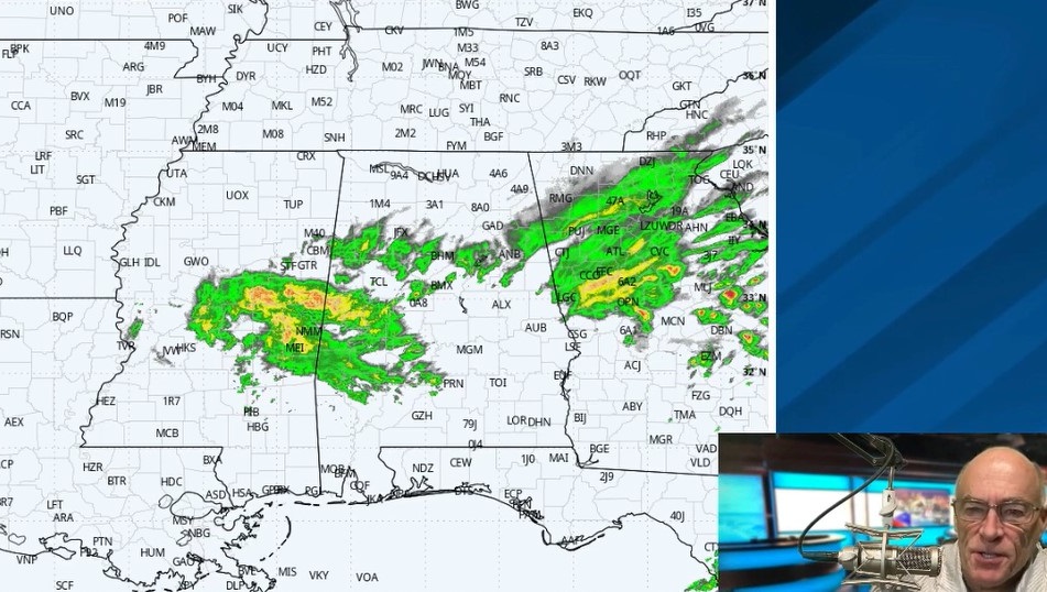
ACTIVE WEATHER DAY AHEAD: We have showers on radar early this morning over parts of North and West Alabama — nothing too heavy or widespread. But later today a cold front will push a band of showers and thunderstorms into the state, and some of those could be strong to severe.
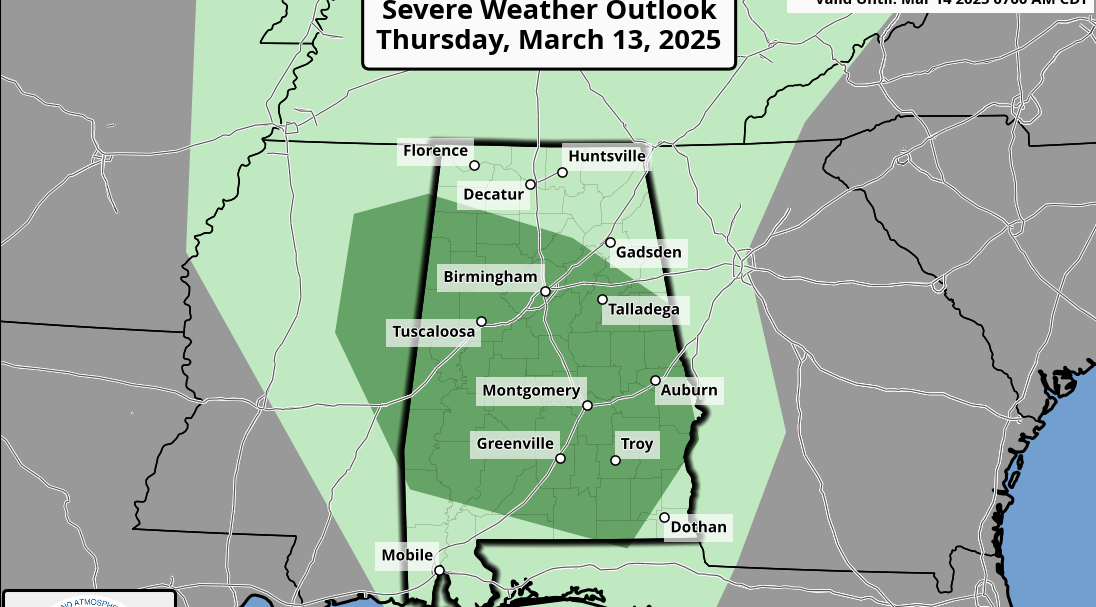
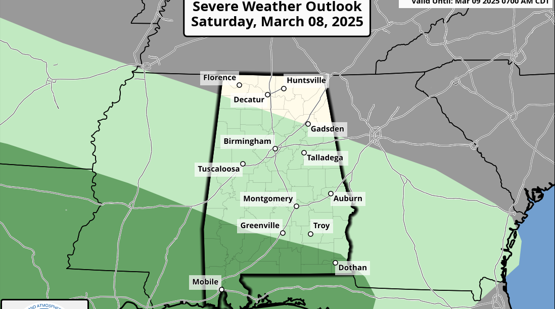
The Storm Prediction Center has a “slight risk” of severe storms defined for far West Alabama, in the broad zone from Muscle Shoals to York, with a “marginal risk” as far east as Scottsboro, Sylacauga, Selma and Grove Hill.

TIMING: The band of storms will impact Northwest Alabama between noon and 3 p.m.; much of Central Alabama, including places like Tuscaloosa, Birmingham, Anniston and Gadsden, between 2 p.m. and 5 p.m; and then communities like Montgomery and Auburn between 4 p.m. and 7 p.m., although by then the storms should be weaker and below severe limits.
THREATS: Thankfully, the main surface low and stronger wind fields will be well to the north of Alabama, so this is a fairly low-end severe weather threat. But heavier storms in the line could produce strong straight-line winds and hail. The tornado threat is very low, but not zero.
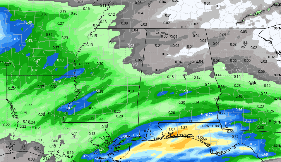
RAIN: Rain amounts of one-half to three-quarters of an inch are expected; no flooding issues.
Rain will end from northwest to southeast this evening as drier air returns to the state.
TOMORROW/THURSDAY: These two days will be dry with a good supply of sunshine; the high tomorrow will be around 70, followed by mid 70s Thursday. We note Thursday morning will be fairly cold with a low between 37 and 40 degrees for most places. Temperatures will warm nearly 40 degrees Thursday from morning low to afternoon high.
FRIDAY AND THE WEEKEND: A cold front will approach Alabama from the north, and will bring the chance of showers Friday afternoon and Friday night. Moisture levels will be limited, and we expect rain to be fairly light and scattered. Friday’s high will be around 70 degrees.
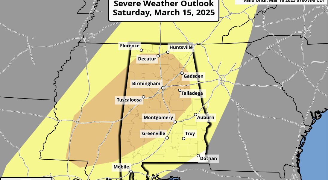
Then, over the weekend, a surface low will form west of the state, and the cold front will hold north of Alabama Saturday. The latest global models push that surface low right over North Alabama Saturday night, bringing widespread rain and possibly a few thunderstorms. This could change, but for now it looks like the main window for widespread rain comes from about 3 p.m. Saturday until 3 a.m. Sunday.
On the positive side, with the surface low moving right on top of us, that means little risk of severe storms, and the SPC has dropped the severe weather risk it defined yesterday for Saturday.
Sunday will be much cooler with gradual clearing; the high will be in the 50s with a cool north breeze.
TO THE NORTH: A good March snow will unfold this weekend in the general area from St. Louis to Richmond. If you are traveling to the north, be aware of the potential.

NEXT WEEK: Forecast confidence is low in this active March pattern, but some rain is possible during the first half of the week as moisture levels rise.
WEATHER BRAINS: You can listen to our weekly 90-minute netcast anytime on the web, or on iTunes. This is the show all about weather featuring many familiar voices, including meteorologists at ABC 33/40.
CONNECT: You can find me on all of the major social networks:
Facebook
Twitter
Google Plus
Instagram
Pinterest
Snapchat: spannwx
For more weather news and information, visit AlabamaWX.