Brian Peters: Shower chances return to Alabama Thursday
Brian Peters: One more dry day for Alabama before rain chances return from Alabama NewsCenter on Vimeo.
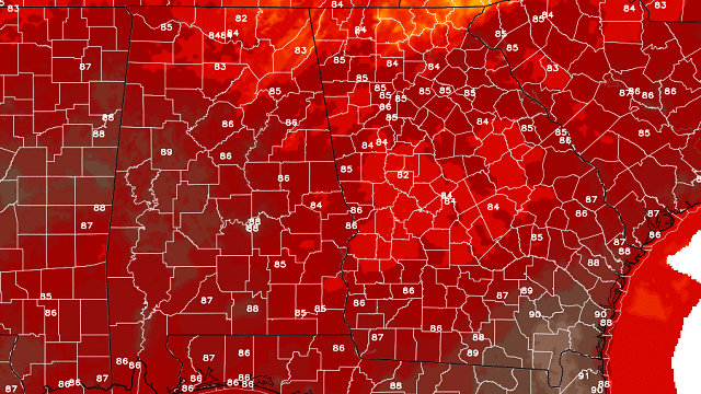
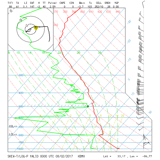
TODAY: The sky across Alabama has become mostly cloudy overnight, and radar even indicated some light patches of precipitation. However, a quick peek at the sounding from the Shelby County Airport showed that we still have a significant dry layer aloft, so most of the precipitation will be evaporating before reaching the ground. It’s possible that some spots might see some sprinkles, but it doesn’t seem likely that anyone will get more than a couple of hundredths of an inch. The increased cloud deck should provide a pretty good filter for the sunshine, keeping highs today in the 84- to 87-degree range.
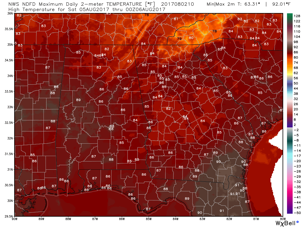
REST OF THE WEEK: A surface low will form over Iowa on Thursday and move into Michigan by Friday, dragging a cold front into the Southeast. The Global Forecast System has trended somewhat slower with the front, but it still appears likely that showers and thunderstorms will be fairly numerous on Friday. Highs will be in the middle to upper 80s.
THE WEEKEND AND BEYOND: The front is likely to stall out over north Alabama, so we should see a fairly good chance of showers and storms all the way into the middle of next week. I’m thinking that showers could be fairly numerous, and with the added clouds and shower potential, our afternoon highs will stay primarily in the middle 80s. Not too shabby for the first half of August.
 Rainfall across Alabama through Monday morning is likely to be in the 1- to 1.5-inch range. While rain chances become pretty good Friday and through the weekend, it will still be in the form of showers and storms, so not everyone will see those totals, just because of the hit-or-miss nature of showers.

TROPICS: The National Hurricane Center in Miami is watching two areas of disturbed weather in the Atlantic Basin. One is in the northeast Gulf of Mexico and the other one well out in the central south Atlantic. Neither of these areas is expected to develop much over the next couple of days.
BEACH FORECAST: At the beaches of Alabama and northwest Florida, the chance for showers returns today and will continue through the weekend and into the start of next week. No complete washouts, but showers could be fairly numerous at times. You can expect to see highs mainly in the middle 80s and lows in the upper 70s. Click here to see the AlabamaWx Beach Forecast Center page.
A LOOK AHEAD: The GFS maintains a weak trough over the eastern half of the country through Aug. 9. After that, the GFS is more bullish, with an upper ridge nosing across the Southeast from Bermuda. This is the kind of pattern we see pretty regularly in the summertime, and it would mean some warmer days, but it does not look like it would be excessive heat. Highs would be primarily in the middle 90s, edging close to the upper 90s. Overnight lows could be fairly warm, too, dipping only into the upper 70s.
WEATHER BRAINS: You can listen to our weekly 90-minute netcast anytime on the web, or on iTunes. This is the show all about weather featuring many familiar voices, including meteorologists at ABC 33/40.
Enjoy another dry day before we see showers increase on Thursday and into Friday. Godspeed.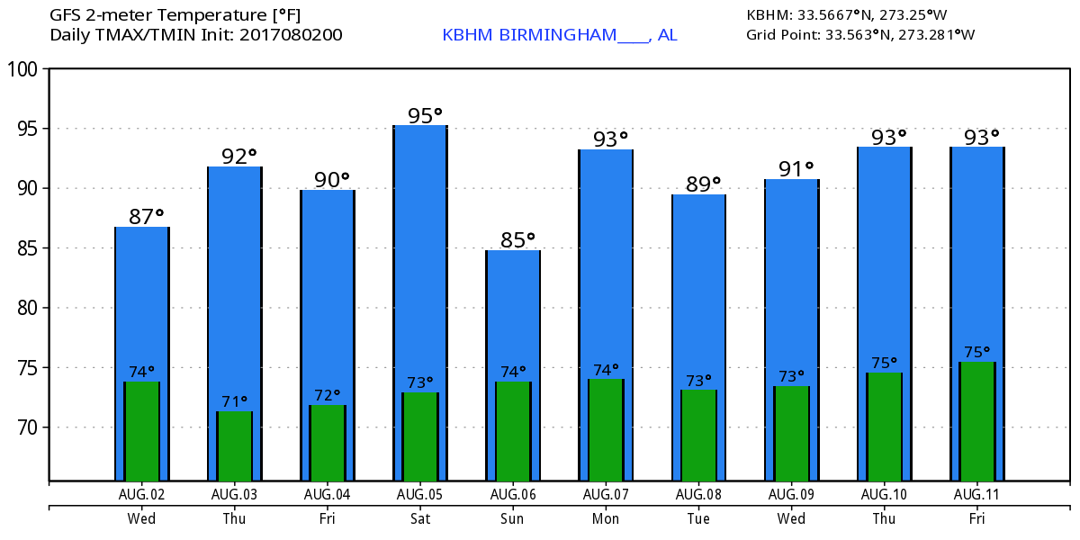
For more weather news and information, visit AlabamaWx.


