Brian Peters: Showers today, drier Saturday for Alabama
Brian Peters: Alabama gets 1 to 3 inches of rain over next five days from Alabama NewsCenter on Vimeo.
TODAY: The Alabama sky has a mixture of clear and cloudy areas this morning, along with some patchy fog that is reducing visibility to 1 mile in some locations. Fog should dissipate by 9 a.m. The front to our northwest is forecast to continue moving slowly southeastward today and Saturday, so we are likely to see showers become a bit more numerous during the afternoon and early evening. Clouds and the presence of showers and thunderstorms should keep highs in the range of 85 to 88.
THE ALABAMA WEEKEND: While the upper trough moves into southeast Canada on Saturday, taking the surface low with it, the surface front will settle into south Alabama Saturday, pushing some drier air into the Tennessee River Valley. I think the Tennessee River Valley area will be shower free on Saturday. The best chances for showers will be across south Alabama and the Alabama/northwest Florida coastal area. That leaves central Alabama between the drier air to the north and the wetter air to the south. We’ll probably have to retain some small potential for showers, but most of us will be shower free. Temperatures Saturday afternoon will reach the upper 80s.
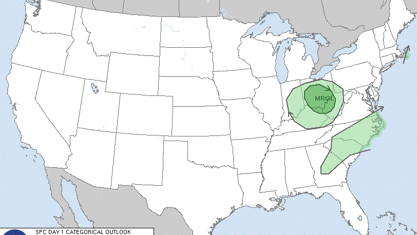
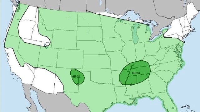
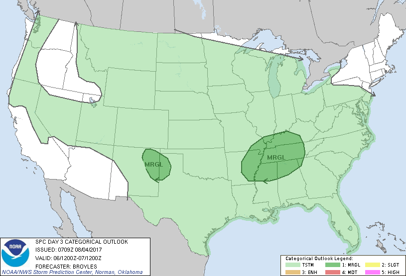
As the upper trough moves farther away from us, the upper flow across the southeast U.S. will become nearly zonal. Small short waves embedded in this flow will be helpful in enhancing rain chances. One of those will be present Sunday, and the Storm Prediction Center has drawn a marginal risk for severe storms over the northern third of Alabama along with parts of Mississippi, Arkansas, Tennessee and Kentucky. Our main threat will come in the form of damaging wind. Highs again should be in the upper 80s.
NEXT WEEK: The chances for showers and thunderstorms increase on Monday. MOS guidance has 62 percent for the probability of precipitation. Added clouds and more numerous showers should hold the highs in check, with most places in the middle 80s.
The upper pattern remains nearly zonal from Tuesday through Thursday with those pesky short waves embedded in the flow that should help to enhance rain chances. The problem for the forecast today is timing those accurately that far into the future, so forecasts may have some adjustments with time. The primary forcing will come with the heat of the day, but those short waves could account for showers overnight as well. Highs will be mainly in the middle 80s, which is not too bad for the first half of August.
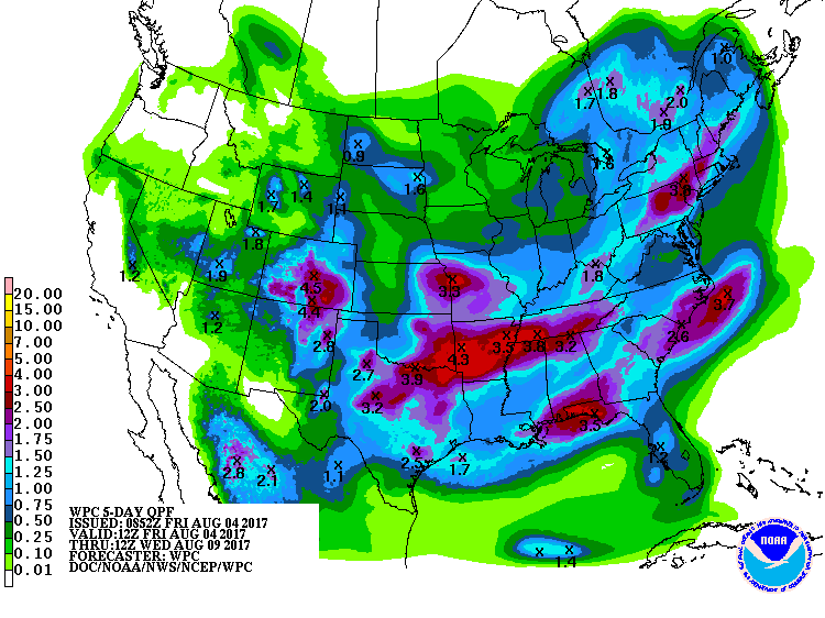
Rainfall through Wednesday morning will be quite varied across the state. Up to 3 inches may be possible along the Gulf Coast as well as the Tennessee River Valley, with amounts for much of central Alabama in the 1- to 2-inch range.
TROPICS: Wednesday we have the potential for development of a tropical system that is forecast to move across the Caribbean into the southwest Gulf of Mexico.
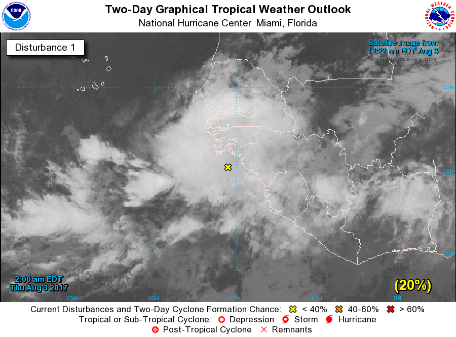
A large area of showers and thunderstorms near the west coast of Africa was associated with a tropical wave. Environmental conditions are forecast to be conducive for gradual development, so a tropical depression could form by early next week from this disturbance. This system is forecast to move toward the west or west-northwest at 10 to 15 mph for the next several days. The Global Forecast System is pretty bullish on developing this system as it moves by north of the Leeward Islands. We’re out into voodoo country, so you’ll have to be careful about making a forecast here. But the GFS brings what appears to be a very strong tropical system just north of the Bahamas, recurving it to the northeast as it approaches the southeastern U.S. coast. Unlike yesterday, the GFS recurves the system so that it produces a glancing blow to coastal North Carolina. This is not until Aug. 15, so there is going to be a lot of time and numerous model runs before we can settle on a consistent track for this potential storm. By comparison, the ECMWF model doesn’t seem to think this system will develop, with no sign of it in the longer range.
Closer to home, an area of disturbed weather had developed just off the coast of South America in the eastern Caribbean. This area is forecast to move westward into the southwest Gulf of Mexico on Wednesday. Both the GFS and the ECMWF take this system into Mexico, but the ECMWF was very close to Brownsville and much farther north than the GFS.
BEACH FORECAST: At the beaches of Alabama and northwest Florida, the chance for showers will continue through the weekend and into the start of next week. No complete washouts, but showers could be fairly numerous at times. You can expect to see highs mainly in the middle 80s and lows in the upper 70s. Click here to see the AlabamaWx Beach Forecast Center page.
WEATHER BRAINS: You can listen to our weekly 90-minute netcast anytime on the web, or on iTunes. This is the show all about weather featuring many familiar voices, including meteorologists at ABC 33/40.
Have a great day, and Godspeed.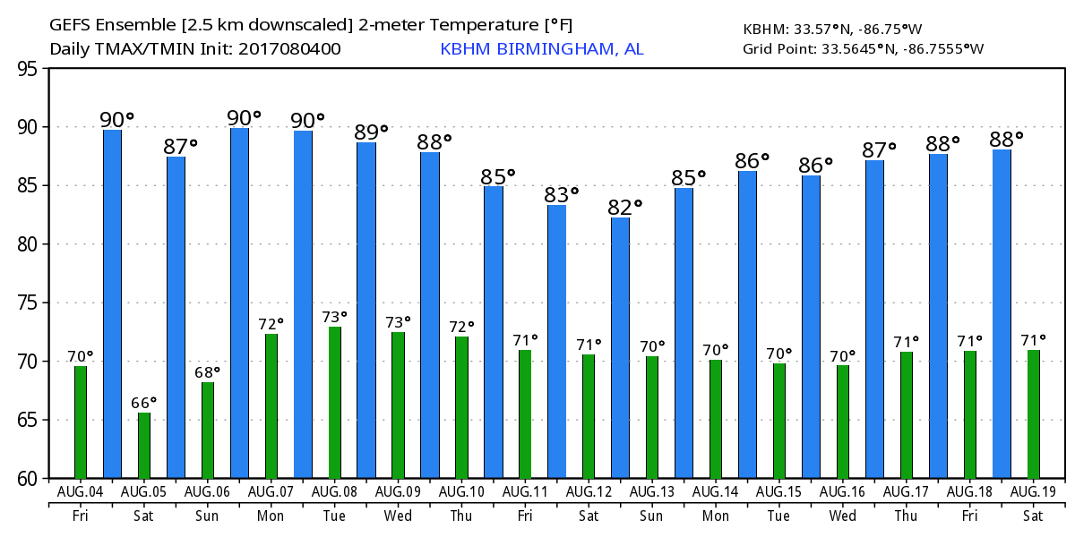 For more weather news and information, visit AlabamaWx.