James Spann: Alabama gets some light rain today, tonight
James Spann: Light rain for Alabama tonight, good rain this weekend from Alabama NewsCenter on Vimeo.
WELCOME TO FEBRUARY: The average high in Birmingham rises from 55 degrees today to 62 degrees on Feb. 28. The warmest February temperature on record is 83, set on Feb. 8, 1918; Feb. 13, 1962, and Feb. 23, 1996. The coldest came on Feb. 14, 1905, when Birmingham’s low was 2 degrees. There are no sub-zero temperatures during February recorded at Birmingham.
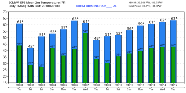
Today will be pleasant with temperatures reaching the low 60s this afternoon; the sky will be mostly cloudy, and we will mention a chance of some light rain late this afternoon and tonight. The best chance of rain comes from about 4 p.m. through midnight; moisture will be very limited, and most communities will see one-quarter inch or less.
TOMORROW AND THE WEEKEND: Look for a sunny day tomorrow, but it will be noticeably colder, with most places not getting past the mid 40s. By Saturday morning we project a low between 22 and 26 degrees across most of north and central Alabama with a clear sky and light wind.
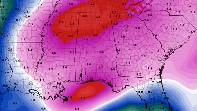
Saturday will be a dry day with a mix of sun and clouds, and we warm nicely, with temperatures reaching the mid 50s by afternoon. Clouds will thicken late in the day, and a widespread, soaking rain event is likely late Saturday night into part of the day Sunday. It seems like the main window for rain over the weekend will come from about midnight Saturday night through noon Sunday. Amounts of around 1 inch are likely, but there is no risk of severe storms, and we probably will hear little thunder.
NEXT WEEK: An active pattern continues. Monday will be dry with seasonal temperatures — a low in the 30s, high in the 50s. Clouds increase Tuesday, and rain and thunderstorms return Tuesday night into Wednesday morning. Both global models (GFS and ECMWF) suggest that there will be some surface-based instability involved; with fairly strong wind fields, we could be looking at some risk of strong to severe storms Tuesday night. It’s way too early to be specific, of course. Then, cooler and drier air returns for the latter half of the week.
No sign of any significant snow or ice issues for Alabama for the next seven to 10 days.
BEACH FORECAST: Click here to see the AlabamaWx Beach Forecast Center page.
WEATHER BRAINS: You can listen to our weekly 90-minute netcast anytime on the web, or on iTunes. This is the show all about weather featuring many familiar voices, including meteorologists at ABC 33/40.
CONNECT: You can find me on all of the major social networks:
Facebook
Twitter
Google Plus
Instagram
Pinterest
Snapchat: spannwx
For more weather news and information from James Spann and his team, visit AlabamaWx.


