James Spann: Freeze warning for Alabama tonight
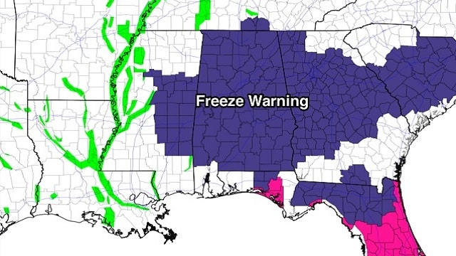
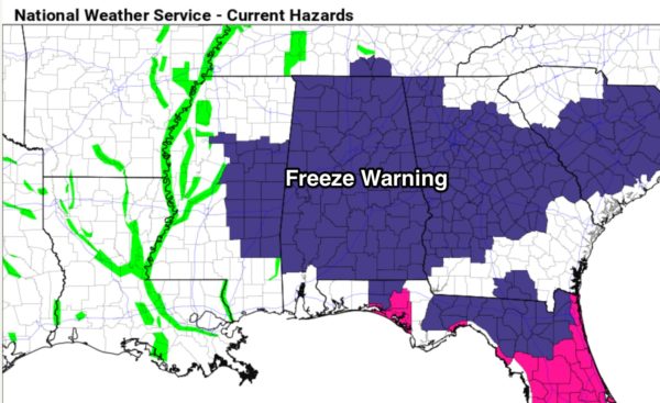
ANOTHER COLD NIGHT AHEAD: A freeze warning is in effect for all of Alabama tonight, with the exception of Mobile and Baldwin counties.
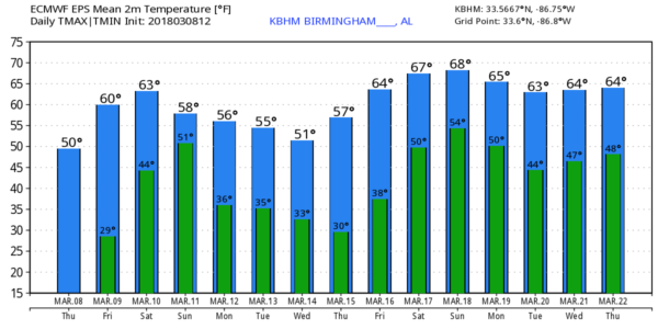
Most locations across north and central Alabama will see a low between 25 and 30 degrees, but colder pockets will visit the lower 20s. With a calm wind, widespread frost is likely. Then, we warm nicely during the day tomorrow with a sunny sky; the high will be in the low to mid 60s.
RAIN RETURNS OVER THE WEEKEND: Clouds will increase Saturday as moist air is pulled northward into the state, and a few showers are possible, mostly the afternoon. But the most widespread rain over the weekend comes Saturday night into Sunday as a surface low moves through north Alabama. Rain amounts should be in the 1- to 2-inch range, and while some thunder is likely, the overall severe weather threat looks low for the northern half of the state. The high Saturday will be in the 67- to 70-degree range; Sunday’s high will be in the low 60s.
NEXT WEEK: An upper trough sets up again over the eastern states, setting the stage for below-average temperatures through the week for Alabama and the Deep South. In fact, lows will be at or below freezing each morning Monday through Thursday; highs will be in the 50s through Wednesday, with 60s Thursday and Friday. For now, the week looks dry.
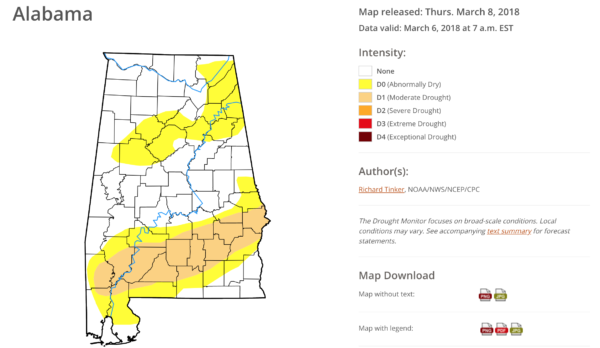
DROUGHT MONITOR: South Alabama remains dry, with “moderate drought” conditions there, based on the new Drought Monitor released this morning.
BEACH FORECAST: Click here to see the AlabamaWx Beach Forecast Center page.
WEATHER BRAINS: You can listen to our weekly 90-minute netcast any time on the web or on iTunes. This is the show all about weather featuring many familiar voices, including meteorologists at ABC 33/40.
CONNECT: You can find me on all of the major social networks:
Facebook
Twitter
Google Plus
Instagram
Pinterest
Snapchat: spannwx
For more weather news and information from James Spann and his team, visit AlabamaWx.


