James Spann: More scattered showers, storms for Alabama

RADAR CHECK: Most of the showers and storms across Alabama at mid-afternoon are over the eastern half of the state, but they are moving northwest, and the western counties will have a chance at some rain over the next few hours. So far the heavier storms have been roughly along and south of I-85.

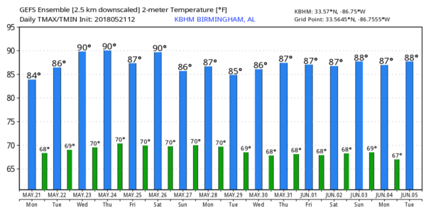
REST OF THE WEEK: The blanket of moist air will stay over the region, and each day we will need to mention at least scattered showers and thunderstorms. They will be most active during the afternoon and evening hours, but with high precipitable water values, we can’t rule out a late-night or morning shower in spots. The sun will be out at times, and highs will be in the 80s.
MEMORIAL DAY WEEKEND: We will keep an eye on the northern Gulf of Mexico as global models continue to show potential for a broad tropical or subtropical type low. The National Hurricane Center gives it a 20 percent chance of developing during the next five days.
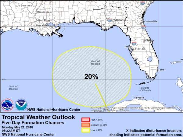
One way or another, it could bring enhanced rain coverage to parts of the Gulf Coast region Saturday through Monday, but it is simply too early to call. The Global Forecast System pushes the broad low into Alabama by Monday, while the ECMWF keeps it a little west of Alabama Monday, coming up through southeast Louisiana and west Mississippi.
Even without the tropical low, the chance of showers and storms will stay in the forecast over the long holiday weekend. But the sun should be out occasionally, and there will be decent breaks in the rain. Highs will be mostly in the low to mid 80s. We will have better clarity on the potential Gulf system later in the week.
HOLIDAY WEEKEND ON THE GULF COAST: Needless to say, we have many questions about the weather from Gulf Shores over to Destin and Panama City Beach. The Gulf feature will certainly limit the amount of sun, and it will rain at times, but we do expect about 2 to 4 hours of sun daily at this point. Again, keep an eye on blog discussions this week for a better look at the potential axis of higher rain over the weekend. Click here to see the AlabamaWx Beach Forecast Center page.

NEXT WEEK: Maritime tropical air will remain over Alabama, meaning the mix of sun and scattered storms will continue with highs mostly in the 80s. Since meteorological summer begins in 11 days, you might want to read this post on summer weather in Alabama.
WEATHER BRAINS: You can listen to our weekly 90-minute netcast any time on the web, or on iTunes. This is the show all about weather featuring many familiar voices, including meteorologists at ABC 33/40. We will produce this week’s show tonight at 7:30. You can watch it live here.
CONNECT: You can find me on all of the major social networks:
Facebook
Twitter
Google Plus
Instagram
Pinterest
Snapchat: spannwx
For more weather news and information from James Spann and his team, visit AlabamaWx.


