James Spann: Alberto makes landfall, moves northward toward Alabama
ALBERTO IS INLAND: The circulation center of Alberto has moved onto the Florida coast west of Panama City Beach this afternoon.

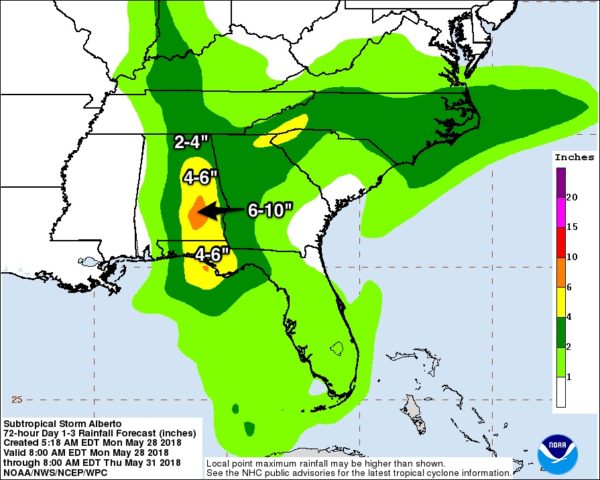
The system will move up through Alabama tomorrow, bringing the potential for heavy rain to the eastern half of the state.

GULF COAST: The most significant rain will come east of Crestview and Fort Walton Beach this evening as Alberto moves slowly northward. A few isolated, short-lived tornadoes will be possible in that zone as well over the next few hours.
The Alabama Gulf Coast and Pensacola remain on the “good” west side of the system; the air is drier there with intervals of sunshine and an offshore flow. There’s no risk of flooding or tornadoes.
Dangerous rip currents continue all along the central Gulf Coast, and nobody should be in the Gulf waters where red flags are flying.
The weather will improve on the coast tomorrow and on through the rest of the week as more typical late May and early June weather resumes — partly sunny days with the routine risk of scattered thunderstorms.
ALABAMA: While weakening, Alberto will move up through the central part of Alabama tomorrow. Most of the rain will be along and east of the track of the center.
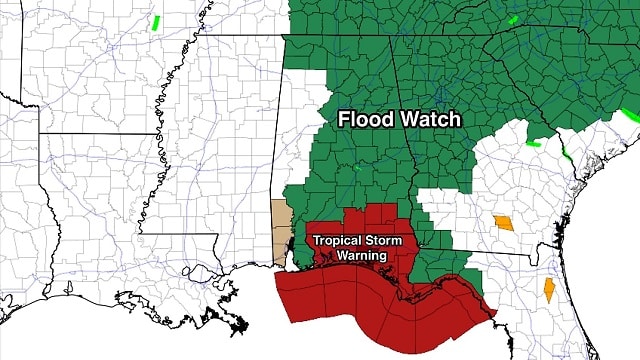
A flood watch is in effect for the eastern half of Alabama tonight and tomorrow.

Rain amounts of 2 to 4 inches are expected through Tuesday night, with isolated amounts of more than 6 inches possible in a few spots. The threat of flooding is the primary issue, and the heavier rains will come over the eastern counties. West Alabama will be on the dry side of the circulation; amounts will be mostly under one-half inch. Some spots near the Mississippi state line will get barely enough to measure.
A few isolated, short-lived tornadoes are possible over the eastern counties of the state tonight and tomorrow; this is a low-end threat. Keep in mind these kind of small tornadoes are literally under the radar, and it is very hard to provide an early warning for them.
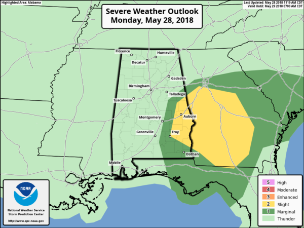
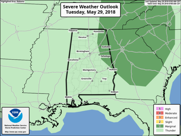
Gradient winds will be the 15-25 mph range for most places as the system moves through; we expect little tree and power line damage.
WEDNESDAY THROUGH FRIDAY: Alberto will be well north of Alabama, and we slowly lapse back into a routine summer pattern with warm, humid days and scattered showers and thunderstorms, most active during the afternoon and evening hours. Highs return to the mid to upper 80s.
THE ALABAMA WEEKEND: No real change. Expect a mix of sun and clouds Saturday and Sunday — warm and very humid. And we will deal with random, scattered, mostly afternoon and evening showers and thunderstorms. Highs over the weekend will be in the 85- to 90-degree range.

BEACH FORECAST: Click here to see the AlabamaWx Beach Forecast Center page.
WEATHER BRAINS: You can listen to our weekly 90-minute netcast any time on the web, or on iTunes. This is the show all about weather featuring many familiar voices, including meteorologists at ABC 33/40.
CONNECT: You can find me on all of the major social networks:
Facebook
Twitter
Google Plus
Instagram
Pinterest
Snapchat: spannwx
For more weather news and information from James Spann and his team, visit AlabamaWx.


