Bill Murray: Showers, storms mainly for south Alabama today
Bill Murray has the Father’s Day weekend forecast for Alabama from Alabama NewsCenter on Vimeo.
FOGGY IN SPOTS: Fog has developed once again this morning across parts of central Alabama. Visibilites have been as low as one-quarter mile in spots like the Shelby County Airport in Calera. Many other spots across south central Alabama have seen visibilities below one-half mile. It has not risen to the advisory category, but be careful if you are driving this morning, especially near bodies of water. The fog will burn off by 9 a.m.
PESKY UPPER LOW: That pesky upper low is over south Alabama this morning. It will conspire with deeper moisture to keep the main rain chances over the southern half of the state today. Highs will generally be in the lower 90s. There will be a few widely scattered storms in the conditionally unstable, moist air mass across the northern half of the state as well.
FOR YOUR FATHER’S DAY: The upper low looks like it will flex its muscles on Sunday, perhaps increasing the shower chances a bit. Showers and storms could start a little earlier in the day, working up through central Alabama. This could keep our highs in the middle and upper 80s.
NEXT WEEK: High pressure aloft will begin to take hold of Alabama’s weather early in the week ahead and a surface high will form to our east, pumping in Gulf moisture. Partly sunny, hot, muggy days will continue with scattered showers and storms, mostly during the peak of the daytime heating process. Highs will be 88-92, lows in the low 70s.
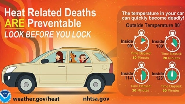
LOOK BEFORE YOU LOCK: Heatstroke is the number one killer of children outside of car crashes. Always remember to look twice before you lock your vehicle. Remember, look before you lock!
 NEXT WEEKEND: It looks like a front will try to nudge in from the north and even try to sneak in from the northeast by late in the weekend. It won’t have any luck, but this could elevate our shower chances.
VOODOO COUNTRY: There are signs that an upper-level low could bring widespread chances for rain by the time we turn the calendar over to July.
TROPICS: A disturbance near the Yucatan channel will move toward the Texas coast over the next few days. While development is not expected, it will bring potential for heavy rain to part of southeast Texas and southwest Louisiana early next week. The rest of the Atlantic basin is quiet.
THIS BUD’S FOR YOU, SOUTHWEST: In the eastern Pacific, Bud is a dissipating tropical depression over northern Mexico, but some of the moisture from the system could work up into the Southwest U.S. this weekend, perhaps easing its drought a bit.
BEACH FORECAST: No effects from the Gulf system or Bud on the beautfiul beaches of Alabama and northwest Florida. Click here to see the AlabamaWx Beach Forecast Center page.
WEATHER BRAINS: You can listen to our weekly 90-minute netcast any time on the web, or on iTunes. This is the show all about weather featuring many familiar voices, including meteorologists at ABC 33/40.
For more weather news and information from James Spann, Bill Murray and the rest of the James Spann team, visit AlabamaWx.
