Brian Peters: Alabama moisture levels rise toward a wet Tuesday

Brian Peters has the Alabama forecast for the beginning of the work week from Alabama NewsCenter on Vimeo.
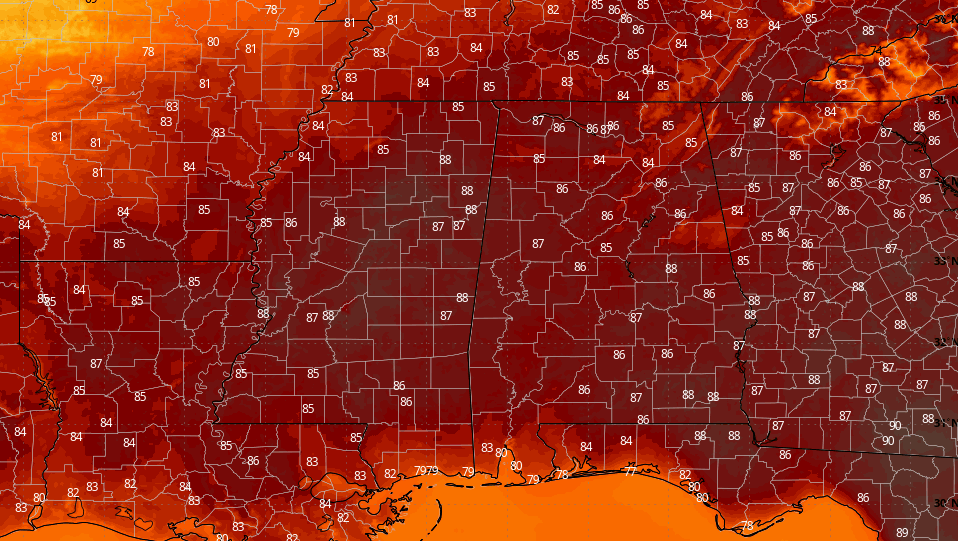
MOISTURE RETURNS: Some clouds stretch across the Alabama sky early this morning, much of it left over from the showers and thunderstorms to our west yesterday. Dew points have begun moving upward as the stationary front along the Alabama/Florida line moves northward and the surface flow becomes more southerly. Look for a mix of sun and clouds today with the possibility for scattered showers as highs climb near 90 degrees.
THE WEEK AHEAD: An upper short-wave trough over South Dakota will dig into the Lower Mississippi River Valley on Tuesday and provide additional lift for showers and storms that will combine with diurnal heating to produce numerous storms. The abundance of clouds along with those storms should hold highs Tuesday in the middle 80s – not bad for the end of July. While we do not anticipate any severe weather Tuesday, some heavy rain is possible. Flash flooding should be limited because of the previously dry couple of weeks.
For the rest of the week, the number and location of showers will be heavily dependent on the location of the stalled upper trough. Wednesday the Global Forecast System is depicting some drier air edging into northwest Alabama, while numerous showers are likely from central Alabama across south Alabama and the Florida Panhandle. Clouds and showers should keep highs in the middle 80s.
As the upper trough ebbs and flows a little we should remain fairly unsettled, with showers and storms likely just about every day through the end of the week. Even into next weekend we should see showers produced by afternoon heating as our high temperatures move closer to 90 degrees. The upper trough will also be weakening, so the number and coverage of showers should become more scattered.
Rainfall during the next five days could produce 3- to 5-inch amounts from northwest Florida to central Virginia. For central Alabama, it still looks reasonable to see fairly widespread amounts of 1 to 2 inches.
NEXT WEEK: By early next week, the upper trough axis will be over the Southeast, so we stay out of any excessive heat, but those daily showers remain possible with highs near 90.
LONG TERM: Voodoo country has taken on a new look. Yesterday the GFS was pretty strong on bringing a strong upper ridge into the eastern U.S. But today the pattern of a fairly deep trough axis over the eastern states is maintained all the way into the middle of August. This would be a favored pattern, since it would keep our temperatures from becoming excessively hot.
TROPICS: All remains quiet across the Atlantic basin; tropical storm formation is not expected through the next several days.
BEACH FORECAST: Click here to see the AlabamaWx Beach Forecast Center page.
WEATHER BRAINS: You can listen to our weekly 90-minute netcast any time on the web, or on iTunes. This is the show all about weather featuring many familiar voices, including meteorologists at ABC 33/40.
SPANN AWAY: We are on a one-a-day schedule for the week as James Spann enjoys some time off.
For more weather news and information from James Spann, Brian Peters and other members of the James Spann team, visit AlabamaWx.


