James Spann: Alabama gets close to record lows early Wednesday
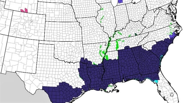
FREEZE WARNING: All 67 Alabama counties are under a freeze warning tonight along with the Florida Panhandle. Most communities across north and central Alabama will see a low between 18 and 24 early Wednesday morning. Birmingham’s record low for March 6 is 18, set in 2015. Most places in the northern half of the state will be below freezing for eight hours tonight. The sky will be clear, and the wind will be light.
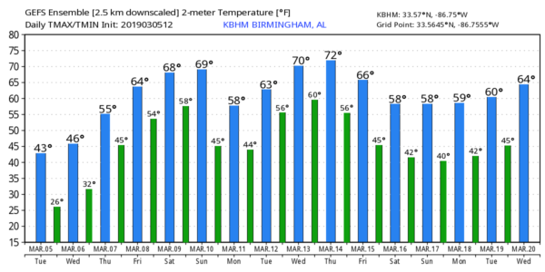
Wednesday will be another sunny but cold day, with a high in the mid to upper 40s. We drop back into the 20s early Thursday morning for our third consecutive morning freeze. A warming trend then begins Thursday afternoon; with ample sunshine we will rise into the low 60s.
FRIDAY AND THE WEEKEND: The sky becomes mostly cloudy Friday and a few scattered showers are possible, but the rain shouldn’t be especially heavy or widespread. The high Friday afternoon will be in the mid to upper 60s.
Then, over the weekend, a vigorous storm system will form west of the state across the Great Plains. Based on forecast instability, wind fields and dynamic support, strong to severe thunderstorms will be possible across parts of the central and southern U.S. Saturday and Saturday night. The Storm Prediction Center has defined a severe weather risk for this region in its outlook for Saturday.
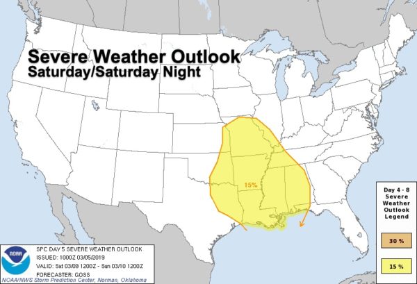
In Alabama, Saturday will be mild and breezy with a high in the 70s. While a few showers are possible during the day, the main threat of strong to severe storms will come from 6 p.m. Saturday through 6 a.m. Sunday. For now it looks like all modes of severe weather will be possible, including a few tornadoes. But it is difficult to be very specific this far out; we will watch model trends in coming days and watch the system evolve to the west.
Rain amounts will be in the 1- to 2-inch range, probably not enough for major flooding concerns. The rain will end early Sunday, followed by gradual clearing. Sunday will stay mild with a high in the low 70s.
NEXT WEEK: Monday will be dry with a high in the 60s. Clouds return Tuesday, and we will deal with more showers and storms by Tuesday night and Wednesday.
STORM SURVEYS: Ten tornadoes have been identified by National Weather Service offices in Birmingham and Mobile from Sunday’s severe thunderstorms. EF-0 tornado tracks were discovered today in Autauga and Bullock counties.
ON THIS DATE IN 1963: An EF4 tornado tore through Bessemer. Most of the damage in the city was in the first 2 miles of the path. More than 200 buildings were damaged, 29 of which were destroyed. There were 35 injuries and no fatalities.

BEACH FORECAST: Click here to see the AlabamaWx Beach Forecast Center page.
WEATHER BRAINS: You can listen to our weekly 90-minute show any time on your favorite podcast app. This is the show all about weather featuring many familiar voices, including the meteorologists at ABC 33/40.
CONNECT: You can find me on the major social networks:
Facebook
Twitter
Instagram
Pinterest
Snapchat: spannwx
For more weather news and information from James Spann and his team, visit AlabamaWx.