James Spann: Alabama stays dry through Wednesday
James Spann has the Alabama forecast to kick off the work week from Alabama NewsCenter on Vimeo.
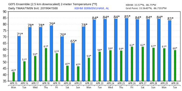
COOL, DRY DAY AHEAD: A few spots have dipped into the upper 30s early this morning; our Skywatcher at Black Creek, just northeast of Gadsden, reported 37 degrees just before daybreak. It was also 37 at Cullman and Haleyville; most places are in the low to mid 40s. Today will feature sunshine in full supply with a high between 68 and 71 degrees (the average high for April 15 at Birmingham is 74).
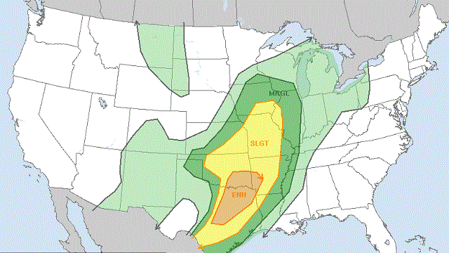
TUESDAY/WEDNESDAY: Sunny weather continues with warmer afternoons; the high will be close to 80 Tuesday, followed by low 80s Wednesday. To the west, severe storms are likely Wednesday in a broad zone from Texas to near Chicago ahead of another vigorous spring storm system.
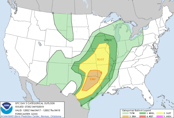
ANOTHER SEVERE WEATHER THREAT: That system will bring rain and storms to Alabama Thursday afternoon and Thursday night, and the Storm Prediction Center has all of Alabama and Mississippi in a severe weather threat.
At this point, it looks like the greatest chance of severe weather for our state will come from roughly 2 p.m. until midnight Thursday — unfortunately, at a time when the air tends to be most unstable. The synoptic setup suggests all modes of severe weather will be possible, including large hail, damaging winds and a few tornadoes. The timing could change as we get closer to the event, but Alabamians will need to be ready for another rough ride Thursday afternoon and Thursday night.
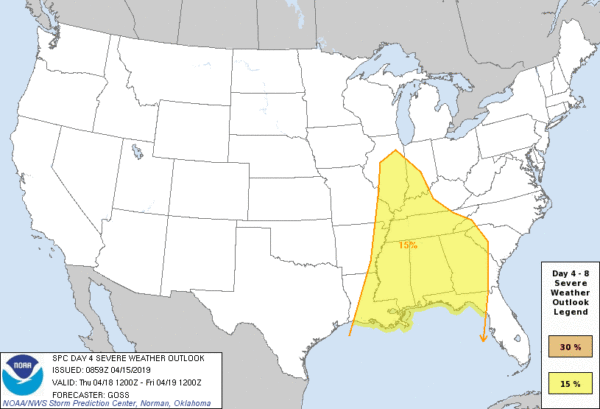
FRIDAY: The severe weather threat will move off to the east, but a deep upper trough will keep the sky cloudy with a chance of some lingering rain at times. And the day will be much cooler, with temperatures struggling to reach the low 60s.
THE ALABAMA WEEKEND: Any lingering clouds should move out early in the day. Otherwise Saturday will be a sunny, pleasant day with a high around 70. Sunday will feature sunshine in full supply with a high close to 80 degrees.
NEXT WEEK: For now much of the week looks warm and dry, with highs most days in the low to mid 80s.
ON THIS DATE IN 2011: The “forgotten” tornado outbreak of April 15, 2011, occurred. Throughout the day, 45 tornado warnings and 19 severe thunderstorm warnings were issued for central Alabama. Of 29 confirmed tornadoes, the total damage path length was more than 244 miles, with 10 of those tornadoes having damage paths more than 10 miles long. Four people were killed, including three in a mobile home at Boones Chapel in northern Autauga County.
The event was forgotten by many because of what would happen 12 days later, on April 27, 2011, when a generational tornado outbreak would kill 252 people in our state.
BEACH FORECAST: Click here to see the AlabamaWx Beach Forecast Center page.
WEATHER BRAINS: You can listen to our weekly 90-minute show any time on your favorite podcast app. This is the show all about weather featuring many familiar voices, including the meteorologists at ABC 33/40.
CONNECT: You can find me on all of the major social networks:
Facebook
Twitter
Instagram
Pinterest
Snapchat: spannwx
For more weather news and information from James Spann and his team, visit AlabamaWx.


