James Spann: Scattered strong storms for Alabama on Saturday
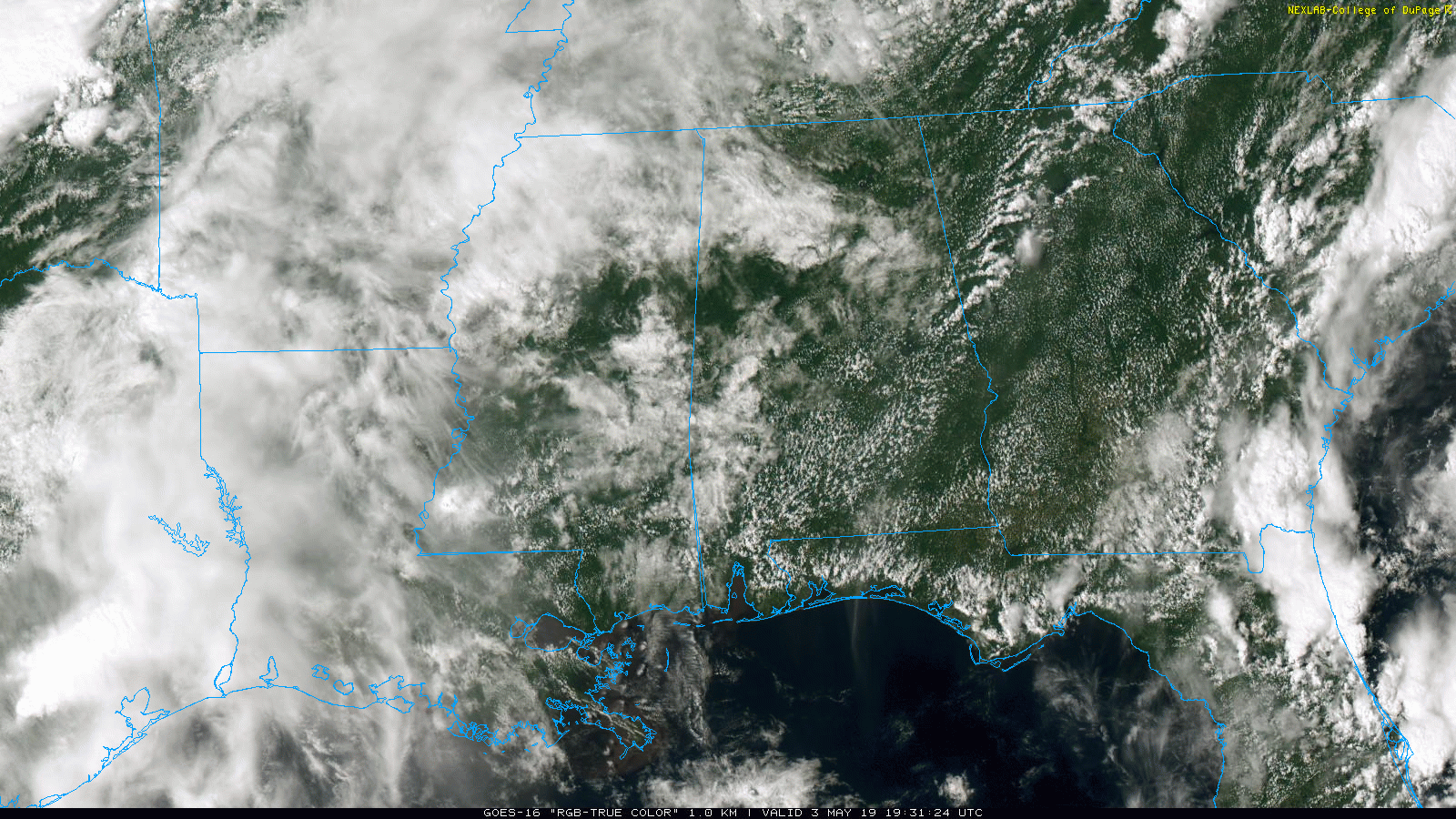
RADAR CHECK: It is a pretty quiet afternoon across Alabama; the sky is generally partly sunny, and showers are few and far between. Most of them are over the northwest counties, where temperatures are in the 70s. Elsewhere, most communities are in the mid 80s. Any showers overnight tonight will remain very isolated.
A FEW STRONG STORMS SATURDAY: A wave in the upper atmosphere will bring an increase in the number of scattered showers and thunderstorms to Alabama Saturday. Still, a decent part of the day will be dry. Showers and storms will be rather random and scattered, much like a summer day.
The Storm Prediction Center maintains a slight risk (level 2 out of 5) of severe storms for much of the state.
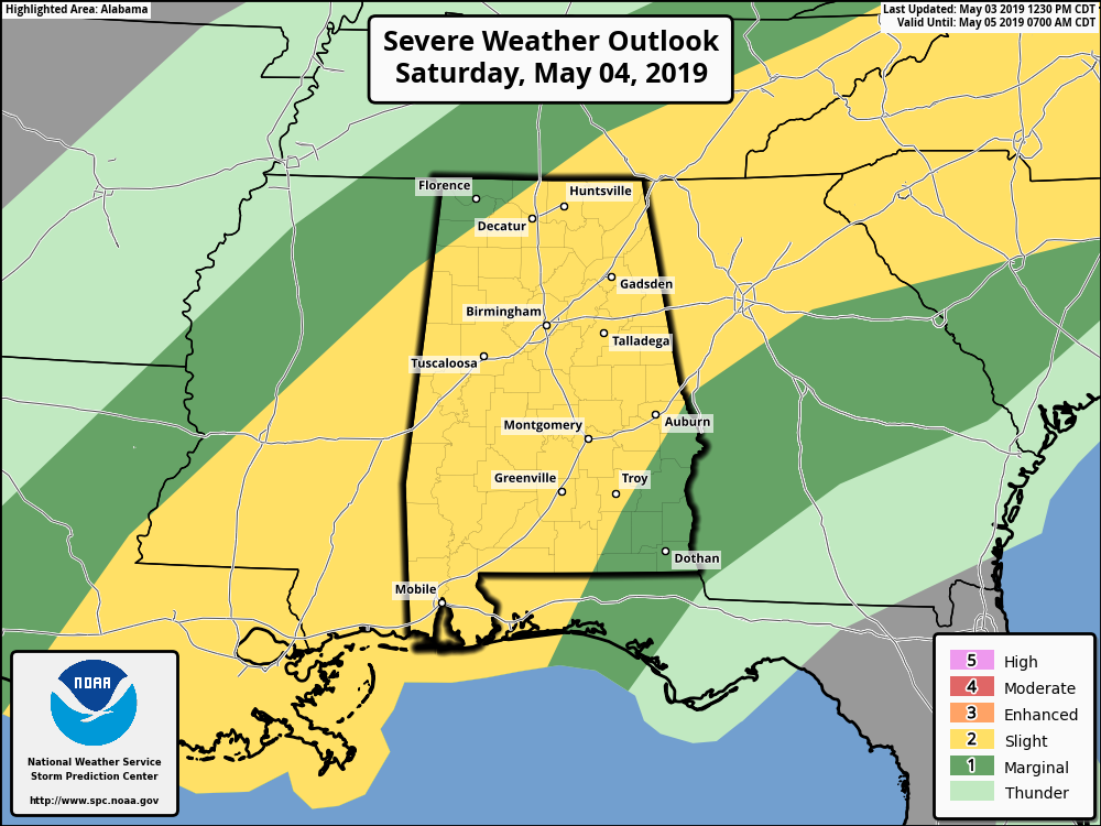
Heavier storms, where they form, will be capable of producing strong, gusty winds and some hail. Winds will be unidirectional, so tornadoes are not expected. This is not a severe weather risk like the ones we experienced back in March and April; this is more of a summer-like setup. The sky will be occasionally cloudy, and the high will be in the 77- to 80-degree range.
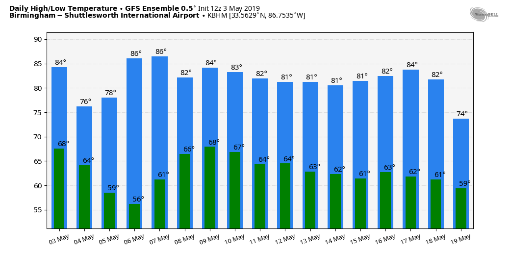
Drier air filters into the state Sunday, and most places will be dry with a good supply of sunshine. The high Sunday afternoon will be between 77 and 81 degrees, much like Saturday.
NEXT WEEK: Monday will be warm and dry with a mostly sunny sky; most of Tuesday will be rain-free as well, although some rain could creep into west Alabama late in the day. Then, we will have some risk of scattered showers and storms over the northern half of the state Wednesday through Friday as moist air returns. Highs through the week will be in the 80s.
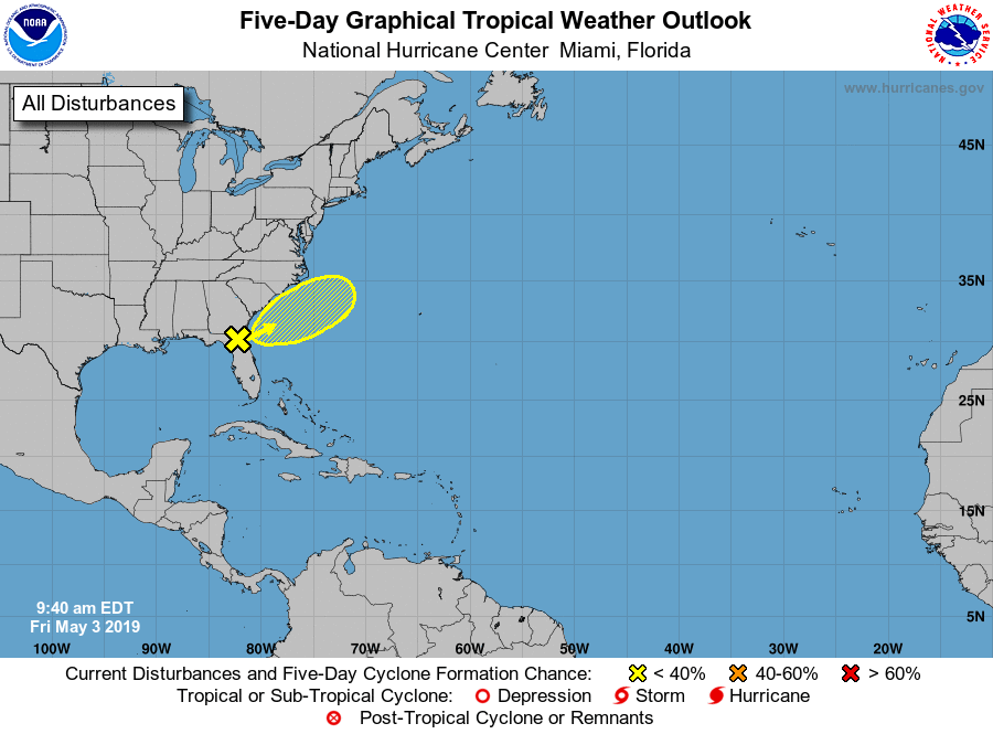
TROPICS: A broad area of low pressure is over northeast Florida this afternoon. It will be moving northeast in coming days, out into the Atlantic, and there is only a 10 percent chance of development there.
ON THIS DATE IN 1999: There were 63 tornadoes in Oklahoma, making this the worst outbreak ever to strike the state. In central Oklahoma alone, eight individual supercell thunderstorms produced 57 tornadoes. Bridge Creek, Moore and southern parts of the Oklahoma City metro area were hit the hardest. When it was near Moore, a truck-mounted Doppler radar measured a wind speed of 318 mph, the highest ever observed in a tornado. Forecasters at the Storm Prediction Center in Norman were faced with the unprecedented situation of a major tornado on the ground threatening their location. As a major F5 tornado was approaching the Oklahoma City metro area from the southwest, the SPC notified its backup, the Air Force Weather Agency at Offutt AFB in Omaha, Nebraska, that they might have to assume operational responsibility if the tornado approached Norman. The storm remained several miles west of the facility but was visible from the SPC roof. Damage from this single tornado was around $1 billion, making it the most costly tornado in history. Estimated damage from the entire tornado outbreak was $1.485 billion, making this the most expensive tornado outbreak ever. In all, 2,314 homes were destroyed and another 7,428 were damaged. To the north in Kansas, an F4 tornado tracked 24 miles through Sumner and Sedgwick counties, killing six, injuring 154 and causing $146 million in damages.
BEACH FORECAST: Click here to see the AlabamaWx Beach Forecast Center page.
WEATHER BRAINS: You can listen to our weekly 90-minute show any time on your favorite podcast app. This is the show all about weather featuring many familiar voices, including the meteorologists at ABC 33/40.
CONNECT: You can find me on all of the major social networks:
Facebook
Twitter
Instagram
Pinterest
Snapchat: spannwx
For more weather news and information from James Spann and his team, visit AlabamaWx.


