James Spann: Showers, storms for Alabama at times through Monday
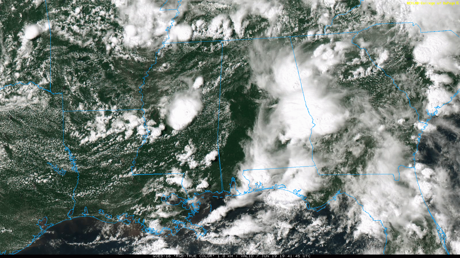
ACTIVE PATTERN CONTINUES: An upper low just northwest of Alabama continues to interact with a tropical air mass over the region and will keep the weather unsettled through the weekend. On radar this afternoon, we have one batch of strong storms moving into Georgia, but more showers and thunderstorms are developing rapidly over the northwest counties of the state. Temperatures are in the 70s where rain is falling and in the 80s elsewhere.
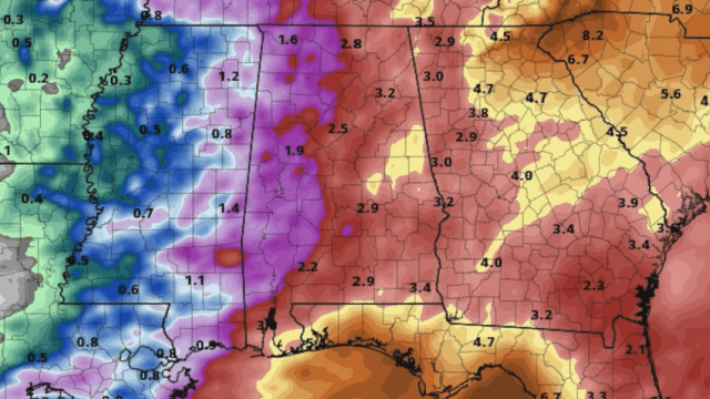
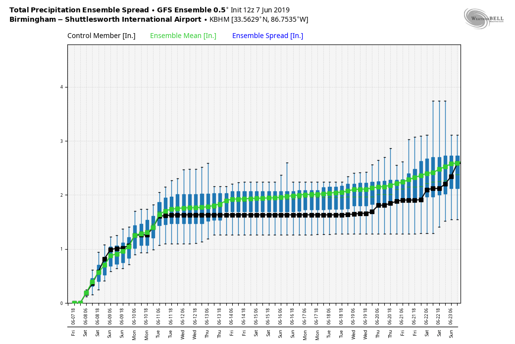
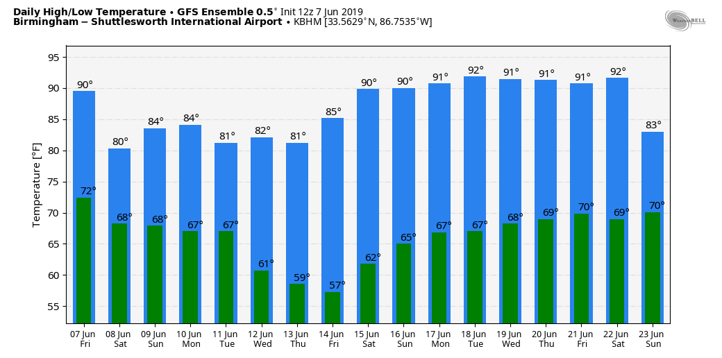
THE WEEKEND: The sky will be mostly cloudy Saturday and Sunday with occasional showers and thunderstorms. Like today, there will be some good breaks in the rain, but a shower or storm will be possible in this environment at any hour of the day or night. There’s no way of providing start/stop times for the rain at any given place in this pattern. Severe storms are not expected, and the high will be in the low to mid 80s both days. Additional rain amounts over the weekend will average 1-2 inches for most communities.
NEXT WEEK: Showers and storms remain possible Monday, but they should be fewer in number on Tuesday and mainly over the eastern and southern counties of the state. The rest of the week looks generally dry, although a few showers are possible over the Tennessee Valley of far north Alabama Wednesday. Highs will be in the 80s.
SMALL TORNADO CONFIRMED: Late Thursday afternoon, a brief spin-up EF0 tornado touched down in Dallas County, causing some roof and shingle damage to a house in Potter Station just west-northwest of Selma. This brings the official count across the state for 2019 up to 58 confirmed tornadoes.
ON THIS DATE IN 1816: The following is found on page 31 in the book “History of the American Clock Business for the Past Sixty Year, and Life of Chauncey Jerome,” written by Chauncey Jerome. The book was published in 1860. “The next summer was a cold one of 1816, which none of the old people will ever forget, and which many of the young have heard a great deal about. There was ice and snow in every month of the year. I well remember on the seventh of June, while on my way to work, about a mile from home, dressed throughout with thick woolen clothes and an overcoat on, my hands got so cold that I was obliged to lay down my tools and put on a pair of mittens which I had in my pocket. It snowed about an hour that day.” This bitter cold event occurred in Plymouth, Connecticut.
Evidence suggests that the anomaly was predominantly a volcanic winter event caused by the massive 1815 eruption of Mount Tambora in the Dutch East Indies (now Indonesia). This eruption was the largest eruption in at least 1,300 years, and perhaps exacerbated by the 1814 eruption of Mayon in the Philippines.
BEACH FORECAST: Click here to see the AlabamaWx Beach Forecast Center page.
WEATHER BRAINS: You can listen to our weekly 90-minute show any time on your favorite podcast app. This is the show all about weather featuring many familiar voices, including the meteorologists at ABC 33/40.
CONNECT: You can find me on all of the major social networks:
Facebook
Twitter
Instagram
Pinterest
Snapchat: spannwx
For more weather news and information from James Spann and his team, visit AlabamaWx.


