Bill Murray: Scattered storms for Alabama today, better rain chances starting Tuesday
Bill Murray has the Alabama forecast for the beginning of the work week from Alabama NewsCenter on Vimeo.
Rain chances will be on the rise across central Alabama over the next few days as a slow-moving upper trough to the west progresses to the east. Daytime heating will drive the chances for scattered afternoon and evening showers and storms, and passing disturbances in the southwesterly flow aloft will enhance conditions for more organized bouts of rain and thunder through the end of the work week.
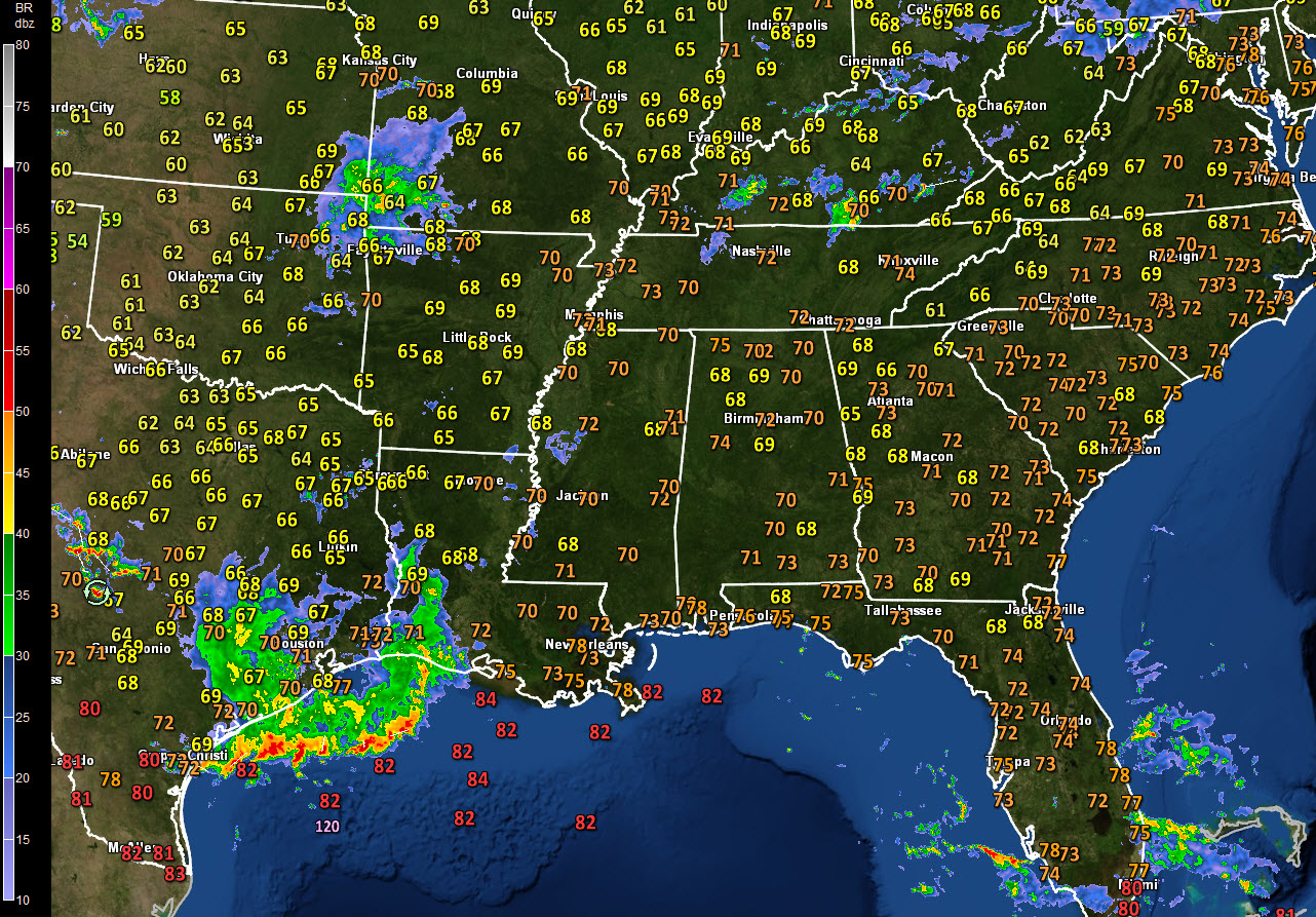
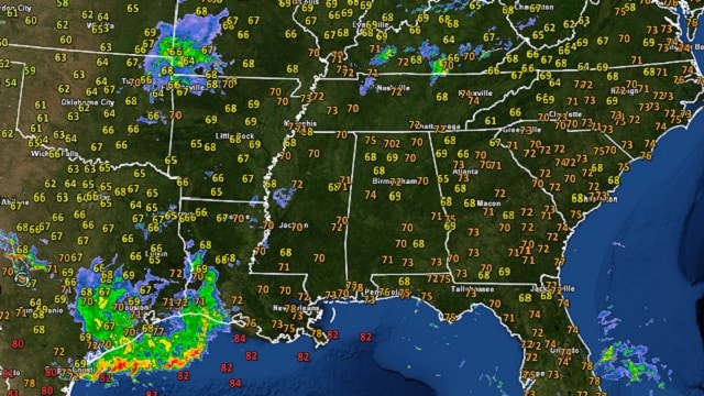
ON THE WEATHER MAPS: A broad upper-level trough is over the Arklatex region this morning, with light upper-level winds across Alabama, as one would expect here in meteorological summer. At the surface, pressures are low across much of the United States, with strong high-pressure ridges off the East and West Coasts. Alabama is sandwiched between very moist air masses to our northwest and southeast, but our moisture levels will become higher over the next 24 hours.
TODAY: Scattered showers and storms will form with the heating of the day. If you are underneath one, you will see heavy rain and deadly lightning as well as some gusty winds. Storms could be strong, but severe weather shouldn’t be a problem. We can’t rule out a couple of rogue severe thunderstorm warnings, though. Those showers will linger until around 9 p.m., then diminish for the night. Lows will be in the upper 60s to near 70 degrees.
BEST RAIN CHANCES: It appears the best rain and thunderstorm chances may come on Tuesday and Thursday because of passing disturbances. Rain chances each of those days will be in the 70- to 80-percent range. Wednesday should feature the regular scattered afternoon and evening showers and storms. Highs will be in the middle and upper 80s. Overnight lows will be around 70.
STRONG STORMS ON THURSDAY? We will have to watch out for a better chance of organized storms on Thursday, it appears, as the trough approaches with its stronger wind fields and colder air aloft. Hail and damaging winds will be the primary threats, although we can’t rule out a tornado threat as well. Stay tuned concerning this developing situation.
HIGH PRESSURE TO RETURN: High pressure will gradually take back control of our weather by the end of the week, with diminishing rain chances into the weekend. The mercury will respond, returning to highs in the 90-degree range with lows in the lower 70s for the weekend.
RAINFALL TOTALS: We’re still expecting rainfall amounts to average between 1 and 1.5 inches across central Alabama over the next seven days. That’s about what we need just to keep drought levels at bay this time of year.
GULF COAST WEATHER: Look for fairly typical beach weather through Tuesday along the beautiful beaches of Alabama and northwest Florida — eight or so hours of sunshine with widely scattered, mainly afternoon and evening thunderstorms; highs near 90 and lows in the middle 70s. Rain and storms will increase starting Wednesday and lasting into Friday. Things will return to fairly typical summerlike conditions by the weekend. Water temperatures are running around 83. Click here to see the Beach Forecast Center page.
WEATHERBRAINS: This week, the panel is talking to Bryan Busby, the chief meteorologist from KMBC in Kansas City. Check out the weekly netcast that’s all about the weather at weatherbrains.com. You can watch the show live at live.bigbrainsmedia.com.
ON THIS DATE IN 1978: The “Whippoorwill” Disaster occurred. A weak tornado struck a showboat on Pomona Lake, Kansas, with 58 people aboard as it left the dock for a dinner cruise. Sixteen people drowned as the boat capsized, making the twister the deadliest tornado of the year. Follow my weather history tweets on Twitter. I am @wxhistorian at Twitter.com.
For more weather news and information from James Spann, Bill Murray and other members of the James Spann team, visit AlabamaWx.


