Scott Martin: It’s summertime in Alabama — hot, humid with daily chance of storms
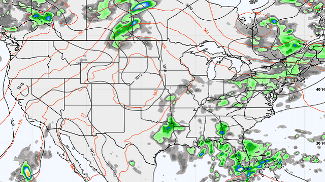
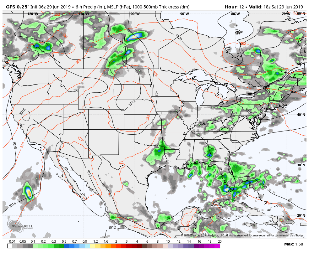
TODAY: We’ll have an upper low to our west over the Arkansas-Louisiana border that will pull more moisture up into Alabama from the Gulf of Mexico. We’ll start off the day with mostly clear skies, but clouds will build with the heating of the day and scattered to numerous showers and thunderstorms will develop. The highest chances throughout the day will be across the southern half of the state. Coverage will start to diminish as the sun begins to set and most of the activity should be gone by the start of the overnight hours. Highs will be in the upper 80s to the lower 90s with lows in the upper 60s to the lower 70s.
 SUNDAY: The story will be much the same for Sunday — partly to mostly sunny skies to start, but clouds build with the heating of the day. We’ll continue to have our standard chance of scattered afternoon to early evening showers and thunderstorms. Highs will be in the upper 80s to the lower 90s.
MONDAY: Ridging builds over the area with a center of high pressure directly to our south off the Gulf Coast. That will allow for our rain chances to decrease somewhat, but our heat levels will begin to rise. We’ll have a small chance of a few isolated showers and thunderstorms with highs topping out in the lower to mid-90s.
TUESDAY: That high doesn’t move much and we’ll continue to have hot, humid conditions across Alabama. We’ll have a very small chance of a few isolated showers and thunderstorms with highs in the lower to mid-90s.
WEDNESDAY: The high will be centered to our southwest over the Louisiana coastline, and that will allow an increase in our rain chances somewhat. That doesn’t affect our temperatures, as highs will continue to be in the lower to mid-90s with a chance of scattered afternoon and early evening showers and thunderstorms.
THURSDAY AND FRIDAY: The pattern doesn’t change much for Thursday and Friday as the high stays nearly in the same place for both days. We’ll stay hot and humid with the standard chance of scattered afternoon and early evening showers and thunderstorms. Highs will be in the lower to mid-90s on both days.
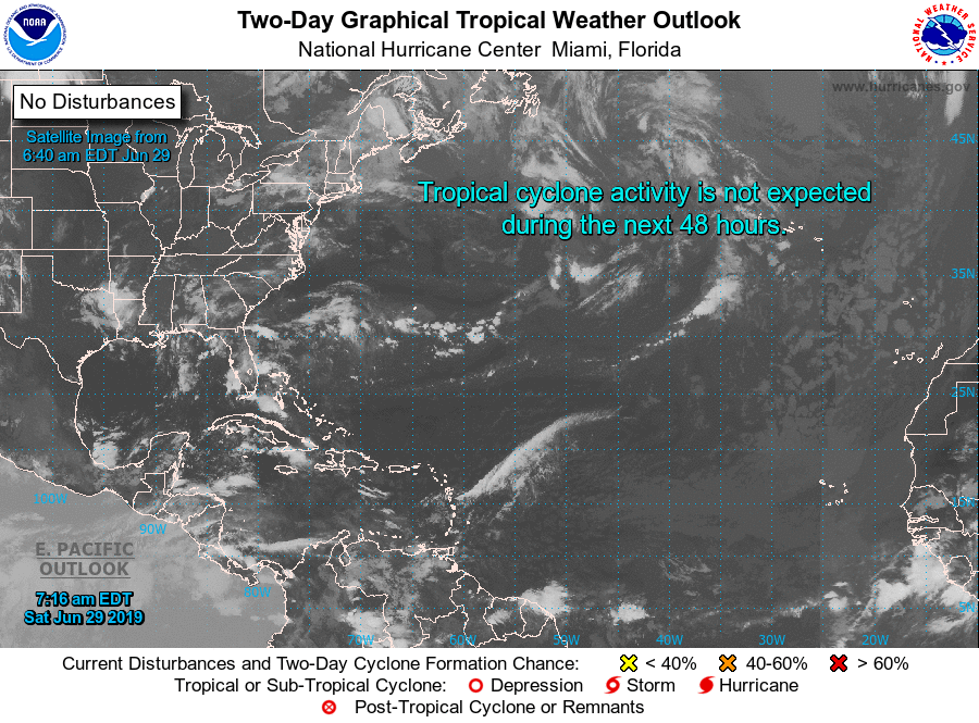
THE TROPICS: The Atlantic Basin remains very quiet at this point and no new tropical cyclones are expected to develop within the next five days.
BEACH FORECAST CENTER: Get the latest weather and rip current forecasts for the beaches from Fort Morgan to Panama City on our Beach Forecast Center page. There, you can select the forecast of the region you are interested in.
For more weather news and information from James Spann, Scott Martin and other members of the James Spann team, visit AlabamaWx.


