James Spann: July front pushing into Alabama
James Spann forecasts a transitional Tuesday for Alabama’s weather from Alabama NewsCenter on Vimeo.
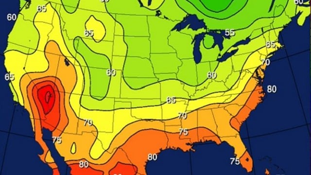
RADAR CHECK: Patches of mostly light rain continue this morning, mainly in areas south and east of Birmingham, ahead of a rather rare July surface front over the Tennessee Valley. This front will continue to push southward today, and by afternoon almost all of the showers and storms will be over the southern half of the state. The sky becomes partly sunny over north Alabama with a high in the mid 80s.
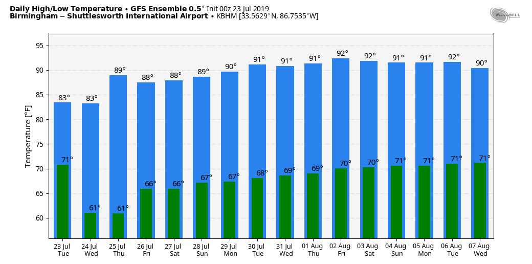
WEDNESDAY THROUGH FRIDAY: Unusually dry air for summer will cover most of Alabama. We project sunny days, lower humidity and cooler nights. Highs will be in the mid 80s Wednesday, followed by upper 80s Thursday and Friday. Morning lows will be in the 60s, although some of the cooler valleys across north Alabama could reach the upper 50s for a taste of fall. Showers will be confined to the immediate Gulf Coast, and even there they should be widely spaced.
THE ALABAMA WEEKEND: Moisture levels will rise Saturday and Sunday, and we will introduce the chance of widely scattered, mostly afternoon and evening showers and thunderstorms both days. The chance of any one spot getting wet will be in the 20% to 30% range, and the high will be between 88 and 91 for most communities with partly sunny days.
NEXT WEEK: For now the weather looks fairly routine for summer — partly sunny, hot, humid days with the risk of a passing afternoon shower or storm in a few spots. Highs will be generally in the low 90s.
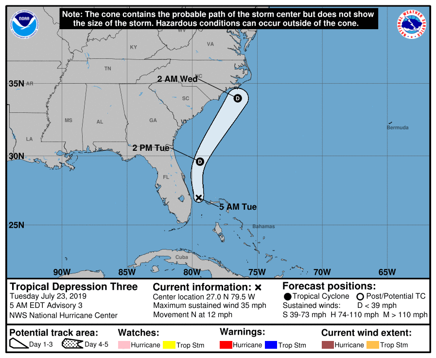
TD 3: Tropical Depression Three is hanging on this morning just east of Florida. It is moving northward and is expected to dissipate later today or tonight because of strong winds aloft. There will be no impact on Alabama or the Gulf Coast, and the rest of the Atlantic basin is quiet.
ON THIS DATE IN 1788: A storm called George Washington’s Hurricane originated near Bermuda on July 19 before making landfall in Virginia. It passed directly over the Lower Chesapeake Bay and Mount Vernon, the home of George Washington. This track is very similar to the path of the Chesapeake-Potomac hurricane of 1933. At Norfolk, winds increased at 5 p.m. on July 23 with the wind originating from the northeast. At 12:30 a.m., the wind suddenly shifted to the south and “blew a perfect hurricane, tearing down chimneys, fences…” Some corn was also leveled, large trees were uprooted and houses were moved from their foundations.
BEACH FORECAST: Click here to see the AlabamaWx Beach Forecast Center page.
WEATHER BRAINS: You can listen to our weekly 90-minute show any time on your favorite podcast app. This is the show all about weather featuring many familiar voices, including the meteorologists at ABC 33/40.
CONNECT: You can find me on the major social networks:
Facebook
Twitter
Instagram
Pinterest
Snapchat: spannwx
For more weather news and information from James Spann and his team, visit AlabamaWx.


