James Spann: Sun, heat, scattered afternoon storms for Alabama
James Spann has the Alabama forecast to begin the work week from Alabama NewsCenter on Vimeo.
FOGGY START: Dense fog advisories are in effect for parts of north and central Alabama this morning; visibilities are restricted in some places, especially where rain came down last night. The fog will dissipate by mid-morning.
MUST BE AUGUST IN ALABAMA: Looks like the atmosphere will deliver some classic summer weather across Alabama this week. Most days will begin with a good supply of sunshine. Then, as the lower atmosphere heats up, the air will become buoyant, and by afternoon we will have an array of random, slow-moving, scattered showers and thunderstorms.
Today, the highest coverage of scattered storms likely will be south of I-20, south of a boundary left by rain that came down over north Alabama last night. The high will be close to 90 degrees for most communities today.
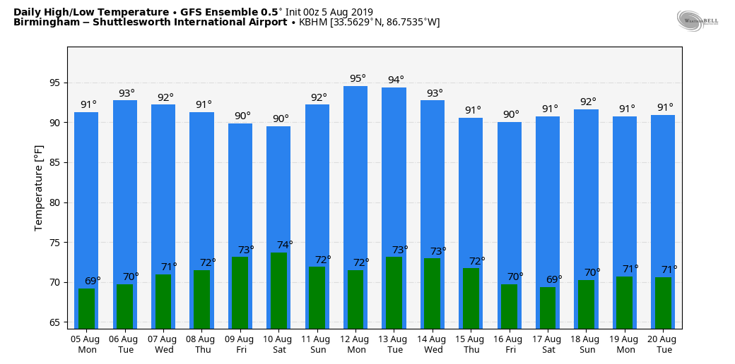
We will broad-brush the forecast with classic summer conditions for the rest of the week: partly sunny, hot, humid days with scattered, mostly afternoon and evening showers and thunderstorms. Highs will be in the 89- to 93-degree range most days.
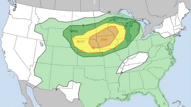
One thing to watch is that we will be in a northwest flow aloft; sometimes organized thunderstorms can form over Missouri or west Tennessee and the winds aloft will carry those into Alabama. Forecasting these mesoscale convective system (MCS) events in advance is very challenging.
THE ALABAMA WEEKEND AND BEYOND: We will roll with a persistence forecast for the weekend and into next week. Look for classic August weather in Alabama — morning sunshine, scattered afternoon and evening thunderstorms, and highs mostly in the low 90s.
INVISIBLE FORCE FIELD? Every summer I hear from people in just about every Alabama county who believe that summer storms always “go around them” or “split,” leaving them high and dry — some kind of invisible force field. Usually when someone gets to the point of frustration, firmly believing they won’t see a summer storm, the next day they get one that sits over their place for hours and brings a flash flood.
It mostly boils down to luck and the placement of small-scale boundaries. In some cases, there can be orographic effect where terrain can play a role in summer thunderstorm placement, especially across northeast Alabama. But, generally speaking, your time will come if you think you are in an Alabama desert. You can’t escape summer storms over a period of days and weeks.
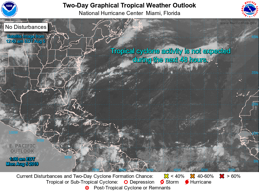
TROPICS: We are getting into the climatological peak of the hurricane season (August/September), but the Atlantic basin remains very quiet and tropical storm formation is not expected this week.
ON THIS DATE IN 1980: Hurricane Allen intensified into a Category 5 hurricane while south of Puerto Rico. This made Allen the earliest Category 5 hurricane on record in the Atlantic, but it was later surpassed by Hurricane Emily, which reached that intensity on July 16, 2005. Shortly before landfall, a dry air mass in the western Gulf of Mexico caused the storm to weaken substantially. Allen made landfall Aug. 9 north of Brownsville, Texas, as a Category 3 storm with maximum sustained winds of 115 mph.
BEACH FORECAST: Click here to see the AlabamaWx Beach Forecast Center page.
WEATHER BRAINS: You can listen to our weekly 90-minute show any time on your favorite podcast app. This is the show all about weather featuring many familiar voices, including the meteorologists at ABC 33/40.
CONNECT: You can find me on all of the major social networks:
Facebook
Twitter
Instagram
Pinterest
Snapchat: spannwx
For more weather news and information from James Spann and his team, visit AlabamaWx.


