James Spann: Alabama stays hot, humid with scattered storms
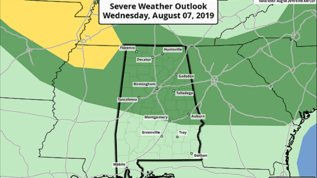
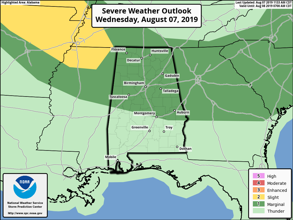
RADAR CHECK: Scattered thunderstorms are increasing across Alabama this afternoon; most of them so far are over the northeast counties of the state. Other storms over Arkansas and west Tennessee will move into the state this evening; all of them are moving southeast. The Storm Prediction Center maintains a marginal risk (level 1 out of 5) for roughly the northern half of Alabama through tonight; some of the heavier storms will be capable of producing strong, gusty straight-line winds.
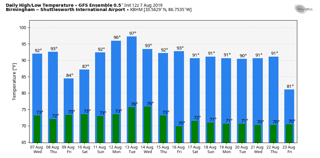
Away from the storms, the sky is partly sunny and temperatures are in the low to mid 90s.
THURSDAY/FRIDAY: Thursday looks like another classic August day — hot and humid, with scattered, mostly afternoon and evening showers or thunderstorms and a high in the low 90s. Storms should become more numerous Friday as a weak surface front approaches Alabama from the north.
THE ALABAMA WEEKEND: Expect a mix of sun and clouds Saturday and Sunday with scattered showers and thunderstorms, generally between noon and 10 p.m. The chance of any one spot getting wet both days is in the 30% to 40% range, and highs will be mostly in the low 90s.
We will keep the persistence forecast going through much of next week: typical summer weather; hot, muggy days with some risk of scattered thunderstorms; highs generally in the low to mid 90s. A few spots over west Alabama could reach the upper 90s early in the week thanks to an upper ridge nosing into the state from the west.
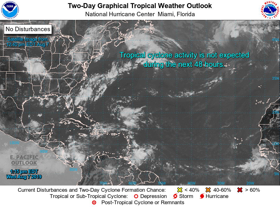
TROPICS: Again today the Atlantic basin remains amazingly quiet for August, and tropical storm formation is not expected through early next week.
ON THIS DATE IN 1980: Hurricane Allen bottomed out at 899 millibars (26.55 inches of mercury) while moving through the Yucatan Channel in the southeastern part of the Gulf of Mexico. Allen was the second-lowest pressure recorded in the Western Hemisphere up to that time. Allen’s winds at the time were sustained at 190 mph. Shortly before landfall the next day, a dry air mass in the western Gulf of Mexico caused the storm to weaken substantially. Allen made landfall north of Brownsville, Texas, as a Category 3 storm with maximum sustained winds of 115 mph.
BEACH FORECAST: Click here to see the AlabamaWx Beach Forecast Center page.
WEATHER BRAINS: You can listen to our weekly 90-minute show any time on your favorite podcast app. This is the show all about weather featuring many familiar voices, including the meteorologists at ABC 33/40.
CONNECT: You can find me on all of the major social networks:
Facebook
Twitter
Instagram
Pinterest
Snapchat: spannwx
For more weather news and information from James Spann and his team, visit AlabamaWx.


