James Spann: Strong storms for north Alabama tonight; heat levels drop Wednesday
SIZZLING AFTERNOON: For a decent part of north and central Alabama, there is a pretty good chance today will be the hottest day of summer 2019. Here are some 3 p.m. observations:
- Shelby County Airport (Calera) — 101
- Demopolis — 100
- Bessemer — 100
- Talladega — 100
- Sylacauga — 100
- Birmingham — 99
- Tuscaloosa — 99
- Gadsden — 99
- Anniston — 98
- Montgomery — 94
- Mobile — 81 (rain cooled the air thanks to a passing thunderstorm)
Showers and storms are widely scattered across the state, and mainly over the central and southern counties.
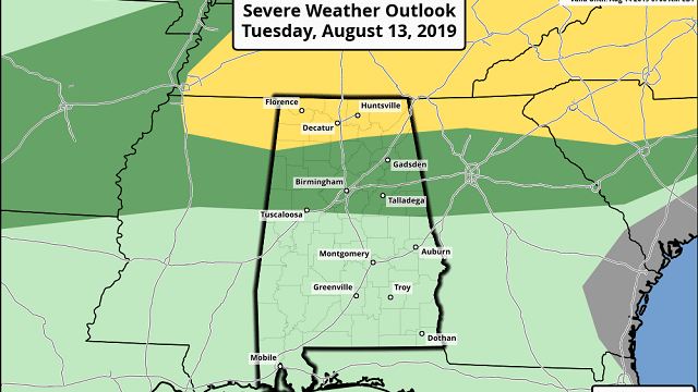
TO THE NORTH: A severe thunderstorm watch has been issued for much of middle Tennessee, and strong storms will likely drop into north Alabama tonight ahead of a surface front. The Storm Prediction Center has the Tennessee Valley of far north Alabama in a slight risk (level 2 of 5) tonight, with a moderate risk down to Tuscaloosa, Sylacauga and Roanoke. The main threat will come from strong straight-line winds.
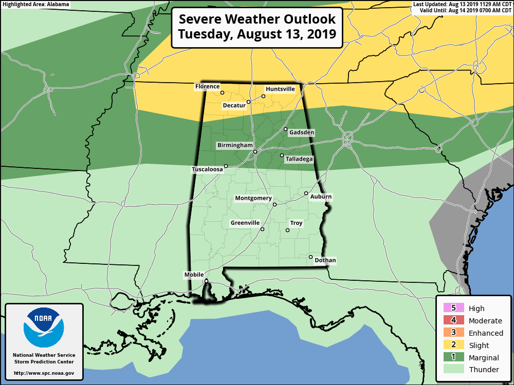
Storms should weaken late tonight as they approach I-20.
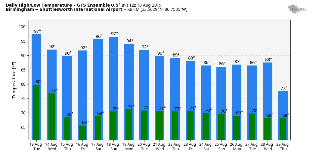
WEDNESDAY: The front will continue moving to the south, and the main threat of showers and storms will be over the southern half of the state, where the SPC has a marginal risk defined. The air will be drier over north Alabama with lower humidity levels, and the heat comes down as well, with highs back in the low 90s.
THURSDAY THROUGH SATURDAY: Much of Alabama will be rain-free with mostly sunny days, lower humidity and slightly cooler nights. Highs will be in the low 90s, lows in the upper 60s. Showers will be confined to the Gulf Coast, and even there they should be widely spaced.
SUNDAY AND NEXT WEEK: The American global model is now trying to bring moisture back into the state Sunday with a chance of scattered showers and thunderstorms, and that risk will continue daily through next week. But earlier runs have kept the state dry Sunday and Monday. We will only mention isolated showers now for Sunday, then bring back the chance of scattered showers and storms each day next week. Highs will be in the 88- to 92-degree range most days.
TROPICS: All remains quiet across the Atlantic basin, and tropical storm formation is not expected through the weekend.
ON THIS DATE IN 1987: A succession of thunderstorms produced rainfall that was unprecedented in 116 years of precipitation records at Chicago during an 18-hour period from the evening of Aug. 13 to the early afternoon of Aug. 14. The resulting flash flood was the worst ever to strike the Chicago metropolitan area, causing three deaths and water damage that amounted to $221 million. O’Hare International Airport received an event total of 9.35 inches of rain in 18 hours, shattering the previous 24-hour record of 6.24 inches. For about 24 hours, the airport was accessible only from the air as all roads were blocked by high water, including the Kennedy Expressway.
BEACH FORECAST: Click here to see the AlabamaWx Beach Forecast Center page.
WEATHER BRAINS: You can listen to our weekly 90-minute show any time on your favorite podcast app. This is the show all about weather featuring many familiar voices, including the meteorologists at ABC 33/40.
CONNECT: You can find me on the major social networks:
Facebook
Twitter
Instagram
Pinterest
Snapchat: spannwx
For more weather news and information from James Spann and his team, visit AlabamaWx.