James Spann: Sun, heat, scattered storms for Alabama
James Spann has the midweek forecast for Alabama from Alabama NewsCenter on Vimeo.
CLASSIC AUGUST WEATHER CONTINUES: Today will be another hot, humid day for Alabama with sunshine this morning and random, slow-moving, scattered showers and thunderstorms this afternoon and tonight. Most communities will see a high in the low 90s this afternoon.
THURSDAY THROUGH THE WEEKEND: The air aloft over Alabama will be a bit colder as a weak upper low forms around the region, making the air more unstable. Accordingly, we expect an increase in the number of scattered showers and thunderstorms on these four days. It won’t rain everywhere, but any one spot stands a 40%-50% chance of getting rain Thursday and 50%-60% Friday and over the weekend. Like recent days, most of the showers and thunderstorms will come from about noon until 10 p.m., but we can’t rule out a late-night or morning shower.
The sun will be out at times, but with an increase in cloud cover and showers heat levels will be lower. The high will be close to 90 on Thursday and then mostly in the mid to upper 80s Friday through Sunday.
NEXT WEEK: For now we will stick with a routine forecast for late August — partly sunny days with scattered, mostly afternoon and evening showers and thunderstorms. Highs will be in the 88- to 92-degree range most days.

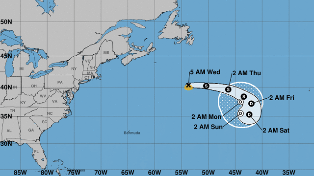
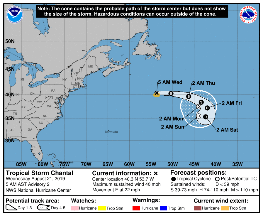
TROPICS: Tropical Storm Chantal formed last night over the open waters of the North Atlantic, far from land. Sustained winds are 40 mph, and the system is expected to look around over the next few days and dissipate. The rest of the Atlantic basin is quiet.
ON THIS DATE IN 1992: Tropical Storm Andrew was midway between Bermuda and Puerto Rico and turning westward into a more favorable environment. Rapid strengthening occurred, with Andrew reaching hurricane strength on Aug. 22 and Category 4 status on Aug. 23. After briefly weakening over the Bahamas, Andrew regained Category 4 status as it blasted its way across South Florida on Aug. 24. The hurricane continued westward into the Gulf of Mexico, where it gradually turned northward. This motion brought Andrew to the central Louisiana coast on Aug. 26 as a Category 3 hurricane. Andrew then turned northeastward, eventually merging with a frontal system over the Mid-Atlantic states on Aug. 28.
BEACH FORECAST: Click here to see the AlabamaWx Beach Forecast Center page.
WEATHER BRAINS: You can listen to our weekly 90-minute show any time on your favorite podcast app. This is the show all about weather featuring many familiar voices, including the meteorologists at ABC 33/40.
CONNECT: You can find me on all of the major social networks:
Facebook
Twitter
Instagram
Pinterest
Snapchat: spannwx
For more weather news and information from James Spann and his team, visit AlabamaWx.


